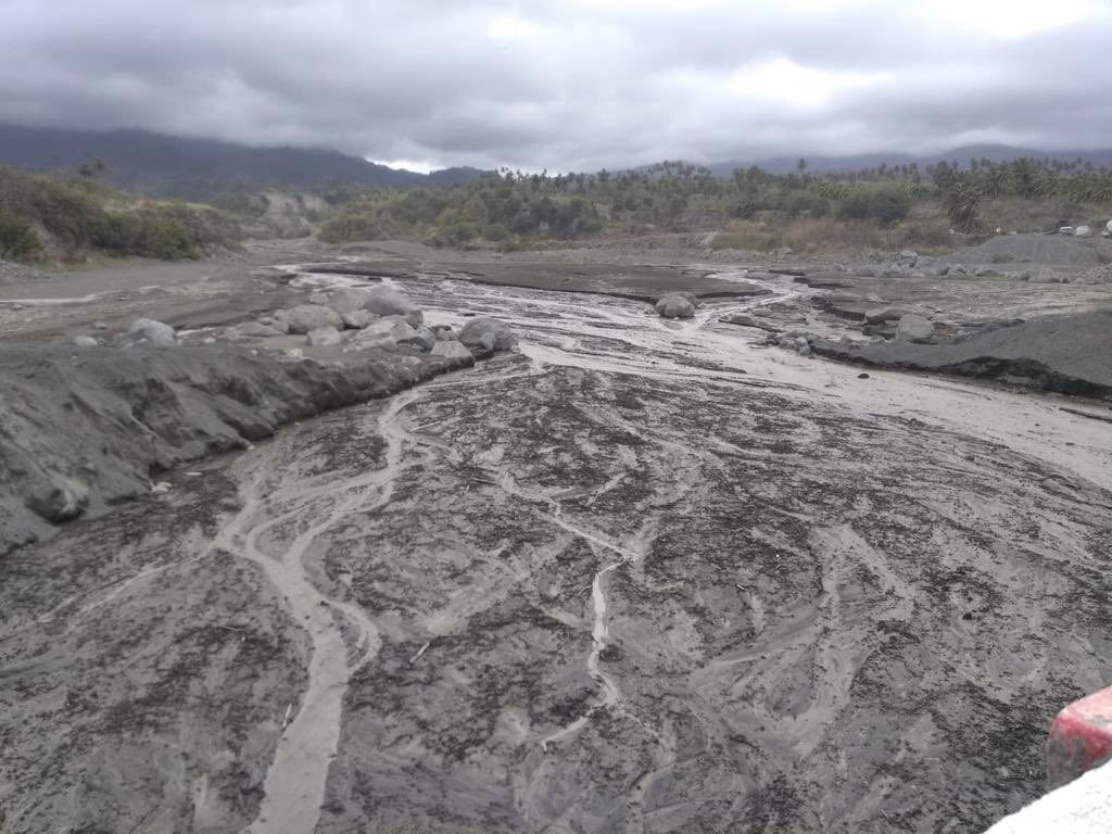
As of 30 April the worst affected areas were in parts of the main island of St Vincent. NEMO reported rainfall accumulations ranging from 75 to 125 mm during a 6 hour period on 29 April 2021.
Flooding brought traffic to a standstill after roads were swamped in areas around the capital Kingstown. Landslides blocked roads on the city's outskirts. At least 2 houses collapsed and several others were damaged in areas around the capital.
The country is still struggling with the effects of ongoing eruptions of the La Soufriere volcano that began 09 April 2021. Following the heavy rain the government issued warnings to residents and drivers, saying "persistent rain and ash build-up on the roads and in drains have created conditions for flooding."
The heavy rain also caused dangerous lahars (volcanic mudflows). The University of the West Indies (UWI) Seismic Research said that heavy rainfall generated lahars in the red and orange zones beneath La Soufriere.
UWI Seismic Research says "Lahars are fast-moving, dense mixture of rocks, ash and vegetation and water originating from a volcano. It has the consistency of wet concrete and can cause severe damage to rivers and valleys around the volcano. Lahars carry large amounts of volcanic material and may generate a rumbling sound. Flooding can also occur as the lahars can block streams and cause the water to find new areas to flow."
NEMO added that "the Red Zone can be impacted by mudflows as ash deposits are thickest in these areas and the absence of trees means that all of the material will find its way down the valleys."
St Lucia
Flooding and landslides also affected parts of the neighbouring island of St Lucia. The country's National Emergency Management Organisation (NEMO) reported flooding in Corinth, Dennery North and Dennery South. A landslide was reported in Barre de L'isle.


Reader Comments
to our Newsletter