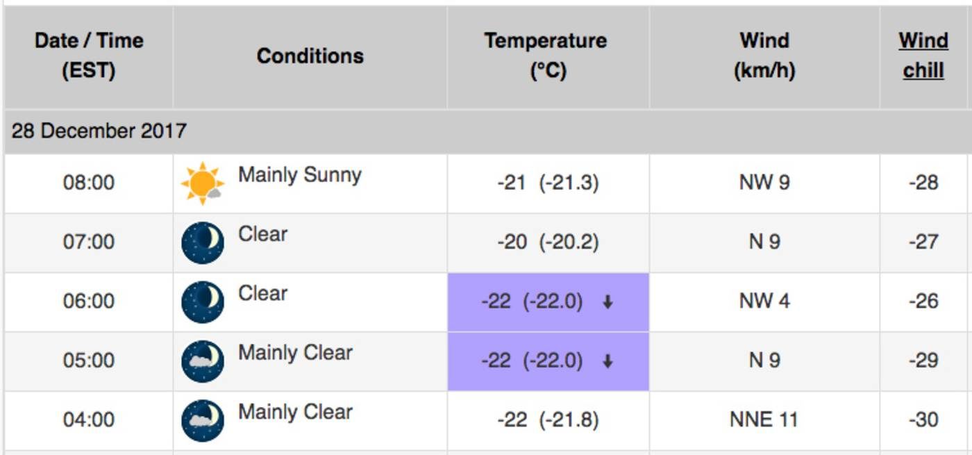
The previous record was set all the way back in 1960, when a low of -18.9 was recorded on this day at Pearson Airport.
Toronto (obviously) remains under an extreme cold weather alert as a series of cold weather systems continues to roll through Southern Ontario.
A period of "very cold wind chills" is expected today, according to Environment Canada, with wind chill values of minus 30 or below recorded already in the city this morning.
The weather agency says that these wind chills will moderate a bit throughout the day, but not by much. With the wind chill, it could feel anywhere between -22 and -27 outside this evening.
You can thank a cross-polar flow for delivering air "straight out of Siberia into much of central Canada, including the Great Lakes" between Boxing Day and Jan. 1, according to the Weather Network.
The final week of 2017 will remain blisteringly cold, and the first week of 2018 is expected to be much the same.
Thanks, Siberia.


Reader Comments
to our Newsletter