Storms
S

Cloud Lightning

Best of the Web: Whoa! Lightning strike leaves 15-FOOT HOLE at gas station in Fort Worth, Texas


Comment: Until this happened in Texas yesterday, this wasn't known to have been physically possible...


lightning hole
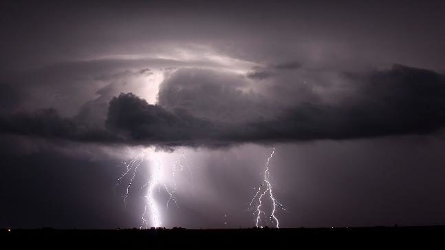
A powerful lightning strike left a huge hole in a Fort Worth parking lot just after 6 a.m. on Shadydell Drive and Boat Club Road on October 30, 2019.

The parking lot, shared by a Chevron gas station and a strip center now has a 15 feet wide and 3 feet deep hole. I have never heard of such events. Pretty powerful lightning, isn't it?

Snowflake

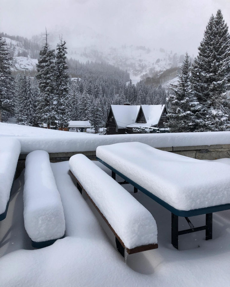
Snowy October in the Rockies with well above average snow falls - up to 1.2 metres (almost 4 feet)

Brighton, Utah two days ago.
Brighton, Utah two days ago on Oct 30th
It has been a good month for early season snow falls in the Rocky Mountains with resorts in Colorado, Utah and Alberta, Canada reporting snow totals up to 1.2 metres thanks to regular storms over the past few weeks.

The month finished with a bang with solid snow falls and cold temps combining to produce quality mid-winter powder over the past few days. However, with only a handful of resorts open, keen skiers were heading into the backcountry to enjoy it, but early season avalanche danger was a risk.

Two storms moved through earlier this week with Montana seeing the most snow, Bridger Bowl receiving 35.5cms on Tuesday night. Big Sky didn't miss out with another 28cms this week, taking the October total to 129.5cms, the resort's third snowiest October in 20 years.

In Utah, the resorts around Little Cottonwood Canyon enjoyed over 30cms in the past three days and Brighton and Alta are looking more like mid-January, with both scheduled to open on November 23.


Snowflake Cold

US braces for arctic blast as Chicago gets earliest snowfall in 30 years, temperatures set to drop 30 degrees

Several areas in Illinois have decided to reschedule Halloween trick-or-treating to this Saturday because of the cold weather and snow
Storms are raging across the central United States from the Gulf Coast to the Great Lakes ahead of an arctic blast that could bring record shattering cold to the South.

Strong winds have brought down trees and power lines from Tennessee to North Dakota after tropical Storm Olga swept in from the Gulf Coast.

Forecasters say the severe storms could now hit states from Alabama to New England.

And in just a few hours, temperatures are expected to drop as much as 30 degrees as a cold front blows in from Canada.

A freeze warning has been issued for several states across the country, including Texas, regions in California, the Carolinas and Georgia.

Many of those areas will see temperatures dip into the 20s and 20s starting Thursday and continue on into Friday.

Chicago has already seen it earliest snow fall in 30 years and temperatures below zero are being registered in the Rockies and Great Basin.


Cloud Lightning

Lightning strikes kill 8, injure 4 in Vidarbha, India

lightning
Eight persons were reportedly killed in separate incidents of lightning strikes in the Yavatmal, Amravati and Akola districts of Vidarbha region of east Maharashtra, informed the police here on Thursday.

On Wednesday, in Yavatmal district, lightning struck Gajanan Baliram Pimple (28),a resident of Lonbehal village in the Arni tehsil, while he was standing under a tree.

In Amravati district, three persons got electrocuted after lightning struck at them when they were standing under a tree.

The deceased were identified as Sayyad Nuruddin Sayyad Badryoyaddin (56), Shobha Sanjay Gathe (45) and Sonali Gajanan Bobde (34).

Comment: Elsewhere in India on the same day a lighting strike killed 2 workers in Telangana.


Tornado1

Cyclone Kyarr, the strongest storm on Earth, is breaking all sorts of records

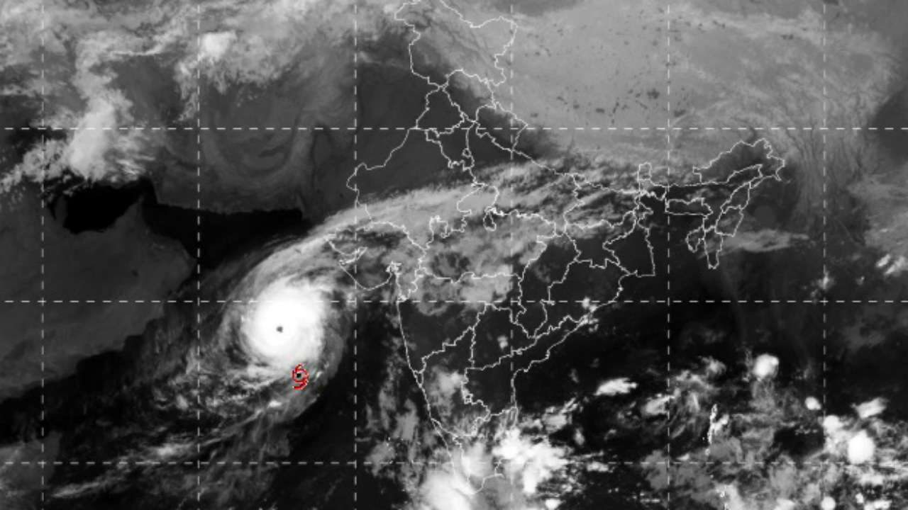
Cyclone Kyarr
Cyclone Kyarr
The northern hemisphere's quietest tropical cyclone basin is currently going off. Cyclone Kyarr formed on Thursday and quickly spun up in the Indian Ocean into the most powerful storm on the planet. While the storm won't have a huge impact on land, it's already making its present felt in the record books in what's been a weird and bad year in general for tropical cyclones, a classification that includes tropical storms, hurricanes, and typhoons as well.

Cyclone Kyarr rapidly intensified over the weekend, going from the equivalent of a Category 2 to Category 4 storm in just six hours on Saturday. It's currently packing winds of around 150 mph, putting it on the high end of Category 4. That makes it a "super cyclonic storm," according to the Indian Meteorological Department. It's also the first such system to form in the Arabian Sea since June 2007's Cyclone Gonu. That system made landfall in the Middle East, inflicting the most widespread damage in Oman despite weakening considerably by landfall.

During its rapid intensification, Kyarr's pressure bombed out to 915 millibars. The lower the pressure, generally the more intense the storm. And in the case of Kyarr, the 915 millibar reading set a new record for Arabian Sea cyclones (a 1999 cyclone that formed on the other side of the Indian Ocean holds the all-time low pressure record for the basin).

Cassiopaea

Another 'rare' gigantic jet snapped, this time over the gulf of Mexico - plus a 'pancake' sunset in N. California

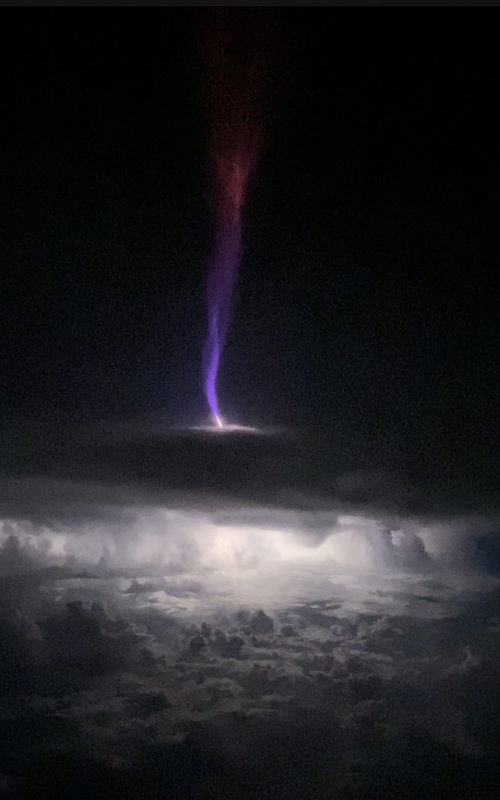
Gigantic Jet
Transient Luminous Event: Taken by Chris Holmes on October 15, 2019 @ Yucatan Peninsula, 35,000ft approximately 35 miles east of the cell.

CLOSE ENCOUNTER WITH A GIGANTIC JET


When you see lightning, run! That's what NOAA advises in lightning safety brochures. On Oct. 15th, however, pilot Chris Holmes had no place to go when lightning started to crackle in thunderstorms around his aircraft.

"I was flying 35,000 feet over the Gulf of Mexico near the Yucatan Peninsula when a super cell started pulsing with light," he says. "It wasn't just ordinary lightning, though. The cell was creating lots of sprites and jets leaping up from the thunderhead." At a distance of only 35 miles, he video-recorded this:

Comment: The growing list of phenomena resulting from our changing atmosphere: For more on what's happening on our planet, check out SOTT radio's: As well as SOTT's monthly Earth Changes Summary - September 2019: Extreme Weather, Planetary Upheaval, Meteor Fireballs:


Tornado1

Hurricane Pablo becomes sixth Atlantic hurricane to form in an unusual location

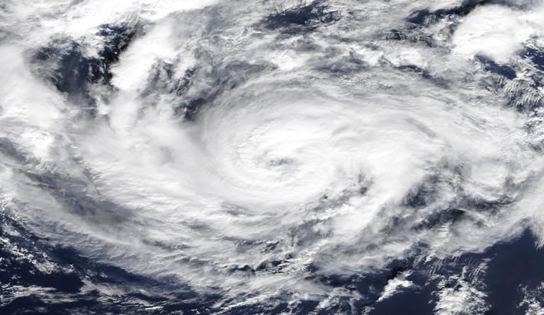
Hurricane Pablo
© NASAHurricane Pablo, as seen in the eastern Atlantic by NASAโ€™s Terra satellite on Oct. 27, 2019
Hurricane Pablo became the sixth Atlantic hurricane on Sunday morning in an unusual location.

Pablo strengthened into a hurricane at 11 a.m. EDT on Sunday at 42.8 degrees north latitude. That's very near the same latitude as Boston on the U.S. East Coast.

Only one other storm since 1950 has first reached hurricane intensity at a farther north latitude, according to Tomer Burg, an atmospheric science PhD student at the University of Oklahoma. That was an unnamed hurricane in 1971 which formed at 46 degrees north latitude, Burg said in a tweet.


Cloud Lightning

Lightning strikes kill 4 in South Africa

lightning
Four people died after being struck by lightning during the weekend's storms in northern KwaZulu-Natal.

This was according to a preliminary report by the Umkhanyakude municipality on Sunday as its disaster management teams were still on the ground assessing the damage.

Spokesperson Mdu Dlamini said the figure could rise as he was made aware of a family home in Jozini that was struck by lightning.

"At this stage we are not sure how many people died at the home belonging to the Dlamini family," he said.

He said in Mkhuze it was reported that a group of five people were walking together when they were struck by lightning. "Two of these people died instantly while the other three are still critical in hospital," said Dlamini.

Cloud Precipitation

10 dead after more floods and landslides hit eastern areas of Japan - 3 inches of rain in an hour

Japan Ground Self-Defense Force at a landslide site in Chiba City.
© Ministry of Defense JapanJapan Ground Self-Defense Force at a landslide site in Chiba City.
Torrential rain has triggered more flooding and mudslides in eastern parts of Japan, just 2 weeks after devastating floods caused by Typhoon Hagibis.

Japan's public broadcaster NHK reported that at least 10 people have died in flooding and mudslides in Fukushima and Chiba Prefectures, with a further 4 still missing.

Japan Meteorological Agency (JMA) said that 85.5mm of rain fell in just 1 hour at Kamogawa in Chiba Prefecture on 25 October. In a 12 hour period on the same day, Ushiku in Chiba recorded 283.5mm of rain and Namie in Fukushima Prefecture recorded 245mm.


Tornado2

Waterspout filmed off Maasim, Philippines

spout
Residents of Maasim, Sarangani marveled at the sight of an ipo-ipo or waterspout occurring over a beach on Friday afternoon at around 3 p.m.

According to Ivan Mayrina's report on 24 Oras Weekend, the water column passed through several boats, then dissipated before it reached the shore.

There were no reports of damage or casualties.

PAGASA said the waterspout was caused by a thunderstorm.