Extreme Temperatures
S

Snowflake

Record snow for numerous communities at Glacier National Park, Montana

Two Medicine restroom nearly completely covered.
© NPSTwo Medicine restroom nearly completely covered. Photo
Plowing has begun in Glacier National Park. The park has seen significant snowfall this year. Snow plowing operations have begun in Two Medicine, with snow drifts up to 15 to 20 feet deep, including roads and picnic areas.

The following press release was sent out by the National Park Service:

Snowflake

Schweitzer ski resort in Idaho breaks all-time record with over 34 feet of snow

Schweitzer Mountain
© Schweitzer Mountain Resort Facebook pageSchweitzer Mountain
Schweitzer Ski Resort says they have broken their snowfall total set back in 1998.

The old record of 412 inches was surpassed earlier this week and that number continues to climb.

The new record of 418 inches at the village at Schweitzer comes out to be about 34 feet.


And the skiing and snowboarding will continue for another week.

Dig Chrismer, the marketing manager at Schweitzer, says they've extended their season until April 14th, 2018.

Fire

Antarctic ice shelves revealed to be rapidly melting...from below

Melting glaciers of Antarctica
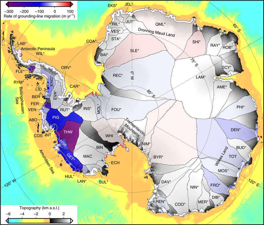
© Konrad et al/Nature GeoscienceThe major glaciers of Antarctica, and the speed with which their grounding line is retreating.
The most extensive study of Antarctic glaciers yet conducted has some bad, if not surprising, news. An area the size of Greater London has melted from the underside of southern ice sheets in just six years. The finding confirms suspicions Antarctic ice loss is well under way, and future sea level rise will be very hard to stop.

Antarctica is surrounded by a mix of sea ice formed on water, and ice shelves. Ice shelves also float, forming when a glacier is buoyant enough that its front end rests on water rather than solid ground. The point where the glacier last touches rock beneath the waterline is known as the "grounding line", and depends on both coastal terrain, and the thickness of ice at that point. Consequently, movement of the grounding line can reveal changes in the underside of the ice shelf, something that is very hard to measure.

Getting into scuba gear and measuring the location of Antarctic grounding lines in person has certain drawbacks, so Dr Hannes Konrad of the University of Leeds used satellite observations of ice altitude and the way water beneath the ice induces surface movement to reveal the shifts in grounding lines for Antarctica's 65 largest glaciers and ice sheets between 2010 and 2016.

The movement has not been consistent, Konrad and co-authors report in Nature Geoscience, both because of local terrain and shifts in ocean currents. However, some glaciers have experienced dramatic movement backwards, indicating substantial thinning of the ice. Previous studies have measured just a third of Antarctica's coastline, providing a very incomplete picture.

"Our study provides clear evidence that retreat is happening across the ice sheet due to ocean melting at its base, and not just at the few spots that have been mapped before now," Konrad said in a statement. "This retreat has had a huge impact on inland glaciers, because releasing them from the seabed removes friction, causing them to speed up and contribute to global sea level rise."

Sheeple

Death toll for Scotland's lambs sees a sharp increase after heavy snow

lambs
The death toll on Scottish sheep farms has seen a sharp increase following spells of heavy snow this winter, according to official figures.

Farming leaders said sheep farmers were facing a "war of attrition" from the weather after a severe winter followed a wet summer and autumn.

And they warned that it could affect productivity for the rest of the year.

Gary Mitchell, vice-president of NFU Scotland, said spring lambs were having a "really tough time".

Cloud Precipitation

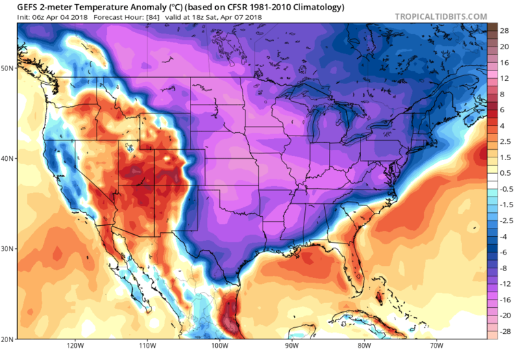
Much of US will see below normal temps this weekend, similarities to storm of 1982 - cold expected throughout April

US north east April 5th 2018 storm
Much of the eastern two-thirds of the nation will feature well below-normal temperatures on Saturday afternoon as depicted by the 06Z GEFS 2-m temperature anomalies; courtesy NOAA, tropicaltidbits.com
Overview

A very active weather pattern is bringing the I-95 corridor intense winds today associated with a strong cold frontal system and there may be another round of springtime accumulating snow this Saturday for much of the region. Winds could gust past 50 mph this afternoon and early evening following the passage of a strong cold front as a fresh cold air mass rushes into the region. On Thursday, it'll be dry and quite cold for this time of year and the winds will start off the day quite strong though they will likely diminish during the mid and late afternoon hours. A "clipper-type" low pressure system will then bring rain showers to the I-95 corridor on Friday and push a cold front through the region. This front will usher in very cold air for this time of year by early Saturday and low pressure will form along the stalling frontal boundary zone and likely generate accumulating snow in the DC-to-Philly-to-NYC corridor.

Comment: Winter in the US has been brutal, but it's reflective of a much wider trend:


Ice Cube

Record breaking April cold set to hit north eastern U.S. this weekend - snow from Washington to Boston

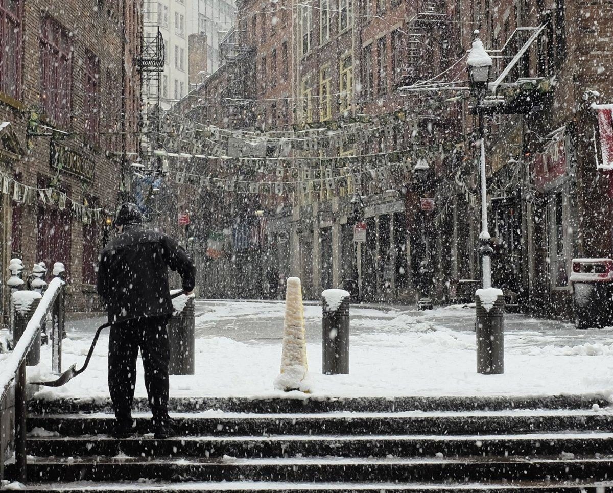
Stone Street in downtown Manhattan on March 22.
© Michael Dabin/New York Daily NewsA worker removes snow from the stairwell by Stone Street in downtown Manhattan on March 22.
An unusually cold winter storm is bound for New York City - again.

Dreams of clear skies and mild weather will have to wait, as forecasters predicted Wednesday that a record-breaking Arctic blast is headed for the East Coast this weekend.

"Ridiculous late season arctic outbreak Fri/Sat," Weather Company meteorologist Michael Palmer tweeted.

Temperatures in the city are expected to drop as much as 20 degrees below the normal and a slushy snow-rain mix will likely start falling on Friday and continue well into Saturday, according to the National Weather Service.

Comment: Arctic blasts, splitting jet streams, polar vortex's - how many new terms have to be invented before forecasters realise that our weather is dramatically changing, it's becoming increasingly colder, the seasons are much more volatile and erratic, and the phenomenon is worldwide, and which is evidence of the fact that we're entering an ice age:


Snowflake

"Where is spring?" Record snowfall across the Upper Midwest

chart
The Upper Midwest is no stranger to snow. Another winter storm moved through the area on Tuesday and dumped more powder across the region.

Snow bands set up and dropped several inches of snow. A few cities even set daily snowfall records Tuesday too. Many of the new records shattered the previous ones. Wausau, WI set a new record that was almost 4โ€ณ greater than the previous record from 1923.

Snowflake

Multiple cities in Wisconsin set snowfall records in spring storm

snow
A spring snowstorm set daily snowfall records in Appleton, Green Bay, Oshkosh, Wausau and several other Wisconsin cities on Tuesday.

The storm dumped 6.4 inches of snow in Appleton, 8.1 inches in Green Bay, 4.4 inches in Oshkosh and 9.3 inches in Wausau โ€” all daily records in those cities, according to the National Weather Service in Green Bay.

Other cities set records too: Antigo at 7.5 inches, Marshfield at 7.2 inches, Merrill at 7.3 inches, Stevens Point at 8.2 inches, Sturgeon Bay at 11 inches and Wisconsin Rapids at 7.9 inches.

A few parts of Waupaca and Oconto counties got nearly a foot of snow during the two-day snowstorm, but most of the region got between 6 and 8 inches.


Snowflake

Heavy spring snowfall hits Michigan with up to 14 inches

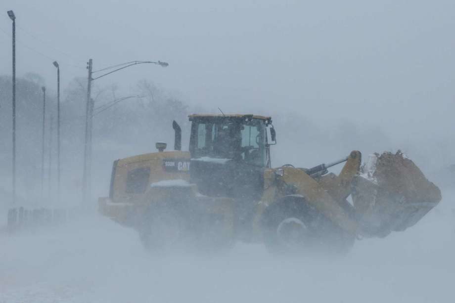
A loader moves sand from a parking lot back to Pere Marquette Beach in Muskegon, Mich.
© Muskegon ChronicleA loader moves sand from a parking lot back to Pere Marquette Beach in Muskegon, Mich.
A spring storm dumped more than a foot of snow in parts of Michigan's northern Lower Peninsula and is blamed for creating hazardous road conditions seen as a factor in three traffic deaths.

A spring storm dumped more than a foot of snow in parts of Michigan's northern Lower Peninsula, creating hazardous road conditions and blamed in at least three traffic deaths.


Snowflake Cold

Snowstorm during Easter dumps up to 11 inches on Nebraska

snow
Wintry weather contributed to crashes in Nebraska this weekend that claimed one life and critically injured a second person.

Snow on Easter โ€” in some areas up to 11 inches โ€” caused about two dozen crashes on Nebraska highways, including one that killed a Grand Island woman.

Ramona Senkbile, 84, died in a crash on U.S. Highway 30 in Grand Island on Sunday, the Nebraska State Patrol said.

Cody Thomas, a patrol spokesman, said Senkbile lost control on the snow and her vehicle was struck by an oncoming pickup.

Comment: See also: Omaha breaks 1899 record for low temperature with more snow back in the forecast