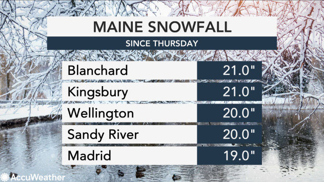
The National Weather Service (NWS) recorded over a foot of snow in nearly 50 locations, almost all of which were in Maine. In New Hampshire, the areas of Pittsburg, Jefferson and Berlin all recorded over 6 inches.
After Bangor, Maine, recorded one of the least snowy stretches in its history, the storm dumped nearly 8 inches of snow on the city according to a NWS spotter at Bangor International Airport. AccuWeather Meteorologist Ryan Adamson previously noted that the city averaged less than 4 inches of snow in April most years.
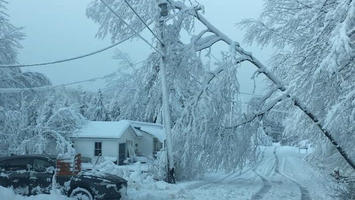
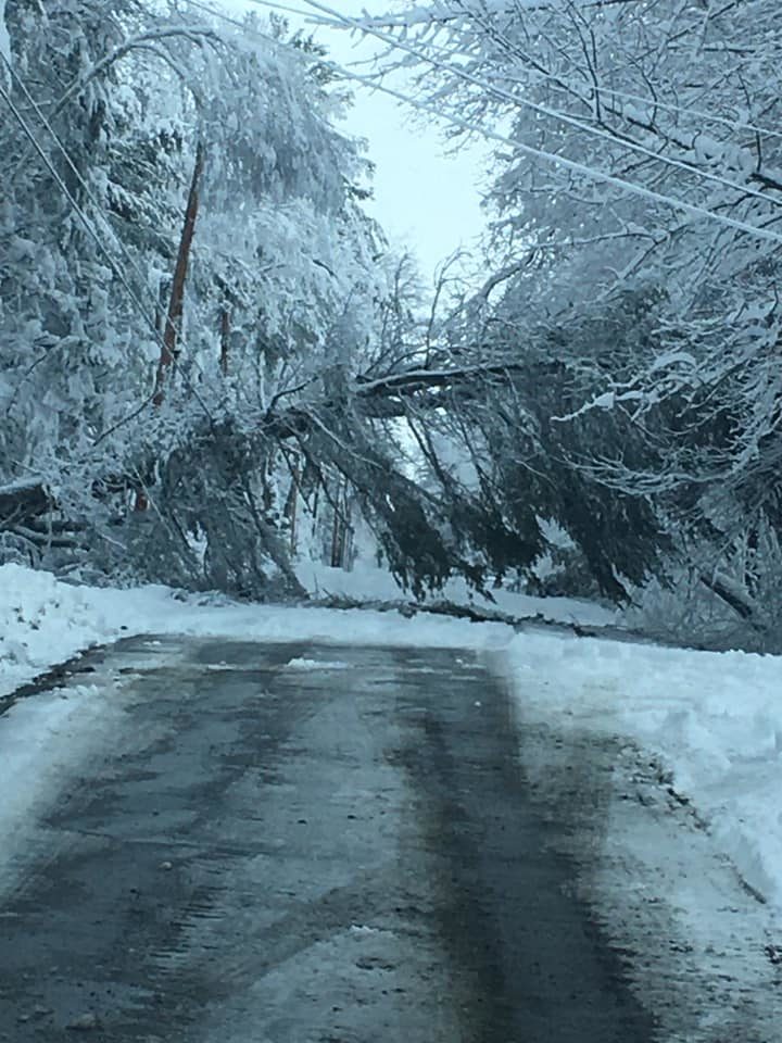
Photos shared by the nearby Dover-Foxcroft police department depicted just how heavily the snow weighed down trees and power lines.

"The sheer weight of the snow is enough to bring down a lot of trees and power lines," Hunter Tubbs of the NWS told The Associated Press.
Maine Gov. Janet Mills closed the state government offices in response to the slick road conditions caused by the storm.
"With heavy, wet snow causing dangerous driving conditions and power outages, I am closing State government offices," Mills said in a statement. "I thank all Maine people for rising to the new challenge of a spring snowstorm in the middle of a pandemic by staying at home and traveling only when absolutely necessary so our first responders and road crews can work safely."
The Maine Turnpike reduced speed limits to 45 mph by request of the State Police on Friday. The Maine Department of Transportation asked drivers to stay off the roads for plows to work uninhibited.
In southern New England, a wind advisory in Massachusetts was in effect on Friday morning for winds over 50 mph in areas such as Martha's Vineyard and Nantucket.
Coastal flooding forced lane closures on Morrissey Blvd. in the Dorchester neighborhood of Boston on Thursday afternoon. Shortly after, Beach Road in Salisbury, Massachusetts, was also closed to due coastal flooding.
Hail reports trickled in from Rhode Island and Massachusetts throughout Thursday afternoon and evening as well.
As the storm system tracked through the Northeast and into Atlantic Canada, the storm system officially met the criteria of a bomb cyclone. According to AccuWeather Senior Meteorologist Alex Sosnowksi, a bomb cyclone is a storm that strengthens so rapidly that the central barometric pressure plummets by 0.71 of an inch of mercury or more in 24 hours.
From Thursday night into Friday night, the storm system's lowest central pressure sunk 0.91 of an inch of mercury, surpassing the requirement for an official bombogenesis.


Reader Comments
to our Newsletter