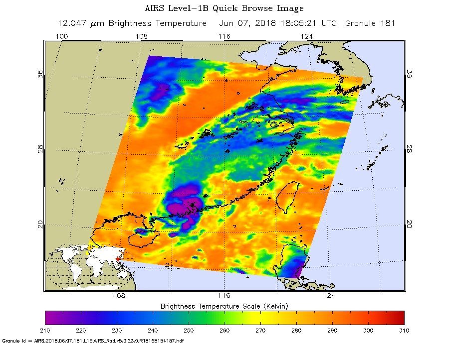
NASA’s Aqua satellite passed over Tropical Depression Ewiniar on June 7 at 2:05 p.m. EDT (1805 UTC) and saw coldest cloud top temperatures (purple) around the center of circulation in a small area on the southeastern China coast.
© NASA JPL/Ed OlsenNASA’s Aqua satellite passed over Tropical Depression Ewiniar on June 7 at 2:05 p.m. EDT (1805 UTC) and saw coldest cloud top temperatures (purple) around the center of circulation in a small area on the southeastern China coast.
Typhoon Ewiniar has brought torrential downpours to China's Guangdong Province, with some areas recording over 250 mm of rain in 24 hours, 08 to 09 June, 2018.

Guangdong provincial civil affairs department said that rainfall from Ewiniar affected Meizhou, Jiangmen, Yangjiang, Zhanjiang and Yunfu.

As of 08 June, 73,000 people had been evacuated to safe locations. The storms also led to flight delays in Baiyun International Airport in Guangzhou, capital of Guangdong.

Heavy rain from Typhoon Ewiniar triggered landslides in the city of Yunfu, causing houses to collapse and landslides that killed five people. One person is still missing according to Guangdong civil affairs officials.


Ewiniar made landfall in Hainan and Guangdong earlier in the week, bringing heavy rain and strong winds. It then moved back into the South China sea before making a third landfall, again in Guangdong, on Thursday 07 June. As a tropical depression, the storm had earlier caused heavy rain in parts of Vietnam, causing landslides and flooding.

locals ride motorbikes on flooded street in heavy rain caused by typhoon Ewiniar, in Haikou, South China's Hainan province, June 6, 2018.
Locals ride motorbikes on flooded street in heavy rain caused by typhoon Ewiniar, in Haikou, South China's Hainan province, June 6, 2018.
Ewiniar was forecast to move northwards and weaken into a tropical depression. However, China Meteorological Administration warned that Guangdong could still see further heavy rain in the wake of Ewiniar as well as influence from the monsoon.