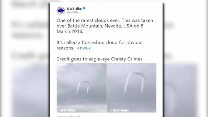
Christy Grimes caught a glimpse of what the National Weather Service calls "one of the rarest clouds ever."
Grimes shot the photos near Battle Mountain Thursday and sent them to the National Weather Service office in Elko, Nevada.
So, with it being one of the rarest clouds, everyone is stuck wondering how the clouds form.
The Elko National Weather Service office gave this great explanation:
"An updraft pushes flattish cumulus clouds up and a horizontal vortex develops from differential updraft speeds.So, if you ever see a horseshoe cloud, make sure to snap a photo, because you're one of the lucky ones.
As the vortex climbs, it gets caught in the faster horizontal winds aloft, and the middle part of the vortex catches the faster speeds with the ends being slower.
The result is that the center of the vortex pulls out ahead. Various time lapses can be found online."


Looks more like a people will get stapled to the underground.