Here are four extreme events we've seen so far, and what could be ahead.
1. Top 10 Cool Start
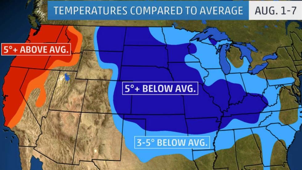
The Plains and Midwest have seen temperatures nowhere near the torrid levels typically expected in early August.
For some cities in those regions, the first eight days of August ranked among the 10 coolest for that period in more than 100 years of records.
Among the locations are Sioux City, Iowa (tied, second-coolest), Kansas City (third-coolest), Denver (ninth-coolest) and Cincinnati (ninth-coolest), according to data from NOAA's Regional Climate Centers.
If you are enjoying the early fall preview, we have good news: this overall cooler-than-average temperature regime is likely to continue into next week.
2. Record Heat Bottled Up in the Northwest
Residents of the Northwest have been sweating it out with record heat to start August.
Tuesday marked the record-breaking 11th consecutive day with highs 90 degrees or hotter in Salem, Oregon. During that stretch, temperatures topped 100 degrees in each of August's first three days in Salem.
Portland and Seattle are among several cities along the Interstate 5 corridor to registered the hottest first eight days of August on record, according to Regional Climate Center data.
To make matters worse, the Pacific Northwest has been socked in with wildfire smoke from Canada during this hot stretch, leading to poor air quality.
Relief from the torrid temperatures is finally on the way this weekend. An area of high pressure aloft will break down and give way to cooler weather that continues into next week.
3. Rare August Tornadoes in the Sooner State
Oklahoma has a tornadic reputation, but that's usually reserved for spring - not early August.
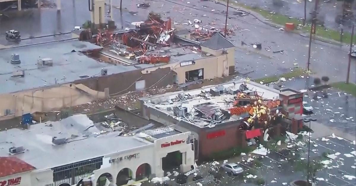
In the wee hours of Aug. 6, however, four tornadoes touched down in northeast Oklahoma. One was an EF2 that tore through southeastern Tulsa and injured 30 people while damaging nearly 200 homes and businesses.
Before Sunday morning's tornado in Tulsa, only two August tornadoes had occurred in Tulsa County since 1950. Both of those previous August tornadoes occurred in the 1950s.
For Oklahoma as a whole, August has averaged the fewest number of tornadoes of any non-winter month dating to 1950, with about one per year.
4. Flash Floods Strike Three Major Metros in Four Days
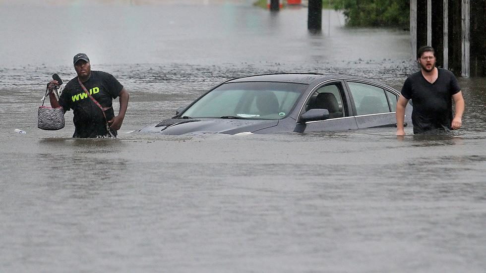
Significant flooding swamped three major metro areas in the South over the course of four days beginning this past Saturday.
Heavy thunderstorms first led to flash flooding in New Orleans late Saturday. Then, floodwaters from slow-moving thunderstorms inundated parts of the San Antonio and Houston areas Monday morning and Tuesday morning, respectively.
In some areas, the flooding prompted water rescues and flooded vehicles, homes and businesses.
The culprit for the soaking storms in the South was deep, tropical moisture interacting with a stalled front and ripples of energy aloft. In this type of weather setup, thunderstorms can be very efficient rain producers, resulting in multiple inches of rain soaking one spot in an hour's time.
In the case of New Orleans, the National Weather Service said isolated locations saw 8 inches of rain in four hours on Saturday.

The South will remain in a wet pattern into next week, which will likely contribute to more bouts of localized flooding.


Comment: Extreme and unusual weather continues in the United States as it did in late July.
For more coverage on the extreme weather affecting the entire planet, check out our monthly SOTT Earth Changes Summaries.