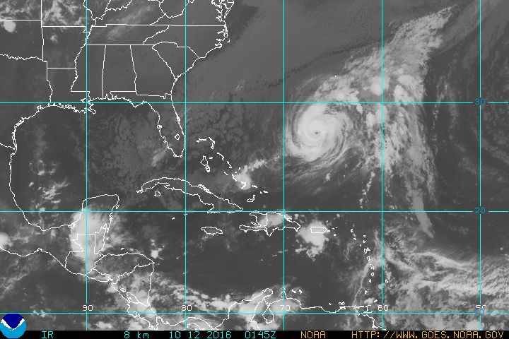
On October 6, against all odds, with strong wind shear conditions in the area it developed into a Category 1 hurricane and just a day later into stronger Category 2, becoming the first time since 1964 that two hurricanes (Matthew and Nicole) at or above Category 2 existed in the western Atlantic Ocean (65°W) simultaneously.
Soon after, Nicole had again weakened into a tropical storm. However, a large storm system moving over the northeast U.S. is not only helping pull what is left of Matthew away from the east coast, but will also drag Nicole to the north at a greater speed than during these past few days, bringing it directly towards Bermuda.
As a result, the Bermuda Weather Service has issued a hurricane warning for the island.
As of Tuesday afternoon, Nicole is to the south of Bermuda, with wind speeds near 120 km/h. The storm is slowly tracking northwest at roughly 7 km/h.
"Additional strengthening is forecast during the next day or two," according to the NHC.
Strong winds, high surf and heavy rain bands are expected to affect the islands at least during a 24 hour period, as the storm begins to make a turn to the northeast just after crossing the islands.
The NHC is now expecting Nicole to pass over Bermuda on Thursday as a category 2 hurricane with sustained winds above 160 km/h. The strong winds, will be accompanied by a 3 to 6 ft (0.9 to 1.8 m) storm surge depending on the exact track of the storm, and 125 to 250 mm of rain capable of producing flooding.
This small island country in the middle of the Atlantic has already experienced some tropical storm action this season. Back on September 23rd, Tropical Storm Karl passed just east of the archipelago with sustained winds of about 105 km/h, causing coastal erosion and flooding in several areas.
Nicole could impact Atlantic Canada
Beyond Thursday model tracks vary, but tend to drive Nicole north-northeast towards Eastern Canada. As a high pressure ridge builds over the North Atlantic later in the week, Nicole could be forced to follow a more northerly track, staying closer to the North America coast, eventually reaching land around the eastern coast of Newfoundland sometime by early next week.
Warmer than average Sea Surface Temperatures (SSTs) in the region could keep Nicole strong enough to bring gusty winds, heavy rain and high surf along coastal areas of southeast Canada by the end of this week.


Reader Comments
to our Newsletter