The lake froze, and sustained winds during the Blizzard of '77 blew 3 feet of accumulated snow off the ice and dumped it across the Niagara Frontier. Great Lakes scientists say it's too early to tell if the lake's present condition will lead to that kind of snow catastrophe this winter.
Until the lake freezes, there's always a chance for lake-effect snow. But as the water turns colder, there's less chance for a repeat of the heavy lake-effect snowfall that hit the area a couple of weeks ago. "It really depends on what happens now and over the next few weeks or month," said Eric J. Anderson, a forecaster at the Great Lakes Environmental Research Laboratory in Ann Arbor, Mich.
Anderson said the cooling of the lake was speeded up by to the polar blast that recently dumped more than 7 feet of snow recently in some communities. "The lake is primed," Anderson said. "If the air temperature drops, the lake is ready to freeze." But could that spell trouble, too?
Buffalonians know as well as anyone that a frozen lake can be a blessing - there's no more lake-effect snow. "Once you seal it - once the water is not liquid - that cuts the evaporation" and with it the lake-effect snow, said George A. Leshkevich, a Great Lakes ice scientist for the National Oceanic and Atmospheric Administration.
Signs of ice
Last winter, ice covered 92.5 percent of the Great Lakes - the most since 1979. As of the middle of November, ice was already forming in some of the northern bays of Lake Superior. "It's the earliest our office has on record for ice," Anderson said. Anderson called the early onset of ice "symptomatic" of a "cold year" over the Great Lakes.
A brutally cold winter, the late arrival of spring and a cool summer over the region kept lake temperatures - including Lake Erie - lower than usual this year. A warm autumn tempered those readings, at least until the arctic blast last month.
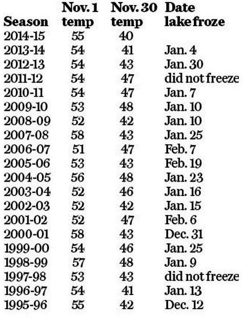
Last year, the Nov. 30 water temperature of Lake Erie in Buffalo was 41 degrees, and ice began forming on the lake during the second week in December. By Dec. 12 - after an arctic blast and round of lake-effect snow - about 10 percent of Lake Erie was already covered in ice.
Forecasters expect the same conditions could occur this month and continue through the winter.
"The ice cover in Lake Erie will be similar to last year," said Jia Wang, an ice and climate forecaster at the Great Lakes laboratory.
As of Tuesday, there was no sign of ice on the lake. When it does appear, it will likely show up first near Toledo and along the Canadian shore near Long Point, Ont.
"The shallow areas are going to get that formation first," Anderson said.
Temperatures vary
The Buffalo office of the National Weather Service takes Lake Erie's daily temperature at a 30-foot depth at the city's water treatment plant, near where the lake spills into the Niagara River.
Tuesday's reading remained at 40 degrees, but there's a 14-degree spread on the thermometer between the western part of the lake and its deepest point between Long Point, Ont., and Erie, Pa.
Scientists said the temperature was at a lake-low 34 degrees in shallow areas near Toledo and 38 degrees near the islands off of Ohio's shore. Surface temperatures on the deeper eastern end of the lake near Buffalo ranged from 42 degrees to 44 degrees with the lake's deepest waters still at 46 degrees to 48 degrees.
So, there's still a ways to go before the lake freezes, ending the lake-effect threat. "The lake freezing is what would end it," said Jeff Wood, a National Weather Service meteorologist in Buffalo. Anderson said, "Even if you start now, you're really not going to start to shut the system down for another three weeks or so." Over the last 30 years, the average date when the lake freezes is Jan. 21, the weather service said.
Lake effects
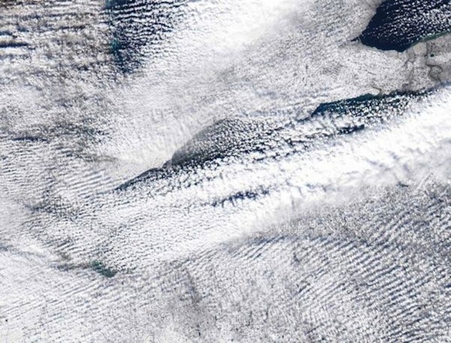
If warmer water is the key to lake-effect snow, will the colder water knock down the ferocity of any more lake-effect storms? The simple answer is yes. Scientists said the wider the spread between the temperatures of the air and the water, the more evaporation occurs and thus greater lake-effect snow. "As the water temperature falls, then the difference between the two is lessened," Leshkevich said. "The possibility of evaporation is going to be reduced."
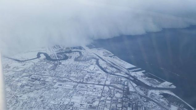
On Nov. 18 - well into the first of the two big lake-effect storms last month - Lake Erie's temperature was 48 degrees, according to the National Weather Service. The air temperature at the surface of the water then was about 24 degrees. At 5,000 feet above the lake, it was 5 degrees. At 20,000 feet it was minus 44. Mix in the west wind, and it all turned into snowfall rates of up to 5 inches an hour.
"The lake was still quite warm and you had an awfully cold air mass aloft," Wood said.


Comment: Ice ages can start at any time and develop quickly. Are you prepared?