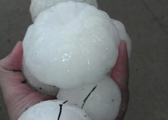
A twister nearly formed near the town just after midnight, the national Storm Prediction Center noted, but the biggest impact was from hail.
"That was a HUGE bow-hook, a monster funnel cloud," WxRisk.com, a private weather forecasting firm, posted on its Facebook page. "Hail in excess of 4.25 in[ches] (107.95 mm). Slightly larger than softballs at times."
The firm said one of three storm cells that moved through the town of 700 "produced monster-size hail for almost 30 minutes ... lots of reports of cars and structures being damaged due to the large hail. Tennis-ball hail, CD hail, Soft-ball hail, and even larger."
Large hail pounded other parts of Kansas overnight as well, and the forecast for Thursday had much of the region, including Kansas, Nebraska, Iowa and Missouri, with a high chance of severe weather, weather.com reported.
"We're getting into that time of year when we get severe thunderstorms just about every day," said Greg Forbes, weather.com's severe weather expert.
The storm system will trigger strong storms in the Ohio Valley on Friday, weather.com forecast.


Reader Comments
to our Newsletter