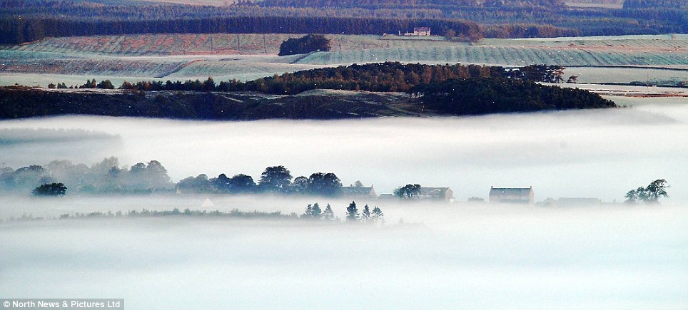
Icy polar winds are to sweep across the country from tomorrow, with temperatures plummeting to below freezing and up to 2ins of snow forecast for parts of the north by the end of the week.
Millions will wake up to frost this week, but the worst of the weather will hit Scotland and North-east England.
Wednesday will be the coldest day of the week, with temperatures as low as -3C on Tuesday night in rural parts of the north. The mercury will also struggle to rise above freezing overnight in the south.
The arrival of Jack Frost can be blamed on polar winds. Charlie Powell, a forecaster at the Met Office, said: 'We have had a nice area of high pressure just to the west of the UK, giving light winds, settled conditions and quite dry weather.
'The change is down to an area of low pressure to the north of that high. It is going sit over Scandinavia and displace that high pressure and bring in colder weather from the Pole.'
Daytime temperatures on Wednesday will be just 9C (48F) in the north and 11C (52F) in the south. Snow is forecast for the Scottish Highlands.
Wind chill could mean that London's temperatures will feel as low as minus 5C (23F).
The good news is the Arctic blast will not last. Mr Powell said: 'After Thursday the high pressure will tend to win out again and cut off that northerly flow, making it less cold.'
Netweather, which correctly predicted last winter's big freeze, as well as the mixed summer, is forecasting a cold December and a white Christmas.
Last winter was the coldest for more than 30 years. Temperatures in December, January and February struggled to stay above zero, with the UK average 1.5C (35F), making it the deepest freeze since 1978-79.
But winter's biggest problem will be another drought which sparks water-saving restrictions, forecasters including ex-BBC weatherman Michael Fish have warned.
The Met Office has warned of snow from Tuesday across Scotland plus higher ground in northern England and Wales. Positive Weather Solutions said even Dartmoor, Devon, is at risk.
Netweather, which issue forecasts by Mr Fish, Britain's most famous weatherman, say winter's biggest worry will not be snow but dramatically below-average rainfall.
Water companies are still recovering from the summer drought, which developed through the driest first six months of a year since 1929.
Average rainfall was down 30 per cent at just 356.8mm, forcing a hosepipe ban for seven million people in north-west England, and drought orders and water-saving pleas in Dumfries and Galloway, Scotland.
Netweather forecaster Paul Michaelwaite, who accurately predicted last winter's freezing weather and the summer's hot start and wet finish, said: 'Rainfall is expected to be significantly below average in December, January and February.
'With winter being a key period in topping up reservoir water levels, the below-average rainfall has the potential to cause real issues with water shortages in 2011.
'We believe this is the most significant aspect of winter, coming after a largely-dry summer for parts of the UK and a very likely dry spring to follow.'
Netweather said the winter drought will be caused by westerly winds - which usually bring rain - being blocked by freak air pressure changes over the Atlantic Ocean.
Winds normally rush to Britain between a high pressure area around the Azores and low pressure area over Iceland - but both zones now have pressure closer to medium, meaning winds are being rebuffed.
This pressure problem is proven by a record low in a meteorological pressure measurement called the North Atlantic Oscillation, Mr Michaelwhite said.
Netweather also said back-to-back White Christmases are on the cards - and there will also be bitter spells of winter cold due to a weather effect known as 'La Nina.'
The weather event - Spanish for 'The girl' - is seeing Pacific Ocean water temperatures up to 6C below normal, with a knock-on effect on Atlantic Ocean temperatures and a colder winter in Europe.
'It is very likely an exceptionally strong La Nina event will take place with a probable peak in December or early January,' Mr Michaelwhite said.
'Unusually cold La Nina ocean temperatures in the tropical Pacific are well established.
'And given the large volume of water with temperatures up to 6C below normal, this could potentially be the strongest La Nina of the last 60 years.'
The Met Office has axed its seasonal forecasts following its disastrous prediction 2009's washout summer would be a 'BBQ summer,' and saying there was a one in seven chance of a cold winter before last year's bitter winter.
Met Office forecaster John Hammond said: 'Our research about seasonal forecasts shows the public find it more useful to have month-ahead forecasts.
'Seasonal forecasts are a developing science and our research into them is continuing.'


Time to get out the Xmas songs. Yippee!
Always better than the usual terrorist trilogy tripe we currently must listen to. Seems the heart isn't too involved in culture anymore as the songs just aren't up to snuff, must be the end of the cycle.