Extreme Temperatures
S


Snowflake

Walloping of snow in Yellowknife, Canada sets a record

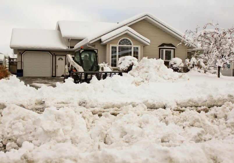
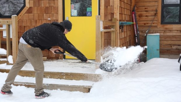
Yellowknifers are cleaning up after they were whalloped with 24.2 centimetres of snow on Tuesday.
© Chantal Dubuc/CBCYellowknifers are cleaning up after they were whalloped with 24.2 centimetres of snow on Tuesday.
24.2 cms fell, beating the previous November record for one-day snowfall

It's a winter wonderland in Yellowknife Wednesday, as the city cleans up after 24.2 centimetres of snow fell on Tuesday — a record breaking amount.

Dan Kulak, a meteorologist with Environment Canada, says Tuesday's system was the most snow that has fallen in one day in Yellowknife in the month of November.

And, it might just be the most snowfall in one day ever recorded in the city.


"A fair amount of snow happened in that one day there," Kulak said.

"The observer at the Yellowknife airport did record over 24 centimetres of snow in the calendar day. That, at this point in time, does look like it is a new record."
Snowflake

Heavy snowfall in spring sweeps across South Africa; 30cm (1 foot) recorded

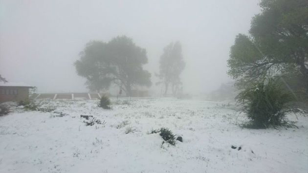
Karoo National Park outside Beaufort-West
© Riaan NelKaroo National Park outside Beaufort-West
Over 30mm of snow fell on the Eastern Cape highlands last night while snowfalls are continuing throughout Thursday.

Amy Vermeulen of Tiffindell Ski Resort said heavy snowfalls fell throughout the evening of November 15. "We had a whopping 30cm and the snow high in the mountains should last until the weekend for those avid snow-seekers wishing to make a snowman or throw some snowballs.

The road to the resort is currently closed but is expected to be open later Thursday afternoon. "Around Tiffindell, the highest five passes in South Africa are also currently closed," Vermeulen said.

Snow Report SA said it is expecting heavy falls in Lesotho and the Eastern Cape Drakensberg today, but only medium to light falls on the KZN Drakensberg, with a small possibly of snow settling in towns like Underberg and Himeville, and some flurries in the KZN Midlands which were unlikely to settle. There was little likely hood of snow on Van Reenen's Pass. Snow Report SA said light snow fell in at Clarens, in the Free State. and in Mooi River.


Snowflake

Early season snow pounds Pacific Northwest and Northern Rockies, ski areas open weeks ahead of schedule

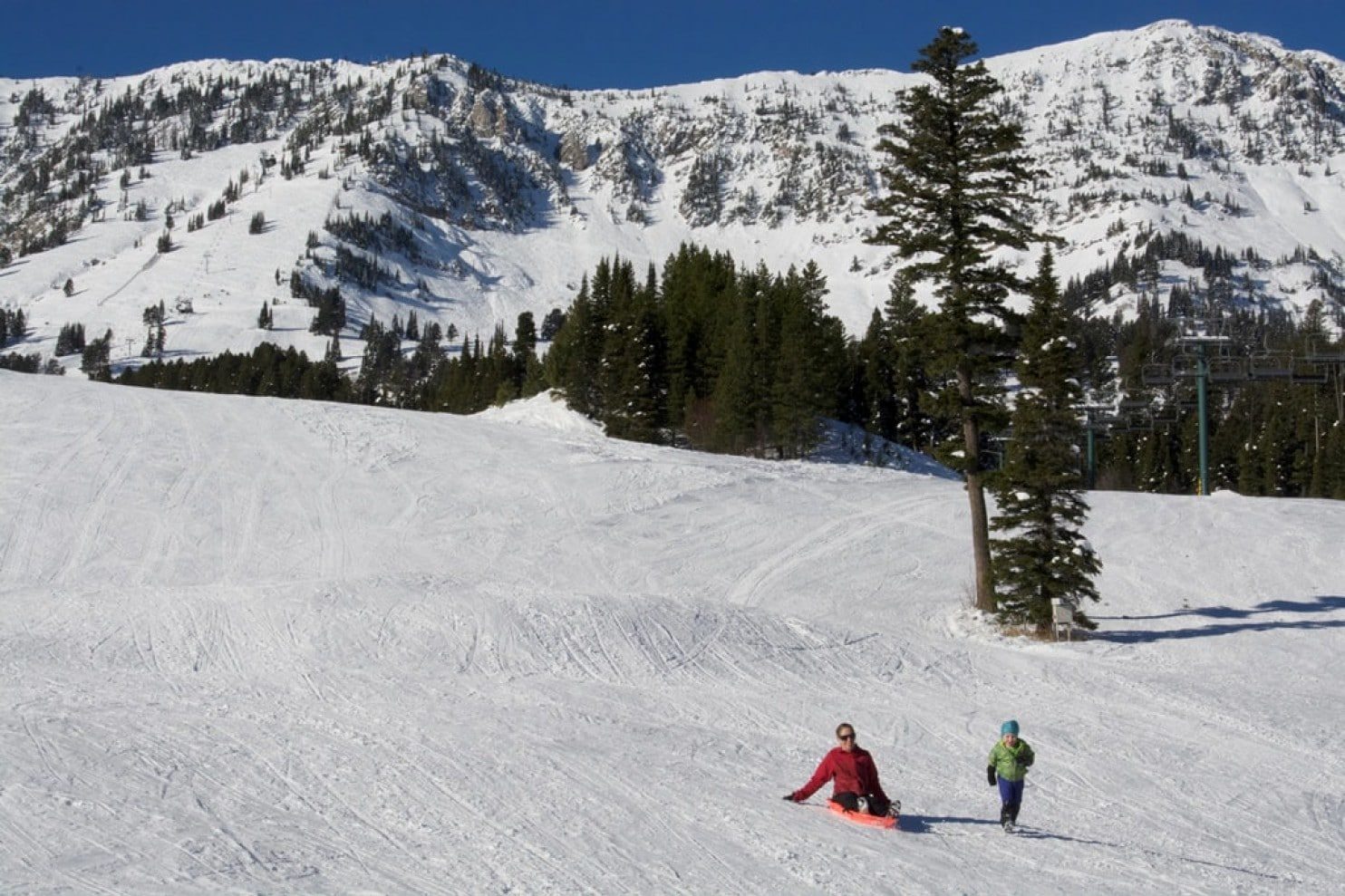
Midwinter conditions in November at Bridger Bowl ski area in southwest Montana on Monday.
© Doug WalesMidwinter conditions in November at Bridger Bowl ski area in southwest Montana on Monday. While the lifts aren’t operating yet, the locals have already taken to the slopes.
A conga line of powerful winter storms parading off the Pacific Ocean over the past several weeks has dumped a huge amount of early-season snow on the Cascades and Northern Rockies, allowing many ski resorts to open weeks ahead of schedule.

Skiers and snowboarders at Bridger Bowl in southwest Montana were stoked to hear that the lifts will be spinning Thanksgiving weekend for the first time since the 2010-2011 season.

Big Sky resort, also in southwest Montana, is cashing in on the early-season snows as well. "Lone Mountain looks incredible right now," said Chelsi Moy, public relations manager. "Big Sky has received 76 inches so far this preseason and crews are putting final touches on the mountain. Things are shaping up nicely for a great opening day on November 23rd."

Snowflake Cold

Egyptians collapsed in Grand Solar Minimum, record cold in British Columbia

egypt
Record cold blankets British Columbia smashing old records kept since 1880 by 5C, Arctic sea ice seems to be increasing as this 2017 melt season ended the earliest on record and the last Pharaoh of Egypt's reign was ended by a major volcanic eruption that reduced food production in a Grand Solar Minimum circa 245BC.


Sources

Snowflake Cold

Hail nets for global crops, strange La Nina and record cold North America

snow
Cycles of out of cycle La Nina events and record snows form 1972 are back across west coast of N. America from Alaska to California. The record snow events of last years all time snow pack depths in the Sierra Nevada's and Rocky mountains are already being eclipsed but this years snow falls. Hail events will require protecting our crops using more expensive nets, Iridium is a good example. Look for more floods, hail, wind and snow events as the Grand Solar Minimum intensifies through 2018.


Sources

Snowflake Cold

Record-breaking cold temperatures for Boston, Massachusetts

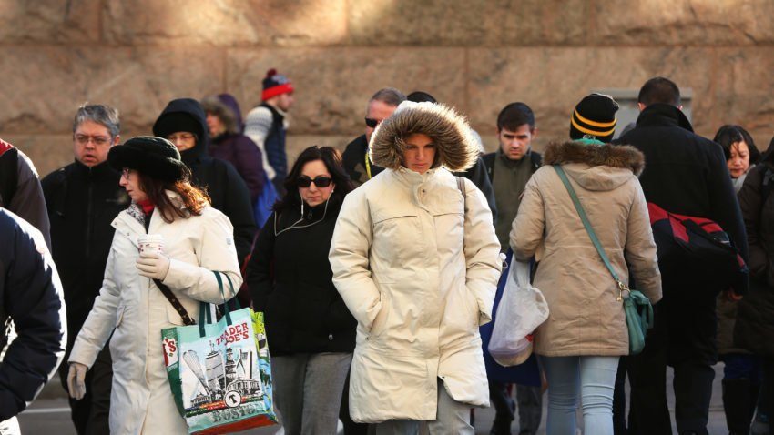
People are in varying stages of bundle outside South Station.
© Pat Greenhouse / Boston GlobePeople are in varying stages of bundle outside South Station
Record lows for the second day in a row.

Boston broke a 116-year-old record Saturday morning when the temperature dropped to 23 degrees, according to the National Weather Service.

The previous record low for November 11 was set at 24 degrees in 1901.


Comment: See also: Return of the Polar Vortex? Arctic Cold Setting Dozens of Daily Records in the Northeast and Midwest


Snowflake Cold

Toronto breaks 79-year-old record as temperature drops to -10.1 C

Toronto cold weather
Toronto has broken a 79-year-old temperature record for the coldest Nov. 10th ever.

The temperature at Pearson International Airport dropped to a low of - 10.1 C at 8 a.m., topping the previous record of - 8.9 C (1938)

Adding insult to injury, the temperature probably seemed even cooler with the wind chill making it feel closer to - 15 for most of the morning rush hour.

The good news is that the temperature will improve throughout the day but only slightly.

Environment Canada is forecasting a high of - 2 C.

An extreme cold weather alert that was first issued on Thursday afternoon will be lifted as of noon, according to the city.

Comment: Dozens of record low temperatures have been recorded in the past few days across the US Northeast and Midwest while New York City set a 103 year old cold record.


Snowflake Cold

New York City sets 103 year record for cold low

NYC cold
© John P
Dr. Ryan Maue has been tracking the forecasts for the Northeast, and the result is...ah, chilling. Maue says the "polar vortex" is responsible for the exceptionally cold and dry air invading the Northeast USA.

He goes on to say that the all time record for New York City of 22°F forecast by morning in NYC would be coldest, earliest temperature on record.

Snowflake Cold

Return of the Polar Vortex? Arctic Cold Setting Dozens of Daily Records in the Northeast and Midwest

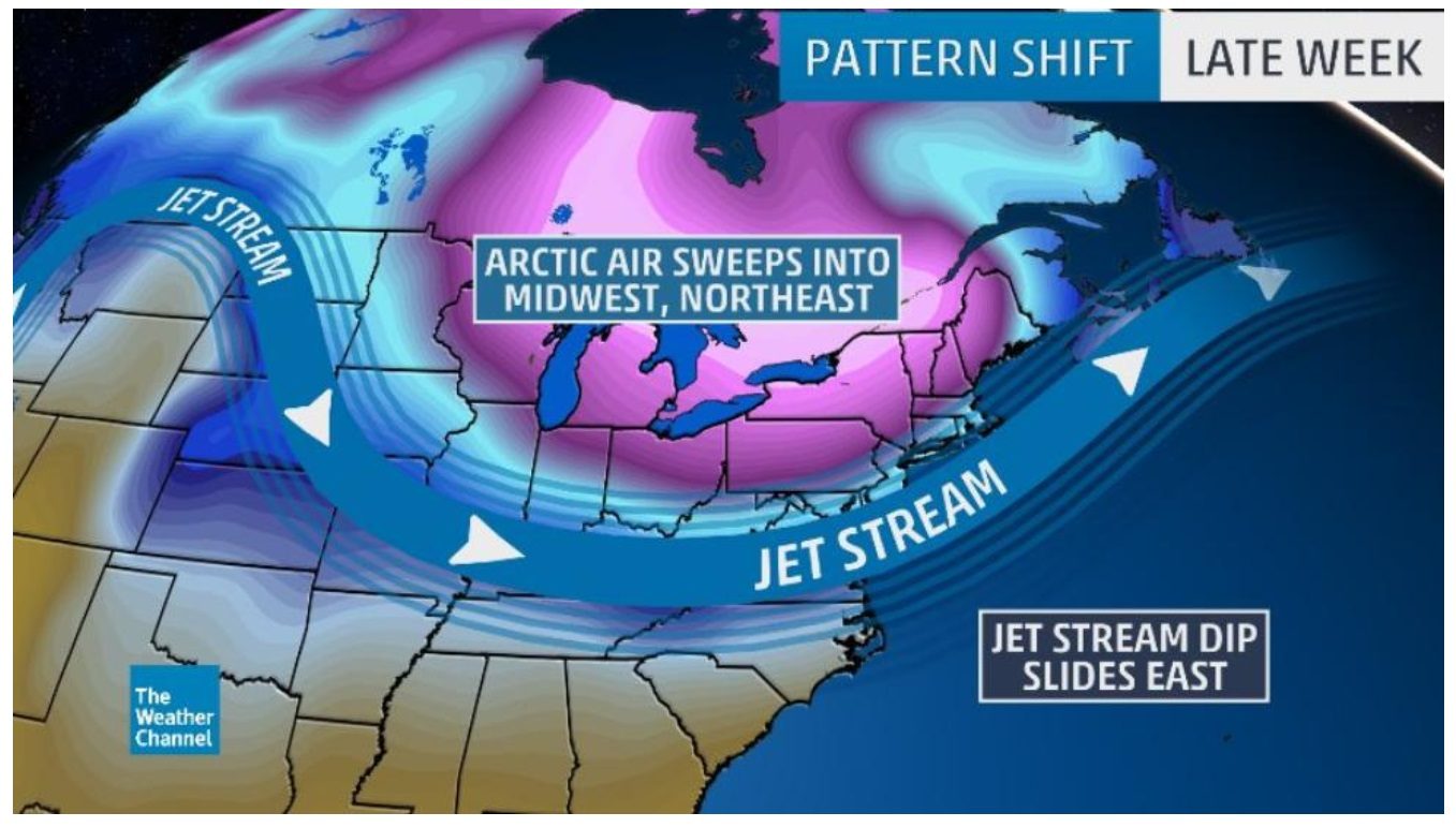
pattern shift
The upper-level weather pattern late this week will bring arctic air to the Midwest and Northeast.
Old Man Winter is paying a strong visit to the Midwest and Northeast this weekend, bringing the coldest air of the season so far, smashing daily records from the Northern Plains to New England.

A pronounced southward dip in the jet stream has driven a cold front through the Midwest and Northeast.

This is bringing a blast of arctic air to portions of the northern tier, which will last into the weekend.

Coldest Air So Far This Season Arrives, Including Record Lows

As anticipated, Saturday morning is the coldest morning of the season, so far, in the Northeast, with record lows already being reported in two dozen locations, including:
  • Atlantic City, New Jersey (21 degrees)
  • Baltimore (21 degrees)
  • Boston (23 degrees)
  • Buffalo, New York (19 degrees)
  • Cleveland (20 degrees)
  • Erie, Pennsylvania (19 degrees)
  • New York City's Central Park (24 degrees)
  • Pittsburgh (17 degrees)
  • Syracuse, New York (16 degrees)
  • Washington D.C. (26 degrees)
  • Youngstown, Ohio (13 degrees)
According to the National Weather Service, Saturday morning's record low in Washington D.C. was their first in November since 1976.

Comment: So much for global warming. And no, global warming is not the cause for the extreme low temperatures we are seeing. If anything, one might expect to see long winters on the east coast and exceptionally cold temperatures into March. See:

Brace yourself, the polar vortex is shifting
Ice Age Cometh: Scientists concerned approaching solar minimum could plunge Earth into deep freeze
Russian scientist: 'The new Little Ice Age has started'
Polar vortex or impending ice age?


Snowflake

Late snowstorm strikes South Island, New Zealand

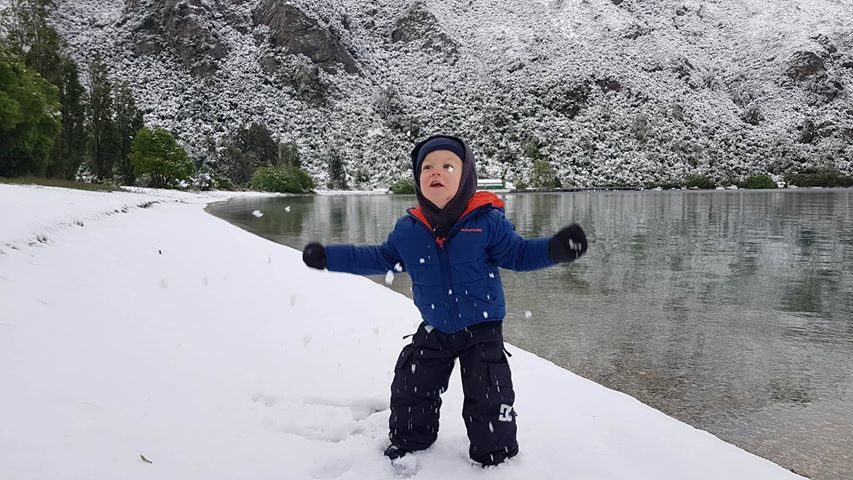
Jakob Williams (2) plays in the snow on the shores of Lake Wakatipu at Kingston
© Warren WilliamsJakob Williams (2) plays in the snow on the shores of Lake Wakatipu at Kingston
The snow and flooding that hit the South overnight caused several schools to close today, affecting hundreds of pupils.

The Ministry of Education advised of the closures, saying regional teams had been contacting schools and early childhood centres.

"Three of the seven schools were forced to close because their school buses couldn't get through on the roads. We are helping all the impacted schools and early learning services. No reports of damage have been received,'' Katrina Casey, deputy secretary of Sector Enablement and Support, said.

The affected schools are: Tapanui School, Blue Mountain College, Heriot School, Northern Southland College, Lumsden School, Mossburn School and Garston School, while the early learning services are: Riverstones Early Learning Centre in Lumsden and Kidz Way Early Learning Centre in Tapanui.

Heavy snow blanketed the mountains around Wanaka overnight down to 300 metres affecting roads, but it is clearing in most places as the day wears on.