Extreme Temperatures
S


Snowflake

Early season snow storm dumps at least 7 inches in parts of east-central Missouri

Webster Groves residents dig out of snowstorm
© St. Louis Post-DispatchWebster Groves residents dig out of snowstorm
The second biggest pre-November 15 snow event on record in east-central Missouri bogged down traffic in the St. Louis area. National Weather Service Meteorologist Kevin Deitsch says snow plows haven't kept up with snowfall that could total eight inches in some places. "Most roads that we've noticed have been covered," said Deitsch. "MoDOT (Missouri Department of Transportation) has been working hard to clear them but the snow has just come down fairly heavy that they haven't been able to keep up."

Southeast Missouri, including Cape Girardeau and the Bootheel region, have received one to two inches of snow from the storm while Jefferson City in mid-Missouri has also received two inches or more. Deitsch says the early winter storm will hover over the region into the midday. " Looks like the precipitation should start to get out of here late this morning to early this afternoon, in the metro probably ending sometime between about noon and 3 p.m."


Snowflake

Record breaking snowfall for parts of the ArkLaMiss region

snow
While the calendar says we're about a week away from Thanksgiving, Mother Nature says it's more like January.

A low pressure system brought some accumulating snow to parts of the Arklamiss today. This is incredibly rare, as snow is more typical later into winter (January, February).

Totals ranged from a dusting to just over half an inch.

While totals were fairly low and impacts were minimal, this event broke a record for earliest accumulating snowfall in history for the twin cities.

And many of us enjoyed it! The kids still had to go to school, but many residents and four legged friends got to enjoy it as well.


Comment: See also: Cold weather gives Texas earliest snowfall ever recorded - 7 inches in the Panhandle


Snowflake

Cold weather gives Texas earliest snowfall ever recorded - 7 inches in the Panhandle

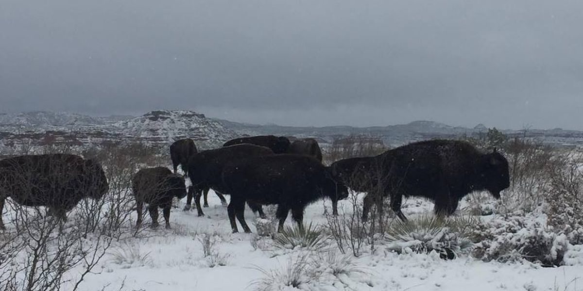
These beautiful images captured bison
© Annie Hepp, Texas Parks and WildlifeThese beautiful images captured bison enjoying the first snowfall of the year in Texas
Houston reported its earliest snowfall ever, beating places like New York City and Boston as a cold snap descended over Texas.

George Bush Intercontinental Airport in Houston set a new record for the first observed snowfall, breaking one set on Nov. 23, 1979, according to a Twitter post from the National Weather Service. Near record-breaking cold has swept into the South, with temperatures in the state 25 degrees Fahrenheit (14 Celsius) or more below average, according to the U.S. Weather Prediction Center in College Park, Maryland.


Snowflake Cold

1.9 meters (over 6 feet) of snow forecast for the Atlas mountains in Morocco

snow
Overcast weather is expected in the Oriental, Saiss, Rif, and Mediterranean regions. The southeast and Atlas region will experience thunderstorms and rain showers.

Snowfall of 1.9 meters is forecast in the high and Middle Atlas. Moderate to strong winds will sweep the eastern and southeastern regions.

The reliefs of the Atlas and southeastern slopes will experience icy cold weather.

The temperature lows today are between 6 and 11 degrees Celsius in the Oriental, the Atlas and Southeastern slopes; between 11 and 16 degrees Celsius in Saiss, Souss, the Atlantic plains, and the northern and southern provinces; and between 16 and 20 degrees Celsius in the far south.

Snowflake Cold

Adapt 2030 Ice Age Report: (Moldy crops & delayed harvests) Your food source is quickly diminishing

snow crop
Late January winter temperatures grip parts of grain growing areas in Canada and USA along with delayed winter wheat planting, massive rains are delaying harvests in the southern part of the US. Farmers report moldy crops and plantings buried in mud.

Record cold extends to southern Mexico with temperatures 25-30F below normal for this time of year.

A new Grand Solar Minimum timeline to crop losses.


Sources

Attention

Massive snowfall causes deadly traffic pile-up & vehicle explosion in Russia's south

blizzard cars driving snow
Terrifying footage was captured when a car exploded during a massive vehicle collision in the Rostov region, where extreme weather conditions caused a major traffic incident on an expressway linking Moscow with southern Russia.

One person died and at least two others sustained injuries, after some 15 cars collided on the M-4 Don highway following heavy snowfall on Tuesday. The major road incident caused heavy traffic on the border of the Rostov and Krasnodar Regions.

Igloo

'We see a cooling trend' says NASA scientist

Abnormally cold weather in Moscow
© Sputnik/Maksim BlinovAbnormally cold weather in Moscow.
The sun is headed towards its solar minimum, a time of far less energy output. That could mean cold winters are on their way, according to officials from NASA, the US space agency.

"We see a cooling trend," Martin Mlynczak of NASA's Langley Research Center said in late September. "High above Earth's surface, near the edge of space, our atmosphere is losing heat energy. If current trends continue, it could soon set a Space Age record for cold."

NASA's SABER [Sounding of the Atmosphere using Broadband Emission Radiometry] instrument aboard the TIMED [Thermosphere Ionosphere Mesosphere Energetics and Dynamics] satellite has been tracking the upper parts of the Earth's atmosphere - those most affected by the sun's rays - since 2001 and is detecting signs that solar output is nearing a low-point.

"The thermosphere always cools off during Solar Minimum. It's one of the most important ways the solar cycle affects our planet," Mlynczak, who is the associate principal investigator for SABER, told Space Weather.
Snowflake Cold

NASA scientist: Lack of sunspots to bring record cold

"It could happen in a matter of months," says Martin Mlynczak of NASA's Langley Research Center

"The sun is entering one of the deepest Solar Minima of the Space Age," wrote Dr Tony Phillips just six weeks ago, on 27 Sep 2018.

Sunspots have been absent for most of 2018 and Earth's upper atmosphere is responding, says Phillips, editor of spaceweather.com.

Data from NASA's TIMED satellite show that the thermosphere (the uppermost layer of air around our planet) is cooling and shrinking, literally decreasing the radius of the atmosphere.

To help track the latest developments, Martin Mlynczak of NASA's Langley Research Center and his colleagues recently introduced the "Thermosphere Climate Index."
Thermosphere Climate Index
© NASAThe Thermosphere Climate Index by Mlynczak and colleagues.
Displays times of Cold, Cool, Neutral, Warm, and Hot since 1940.

Snowflake Cold

Siberian temperatures plunge to -40°C (-40°F)

The minimum temperature is November 12, 2018
© GismeteoThe minimum temperatures on November 12, 2018.
This is considered very cold for this time of year, deviating from the norm by 13 - 16 degrees.

At the end of last week in southern Siberia, daytime temperature dropped from 0 to −20°C.

An interesting phenomenon was observed - the reverse daily temperature variation, when it is warmer at night than during the day.

During the weekend the cold intensified.

On Monday morning in the suburbs of Krasnoyarsk, the thermometer dropped to - 36°C. In Evenkia, the first 40°C of the season was recorded.

Thanks to Martin Siebert for these links.

Comment: See in addition:


Snowflake

Up to 130cm (51 inches) of snow has fallen in Labrador and winter hasn't even begun

chart
Bundle up, sit by the fire and warm your hot chocolate before reading this. It's only November 12 and one spot in the country has already picked up four and a half feet of snow!

That lucky (or maybe unlucky) winner is...Happy Valley-Goose Bay, Labrador at a whopping 130+ cm of snow since the start of September.

While Labrador is by no means a stranger to some hefty fall snow, these amounts may even feel excessive by the East Coast standard. This actually marks the most snow on record for this short time frame after a huge bump in totals thanks to a punishing month of October. Happy Valley-Goose Bay picked up nearly 85 cm in October alone with a total of 139.6 cm measured by November 11. That smashed previous October records, which all sat around 60 cm, in the years of 1999, 1996, 1962 and 1944.