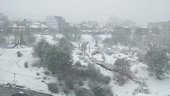
A blizzard has hit southern Argentina since late morning this Saturday. The flakes began to fall in the city of Ushuaia around five in the morning and since then the white precipitation has not stopped. The snow intensified at times and fell hard, which brought accumulation and whitened the city of the Argentine province of Tierra del Fuego.
According to data from the Ushuaia airport, snow was heavy in the early afternoon of this Saturday with a temperature between 0ºC and 1ºC. Since the end of the night, the temperature in Argentina's southernmost city has barely fluctuated, varying between -1ºC and 1ºC. Meteorologist Nacho Lopez Amorim, from the National Weather Service, described the snowfall for the second half of October on his social networks as "impressive".
The pocket of icy air that brings snow to South America should advance north across the Atlantic Ocean, bordering the coast of Argentina, and should be close to the coast of southern Brazil between Tuesday and Wednesday, reinforcing the air mass cold that has entered in the last hours.
Therefore, the trend is for a sequence of nights with temperatures below average in Rio Grande do Sul to extend into the second half of next week.
As already explained by MetSul, the Antarctic Oscillation entered negative territory during the first half of this month. As a result, the strong wind belt around Antarctica that keeps the coldest air "trapped" in the region has weakened.
The effect of the negative phase of the oscillation was the increase in cold air incursions into South America in the last two weeks. This explains the high frequency of cold fronts with rain in the South and Southeast of Brazil, in addition to the several days with mild or pleasant marks.
TEMPO | Grande nevada na Terra do Fogo, no Sul da Argentina. Vídeo de @MarianoJDiez. Meteorologista @MeteoNacho do @SMN_Argentina descreveu evento como "impressionante" para a segunda metade de outubro. pic.twitter.com/QYGyq15Gdq
— MetSul.com (@metsul) October 16, 2021
(Translated by Google)


Reader Comments
to our Newsletter