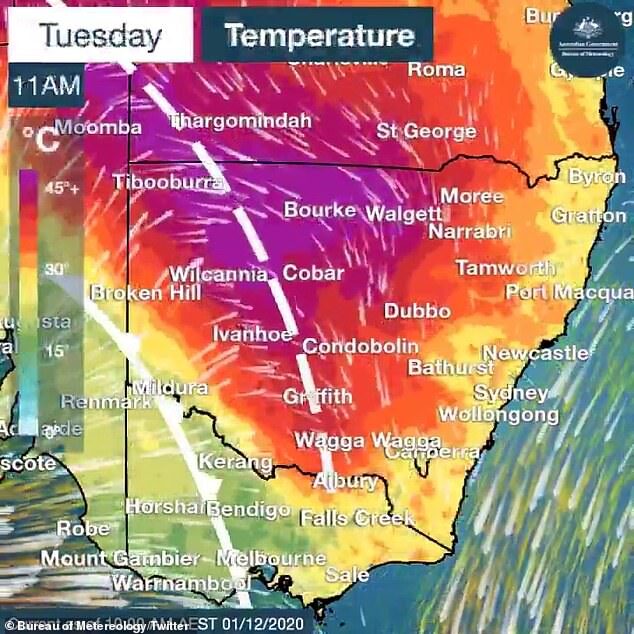
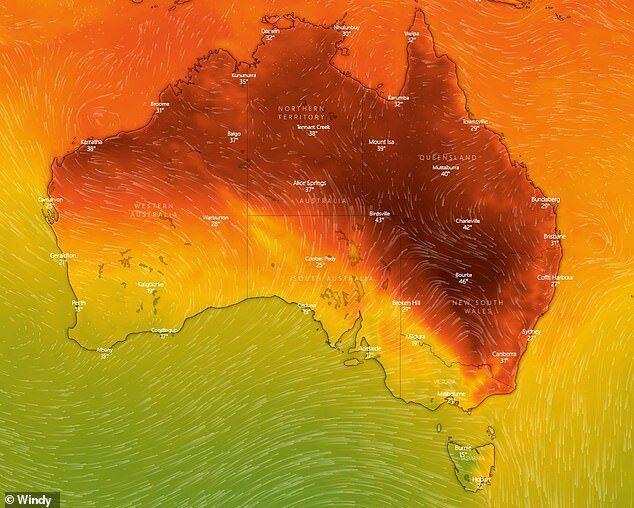
The brutal weekend heatwave has continued in large parts of the country's east and south, with temperatures reaching well into the mid-forties in central NSW, Queensland and South Australia.
The Bureau of Meteorology issued an extreme heatwave warning on Tuesday after temperatures peaked as high as 18C above average.
On the other end of the scale, snow is due to hit alpine regions in Tasmania on Wednesday.
'Late spring and early summer is when we always see the biggest temperature contrasts in Australia,' Weatherzone meteorologist Ben Domensino said.
Bourke in northwestern NSW was the hottest place in the country on Tuesday with a top temperature of 48C forecast.
In Queensland, Birdsville reached 47C with windy conditions, with north-east NSW set to feel the heat on Wednesday.
'Total fire bans are in force across seven areas including North Western, Northern Slopes, Lower Central West Plains, Central Ranges, Northern Riverina, Eastern Riverina and Southern Riverina,' NSW RFS warned on Twitter.
Extreme weather conditions are hindering Queensland firefighters as they try to contain a devastating bushfire on world heritage-listed Fraser Island.
More than 40 per cent of the tourist mecca has been razed by the out-of-control fire.
The blaze has been burning for more than six weeks after it was sparked by an illegal campfire, with tourists currently unable to arrive on the island.
Queensland Fire and Emergency Service said the weather forecast continues to fuel the fire.
'Smoke will affect visibility and air quality on K'gari (Fraser Island) and adjacent mainland areas over the coming days,' QFES said.
Sweltering conditions were felt in Western Sydney on Tuesday, with Penrith reaching a scorching 41C.
But the southern part of the country has dodged the extreme heat, with a strong cold front moving through NSW alpine areas on Tuesday afternoon.
A damaging wind warning is in place this evening for snowy regions including Perisher and Charlotte's Pass, with gusts in excess of 90km/h possible above 1200 metres.
Further south in Tasmania, snowfalls are likely overnight.

The extreme weather contrast is nothing new for early summer in Australia and occurs when hot and cold air masses cross over before the wet season begins.
'At this time of year, we have weather patterns where cold air moves up from the Southern Ocean - which is always still cold at this time of year - and hot air building up over central and northern Australia before the wet season kicks in, and this is a particularly hot air mass for the start of summer,' Mr Domensino said.
'When we see those two airmasses crashing into each other, the contrast in temperatures can be quite dramatic.'
Brisbane simmered through 32C heat on Tuesday, while Melbourne reached 27C with showers developing.
Perth hit 24C under mostly sunny conditions while Adelaide was gusty with a high of 21C.
Hobart reached 26C, while Canberra and Darwin soared to 35C and 33C respectively.


Reader Comments
to our Newsletter