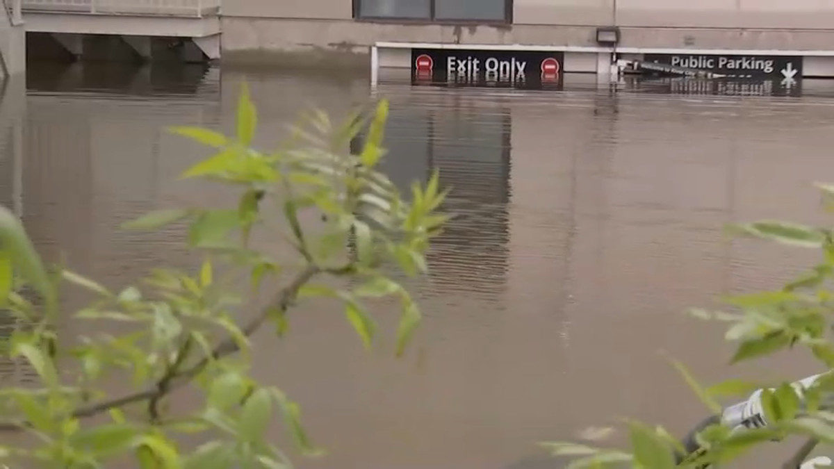
National Weather Service (NWS) said Chicago has recorded 8.30 inches / 210.82mm of rain so far this month, breaking previous records for the month of May of 8.25″ set just last year. NWS Chicago said, "this also marks three straight years of setting new May precipitation records."
Flash flooding, some significant, was observed across numerous locations in the Chicago Metropolitan Area during the night of 17 May, especially near the Chicago River. Several people were rescued by fire crews.
NWS said 3.11 inches / 79mm of rain fell in 24 hours in the city on 17 May, making it the fifth wettest May calendar day ever in Chicago. Just days earlier Chicago had seen its wettest ever May calendar day after recording 3.53 inches / 89.66 mm of rain
On 18 May overflowing creeks and rivers caused flooding in the suburb of Lyons, Illinois, prompting the evacuation of around 40 people.
The period of heavy rain has caused rivers to swell. NWS Chicago said "river flooding is ongoing across the area, with most rivers experiencing minor to moderate flooding. Major flooding is expected or occurring on portions of the Illinois and Des Plaines rivers."
Meanwhile in Michigan, Muskegon and Ottawa Counties both declared a local state of emergency 18 May in response to high water levels on lakes, combined with flash flooding caused by rainfall over the weekend.
Flooding is also expected elsewhere in the state. NWS Detroit said on 19 May that "a Flood Warning is in effect for Midland, Bay, and Saginaw Counties this morning. About 2 to 5 inches of rain have fallen over this area over the past several days and numerous roads have been closed due to flooding."
Social Media
The May precipitation record for Chicago has been broken with the 0.11" observed today at O'Hare through 4am, pushing the monthly total to 8.30". This passes the previous record of 8.25" set just last year. This also marks three straight years of setting new May precip records.
— NWS Chicago (@NWSChicago) May 19, 2020
Lower Wacker drive. Entire lower level flooded. All traffic suspended. pic.twitter.com/O3t6Kv6WwD
— Chicago Fire Media (@CFDMedia) May 18, 2020
Lower Wacker drive closed due to flooding. Water still rising. CFD has removed homeless who were camped out pic.twitter.com/xhk5EqgimD
— Chicago Fire Media (@CFDMedia) May 18, 2020
A MESS: People in the SW suburbs deal with flood headaches after heavy rains hit Chicagoland.
— Steven Graves (@StevenGravesTV) May 18, 2020
About 45+ people were rescued from homes in Lyons.
Some decided it was best to stay. Even though it's unclear when this will go down. @cbschicago pic.twitter.com/SQ44UrJBjA
A Flood Warning is in effect for Midland, Bay, and Saginaw Counties this morning. About 2 to 5 inches of rain have fallen over this area over the past several days and numerous roads have been closed due to flooding. Do not drive through flood water! #miwx
— NWS Detroit (@NWSDetroit) May 19, 2020
Daily rainfall records were set at all SE Michigan climate sites yesterday (all previous records from 2000).
— NWS Detroit (@NWSDetroit) May 19, 2020
- Tri Cities: 3.12" (prev. record 1.20")
- Flint: 2.57" (2.23")
- Detroit: 1.71" (1.50") #miwx


Reader Comments
to our Newsletter