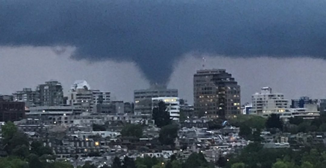
Photos and a video posted onto social media show a funnel cloud hovering over the Fraser River delta near Vancouver International Airport. The distinctive weather formation was also seen from a distance in the southern horizon from downtown Vancouver.
A thunderstorm cell was reported in the area, but according to The Weather Network meteorologist Tyler Hamilton it is a tossup over whether this was a supercell, which is commonly associated with producing potent tornadoes.
I was so stunned I took a brief video to prove it was actually over the Fraser. pic.twitter.com/TppdfKmIXt
— ... (@calonyction) May 13, 2020
I was hoping to build this into a little article/video - hoping to use both of your photos, with permission of course🌪
— Tyler Hamilton (@50ShadesofVan) May 13, 2020
But he says there is also a possibility this was a non-supercell funnel that formed from the movement of cold air in unstable conditions. Such funnels form higher in the atmosphere and have a weaker rotation and updraft than a typical tornado formed by a cumulonimbus cloud or supercell.
Funnel clouds are relatively rare in Metro Vancouver, but they are actually common along the Canadian and American Pacific Coast during the fall and spring months.
Daily Hive reported a waterspout sighting near the airport in 2015, and an EF0 tornado may have touched down in the Fraser Valley in 2018.
Hanging in there #YVR pic.twitter.com/FwUnjmNGT3
— Chris Doyle (@ensembleator) May 13, 2020


Reader Comments
to our Newsletter