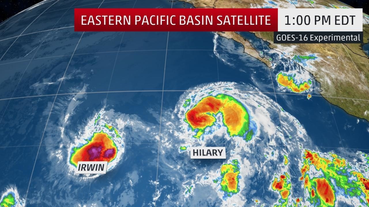
The highest cloud tops, corresponding to the most vigorous convection, are shown in the dark red and pink colors. Clustering, deep convection is a sign of a developing tropical cyclone.
Hurricane Hilary and Tropical Storm Irwin, are, fortunately, no threat to Mexico's Pacific coast.
Their centers are now sufficiently close - about 600 miles apart - that a phenomenon meteorologists call the Fujiwhara effect kicks in.
Named after a Japanese researcher who discovered this in experiments with water in the early 1920s, the Fujiwhara effect details how two tropical cyclones less than 900 miles apart rotate counter-clockwise about one another.
Think of the teacup ride at Disney or the Tilt-a-Whirl at your local county fair, but with tropical systems instead. In the teacup ride, adjacent teacups can not only spin, but revolve about each other.
In this case, Irwin, the westernmost storm of the pair, has temporarily stalled, but will soon get pulled north and will revolve counterclockwise around the circulation of Hilary this weekend, according to the latest forecast guidance.
Each storm will rotate about each other, before both eventually weaken over cooler water in a more stable air mass next week.
(If you're interested in a more technical explanation, University of Albany, SUNY Ph.D. candidate, Philippe Papin tweeted an excellent explanation.)
While neither named storm will impact land directly, there will be one impact into the weekend.
Higher swells may reach the Southern California coast as soon as Friday, continuing into early next week. Minor beach erosion and coastal flooding are possible, particularly on south-facing beaches, according to the National Weather Service.
Separate West Pacific Dance
More than 5,000 miles away, Typhoon Noru, the first typhoon of 2017, teamed up with another tropical cyclone named Kulap in a separate Fujiwhara effect.
While Kulap had degenerated to a remnant, one could still pick out its leftover circulation in Himawari-8 visible satellite imagery on July 27, south-southwest of Noru.
Tuesday, thanks, in part, to the Fujiwhara interaction, Noru crossed its previous path from last week completing an oval-shaped loop, and will now migrate westward.
Thanks to weak steering winds over the northwest Pacific, Noru may loaf and lollygag near Iwo To (previously known as Iwo Jima) well into next week.
We still can't rule out an eventual land impact in Japan, but that may not come until late next week or the following weekend. In the meantime, Noru may intensify, and is likely to at least generate large swells that will reach the Japanese Pacific coast and persist into next week.
Satellite loops of these dual Fujiwhara events should be compelling to meteorologists and weather enthusiasts alike.
To see this happen once a season isn't unusual, according to a 2014 study in the western Pacific Ocean, but for this to happen in two separate areas within days is very unusual.


Comment: Eight tropical cyclones spinning simultaneously in the north Pacific Ocean for first time since 1974