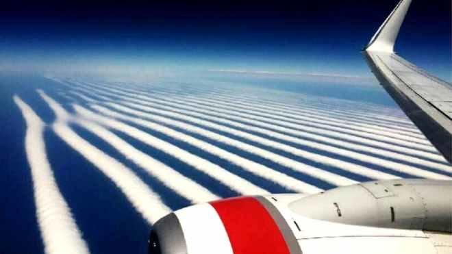
"Flying above the clouds has never looked this good!" read the tweet. "These incredible cloud formations were seen on board VA714 from Perth to Adelaide.The mysterious white fluffy rows are examples of wave clouds, the most famous of which — the Morning Glory — is found only in Northern Australia.
While these invisible waves in the sky occur elsewhere, it's the cloud accompanying it which is so rare.Their distinctive fat sausage shape is due to water vapour rising to form the cloud then evaporating back again to the ground.
"Wave clouds can form anywhere on the continent but they are only called the Morning Glory when they form across the Gulf of Carpentaria, Neil Bennett, a Western Australian spokesman for the Bureau of Meteorology told news.com.au.
Mr Bennett said the wave clouds formed because the air effectively "bounced" around in the sky.
"Wave clouds form in a stable atmosphere where the cloud itself isn't able to develop into a vertical state because it is in the air that is cooler around.
"As it descends, the warming process that naturally occurs causes this bouncing effect of the air and until that is flattened out you get these rolls of cloud that are evenly spaced."
Wave clouds usually form over mountain ranges but weather conditions have to be just right.
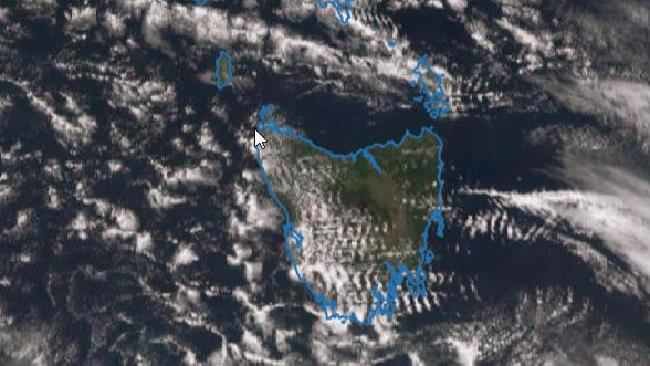
In what is amounting to something of a wave cloud season, the rows of white were also seen on the Bureau's satellite over both Tasmania and New Zealand on Wednesday.

"While jets are usually fine, these clouds can cause problems with smaller aircraft as the air goes up and down in small space and can create turbulence and a bumpy ride," said Mr Bennett.
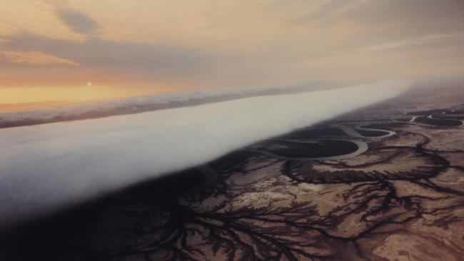
Perfectly formed, clouds such as the Morning Glory can be 100m wide but can stretch — sometimes almost perfectly straight — for a thousand kilometres from one side of the Gulf of Carpentaria to the other.
The Morning Glory usually occurs only during spring with Burketown, in remote northern Queensland, an epicentre for cloud chasers.
"There are fewer people who have flown on the Morning Glory than have climbed Mount Everest," Garrett Russell of the Caboolture Gliding Club, in south-east Queensland, told news.com.au.
He has headed to Burketown, glider in tow, to see the cloud on two occasions.
In Queensland, the cloud's distinctive shape is caused by two fronts meeting over Cape York and head west across the Gulf of Carpentaria.
At night, air over the Cape cools and slips under a layer of warm air to form the wave cloud that roll across the waters and then dissipate over land.
When you head towards one, he says, you feel so small and insignificant, "It's like you're a shrimp heading towards the mouth of a great whale."
"Imagine a huge roll of cotton wool that stretches from one horizon to the other and is moving across the landscape at something like 40km/h," said Mr Russell.
Local Aboriginal people in northern Queensland call the Morning Glory the kangólgi and the cloud's arrival is a good omen that bird numbers will soon boom.


Comment: Another rare morning glory roll cloud was sighted in Queensland, Australia last July.