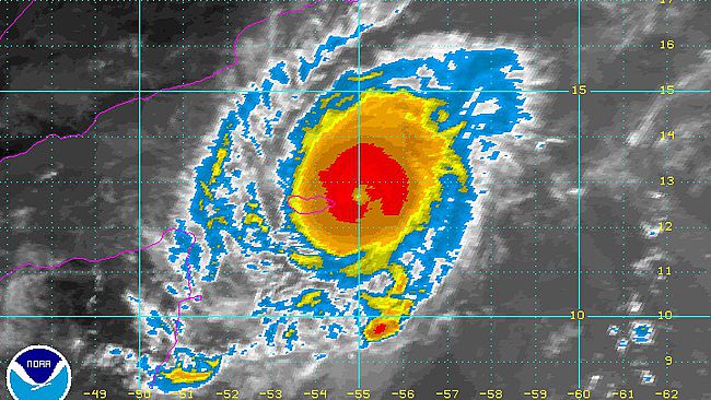
Tropical Cyclone Megh will continue to closely follow in the footsteps of
Tropical Cyclone Chapala into Wednesday, but only in terms of its track, not its intensity.
Much like Chapala, Megh will continue to track from the Arabian Sea to the Gulf of Aden into midweek. Megh is taking a track slightly farther south than Chapala but still threatens to impact many of the same communities that endured the recent powerful cyclone's wrath.
Megh is not expected to strengthen into the equivalent of a Category 4 hurricane such as Chapala,
but may bring more devastating conditions to Socotra. Megh made landfall across the eastern portion of Socotra with maximum sustained winds of 203 kph (127 mph), equivalent of a Category 3 hurricane just before noon local time on Sunday. Chapala passed to the north of Socotra.
"At peak intensity, Tropical Cyclone Chapala (04A) was the equivalent to a Category 4 hurricane in the Atlantic or eastern Pacific Ocean on [Oct. 30], making it one of the strongest cyclones on record in the Arabian Sea," stated AccuWeather Meteorologist Eric Leister.
Megh has strengthened to the equivalent of a Category 3 hurricane in the Atlantic or Pacific oceans as it blasts across the island of Socotra across the Arabian Sea before a weakening trend begins as it moves across the Gulf of Aden.

© NOAA
Beyond Socotra, the impacts of Megh will dramatically lessen as it tracks into the Gulf of Aden and encounters dry air from the Arabian Peninsula. Since Megh will not be as strong as Chapala was when it began to interact with the dry air, Megh will weaken faster in the Gulf of Aden, but could still make landfall as the equivalent of a tropical storm.
Regardless, AccuWeather Meteorologist Adam Douty expects scattered showers and thunderstorms to accompany Megh as it grazes the northeastern tip of Somalia or curves into south-central mainland Yemen, site of where Chapala plowed onshore. "There will be an isolated flooding threat, especially considering the mountainous desert terrain of the region," said Douty.
Between Yemen and the northeastern tip of Somalia, the potential for localized downpours to trigger flooding will be greatest over the latter region. In addition, sporadic damaging winds cannot be ruled out as Megh makes its closest approach to Somalia.
Content contributed by AccuWeather Meteorologist Rob Richards and Brett Rathbun.Update:Megh will now track west-northwest into south-central mainland Yemen, slightly southwest of the site where Chapala plowed onshore.
"There will be a flooding threat, especially considering the mountainous desert terrain of the region," said AccuWeather Meteorologist Adam Douty.
By the time Megh approaches Yemen, it will be rapidly weakening as dry air cuts off tropical moisture the cyclone needs to survive.
While any threat for damaging winds will be limited to an area within 20 miles of where the cyclone makes landfall, flooding will be possible across the entire region as any tropical downpours can quickly result in flash flooding.
Content contributed by AccuWeather Meteorologists Eric Leister, Rob Richards and Brett Rathbun.
Comment: Another tragedy for Yemen. The Yemeni people are already suffering a humanitarian disaster as a result of Saudi Arabia and its Gulf allies: