Belleoram Mayor Steward May told CBC News that his home was one of five houses that was evacuated.
"Heavy flooding started around 7 a.m. A neighbour woke me up. I just got myself and the dog out of the house," said May.
"At my house there was a heavy flow of rocks and water that was halfway up my front door. The homes have been very badly damaged."
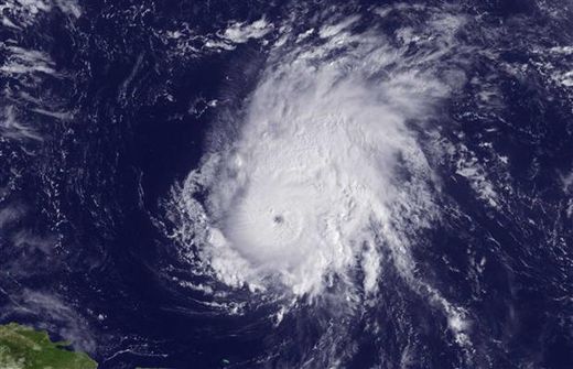
Ophelia, which was downgraded in the early morning Monday from a Category 1 hurricane, doused eastern Newfoundland with sustained precipitation and is forecast to bring large waves to coastal communities on the island.
Four houses in the south coast community of Belleoram were evacuated because of flooding, but police said roads in and out of the community are intact.
Water damaged the road between Lawn and St. Lawrence, prompting police to close the road as a precaution.
Flooding also washed out a bridge over Little Barasway Brook between Grand Bank and Marystown. Officials in nearby Rushoon closed the community's school because of flooding on local roads there.
There are also reports of flooding and damage on the Bonavista Peninsula.
The town manager of Trinity Bay North said the storm isn't as powerful as Hurricane Igor, which caused millions of dollars of damage to roads and homes in eastern Newfoundland last September.
"We received I'd say 100 calls [Monday] morning from people who are worried because water is getting into their basements," said Darryl Johnson.
Water damaged some gravel roads in the area and caused a partial washout of the main highway near Melrose.
Bishop White School in Port Rexton was closed because of the storm.
On the northeast coast, Anthony Paddon Elementary in Musgravetown closed for the afternoon as well.
"The heavy rain is moving into St. John's," said Daniel Jubainville of Environment Canada's Gander weather office before 6 a.m. NT Monday.
"Already some parts of the Avalon are getting heavier rains. If you are up in Whitborne or driving along towards Goobies, it's probably pretty wet there now."
He said the rain is expected to continue until about noon.
The strongest winds are expected to remain offshore, but they will create heavy seas and swells for coastal areas.


Reader Comments
to our Newsletter