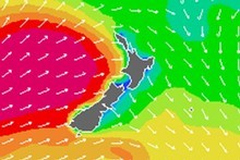
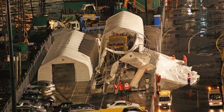
People are being warned to stay away from downed power lines, while roads in both islands have been shut due to heavy snow and debris falling on roads.
At least 14,000 customers are without electricity in the greater Auckland region on Friday night which has been battered by heavy rain and winds gusting over 100km/h in some places.
Electricity lines company Vector says crews are trying to restore power to pockets of affected residents in the Auckland region and parts of Waiheke Island.
A spokesperson says branches coming down from trees onto powerlines, as well as a large lightening strike, has caused the outages.
Emergency services have been inundated with weather related callouts, dealing with downed trees, powerlines and roofs blowing off houses.
The Coastguard says hurricane-force winds of more than 140km/h have been recorded at the Manukau Heads as the storm lashes the region.
Further south, electricity lines company Powerco says the storm has caused power cuts to about 12,000 customers in and around Thames, Paeroa, Kerepeki, Waihi, Matapihi and Te Puke.

Earlier, the Wellington region was hammered with about two hours of heavy rain, thunderstorms, wind and lightening which knocked out power to about 3500 homes. Power has since been restored.
The capital and surrounding areas were hit by the front between 11am and 1pm, bringing heavy rain and winds of up to 130km/h. There were 109 lightening strikes recorded during the period.
Roads Closed
Snow has closed State Highway 94 from Te Anau to Milford Sound on Friday night and motorists are urged to use chains on other roads in the South Island.
Snow has also been falling in Queenstown and is expected to be at sea level in some coastal parts of Otago and Southland.
MetService says snow is expected to fall to 800 metres in the central North Island and could affect the Desert Road.
In Auckland, police say the northwestern motorway has been closed from Newton Road to St Lukes Rd, west-bound, due to damage to signs on Friday night. There are also reports of debris across roads throughout the city.
Strong winds have brought down trees throughout Waikato, closing some roads. State Highway 21, the main road to Hamilton airport, has been closed at Narrows Bridge as the water levels of the Waikato River rise.
Trees are blocking parts of State Highway 1 at Huntly, and State Highway 39 between Tuhikaramea and Ngahinapouri, and the northbound lane of the Waikato expressway near Te Kauwhata.
Big swells recorded
MetService says a buoy which measures waves on the coast south-west of Hamilton has recorded swells of between six and nine metres.
That is more than double the height the waves were at midday on Friday, and it expects them to get bigger.
The Kapiti Coast District Council is warning high tides and waves, predicted to peak at up to seven metres, could create dangerous conditions on shore areas and seawalls.


...of flying over this storm system. It was disturbing to say the least - providing a visceral understanding of the current reality.
We left the hotel early that day and spent some time in Dunedin. The weather was nice though a bit windy. As we drove towards the airport in the afternoon, the weather started to turn nasty and cold. It's chilly in NZ at the moment but the rapid cold was noticeable. By the time we got to the airport, it was raining (rain mixed with snow) and the winds were very strong indeed.
The flight was delayed by 2 hours.
In the matter of 1 hour, the temperature fell from 7degC to just 3degC. Watching the live weather display was interesting to say the least. All flights were grounded and we were waiting in an overcrowded departure lounge.
The conditions changed back very rapidly which allowed us to leave. The rain stopped and the Sun came out although the temp remained very low. It wasn't until we were up in the sky that we realised the extend of the cloud cover. It was immense and chaotic - there was lots of turbulence on the way up and, at times, during the flight - despite the high altitude.
Two weeks ago - incidentally, as I was arriving in NZ - the weather was very bad as well. The winds in Dunedin were up to 175 km/h! The landing was very difficult and the plane was getting swayed from side to side. The pilot announced that there would be a 50/50 chance of us being diverted to Christchurch - of all places (this is the day after the earthquake).
So the weather in that part of the world is very interesting indeed - even though it is not all that flash at the best of times. The joke is that this is the end of the Earth, really - you know, as in the last country on the planet. Methinks, the changes are starting to show here first and will progressively extend to the rest of the planet.
Have a look at the latest satellite image (here). All sorts of swirly humongous pressure systems are starting to develop in the Northern Hemisphere. Looks like the best is yet (and soon) to come.
Things are about to start getting very interesting...