© Jan Alverstad
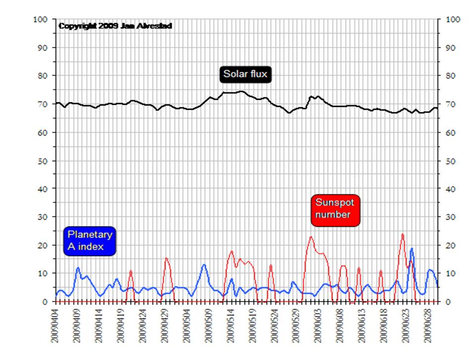
Despite an active start to the month and a rather steady stream of cycle 24 microdots, the official sunspot number for June came in at 2.6 below the 3.5 needed to make November 2008 the solar minimum. This means it can't be earlier than December, 2008. It seems unlikely unless the sun goes back into a deep slumber as it did last summer and July stays at or below 0.5 (the value of the month it will replace in the 13 month average), December 2008 won't be the sunspot minimum with a 13 month mean of 1.7. Only three minima since 1750 had official minima below 1.7 (1913 1.5, 1810 0, 1823 0.1). Of course modern measurement technologies are better than older technologies so there is some uncertainty as to whether microdots back then would have been seen.

© Jan Alverstad
This chart maintained daily by Jan Alverstad at
Solar Terrestrial Activity Report shows the increased solar spikiness in sunspot numbers in May and June but surprisingly a very low solar flux and a still rather low planetary A index number (geomagnetic activity). The sun is farthest from the earth in June/July which means the flux is lower, but official values are adjusted to account for that.
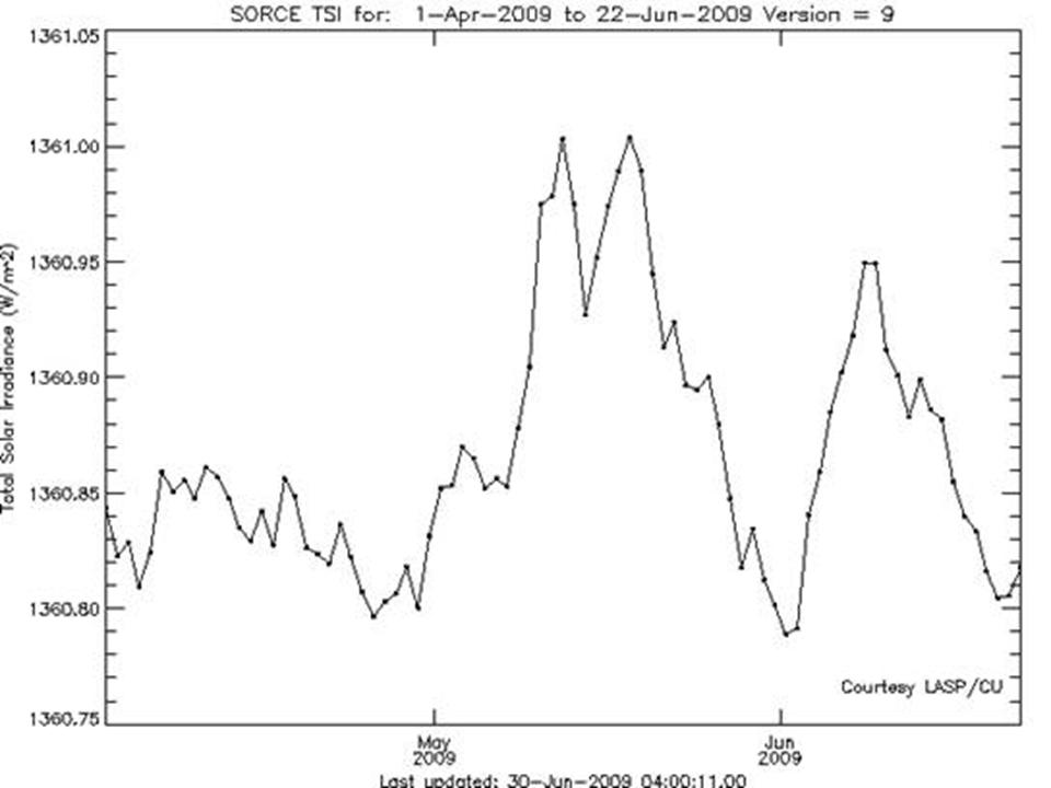
The Total Solar Irradiance as measure by
SORCE (Solar Radiation and Climate Experiment) was also interesting the last two months showing two spikes but then a recent return to minimum levels.

© SORCE
June 2008 In The United States
The first half of the month was extremely cold and even snowy in south Central Canada and the northern United States. In snowed in North Dakota and in California in early June. It was also unusually cold in the southwest - well below the normal (often 10-20 degrees) in places like Palm Springs, CA. In general, the desert southwest was unusually mild. Phoenix had 15 straight days with highs below 100F, the first time in June since 1913.
June, especially the second half was very hot in the southern plains and the heat expanded north and east a bit after mid-month before being suppressed again by months end.
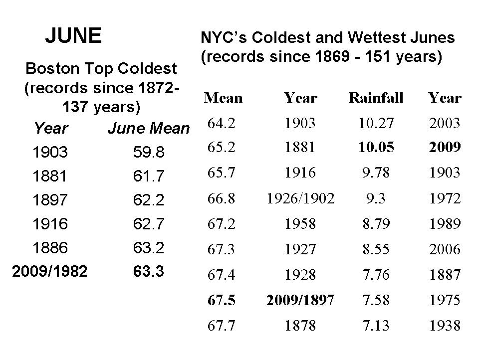
In the northeast, the month was unusually cold, cloudy and wet. In Boston it was 4.7F below normal in a tie for 6th coldest June (with 1982) in 138 years of record keeping, all the other years were before 1916. It was just short of two standard deviations colder then normal. The NWS spot checked the average maximum temp at Boston for the month and it appears this is the second coldest average high temp since 1872. 1903 is the record. A trace or more of rain fell on 22 days of the month. Measurable (0.01 inches or more) occurred on 16 days just short of the record of 18 set in 1942.
At Blue Hill Observatory in Milton, MA, just southwest of Boston, the month of June had between 26 and 27% of the possible bright sunshine. Normal for June is 55% and the gloomiest June in 1903 had just 25% of the possible sunshine. Second place had been June, 1998, with 36%. So, this month has taken over 2nd place, not an enviable distinction for vacationers.
New York City's Central Park was also cool, cloudy and wet. The month averaged 3.7F below normal and tied with 1897 as the
8th coldest since 1869 (151 years). It rained in 23 days of the month and ended up as the second wettest June ever falling short of 1927. Recall Joe Romm of Climate Progress had blamed the rains at the US Open on global warming and chuckled the heat waves would make the climate debate in DC all that much more exciting.

© LASP/CU
Reader Comments
to our Newsletter