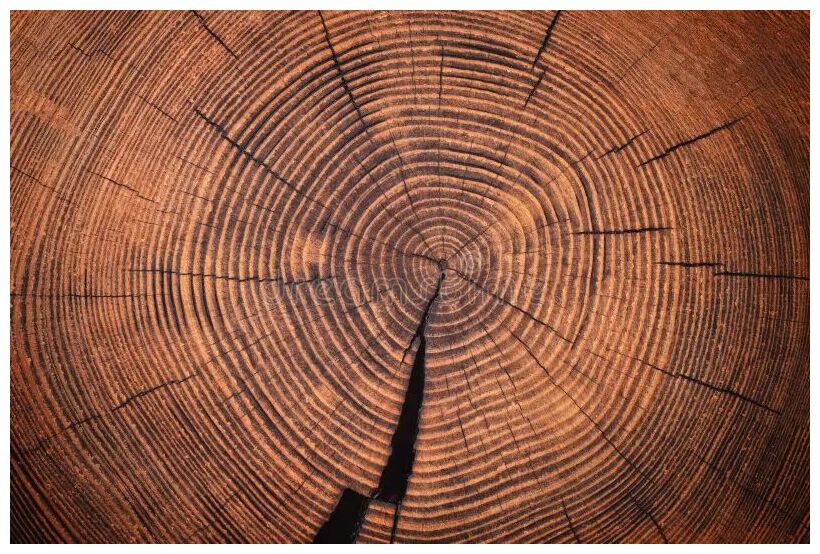
Nagoya University doctoral student Fusa Miyake made the discovery in 2012 while studying rings in the stump of a 1900-year-old Japanese cedar. One ring, in particular, drew her attention. Grown in the year 774-75 AD, it contained a 12% jump in radioactive carbon-14 (14C), about 20 times greater than ordinary fluctuations from cosmic radiation. Other teams confirmed the spike in wood from Germany, Russia, the United States, Finland, and New Zealand. Whatever happened, trees all over the world experienced it.
Most researchers think it was a solar storm — an extraordinary one. Often, we point to the Carrington Event of 1859 as the worst-case scenario for solar storms. The 774-75 AD storm was at least 10 times stronger; if it happened today, it would floor modern technology. Since Miyake's initial discovery, she and others have confirmed five more examples (12,450 BC, 7176 BC, 5259 BC, 664-663 BC, 993 AD). Researchers call them "Miyake Events."
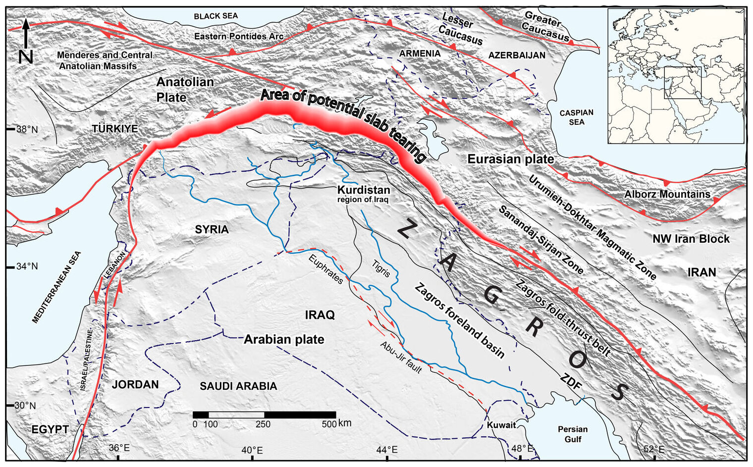
An international research team led by the University of Göttingen has investigated the influence of the forces exerted by the Zagros Mountains in the Kurdistan region of Iraq on how much the surface of the Earth has bent over the last 20 million years. Their research revealed that in the present day, deep below the Earth's surface, the Neotethys oceanic plate - the ocean floor that used to be between the Arabian and Eurasian continents - is breaking off horizontally, with a tear progressively lengthening from southeast Turkey to northwest Iran. Their findings show how the evolution of the Earth's surface is controlled by processes deep within the planet's interior. The research was published in the journal Solid Earth.
When two continents converge over millions of years, the oceanic floor between them slides to great depths beneath the continents. Eventually, the continents collide, and masses of rock from their edges are lifted up into towering mountain ranges. Over millions of years, the immense weight of these mountains causes the Earth's surface around them to bend downward. Over time, sediments eroded from the mountains accumulate in this depression, forming plains such as Mesopotamia in the Middle East. The researchers modelled the downward bend of the Earth's surfaces based on the Zagros Mountain's load where the Arabian continent is colliding with Eurasia. They combined the resulting size of the depression with the computed topography based on the Earth's mantle to reproduce the unusually deep depression in the southeastern segment of the study area. The researchers found that the weight of the mountains alone cannot account for the 3-4 km deep depression that has formed and been filled with sediment over the past 15 million years.
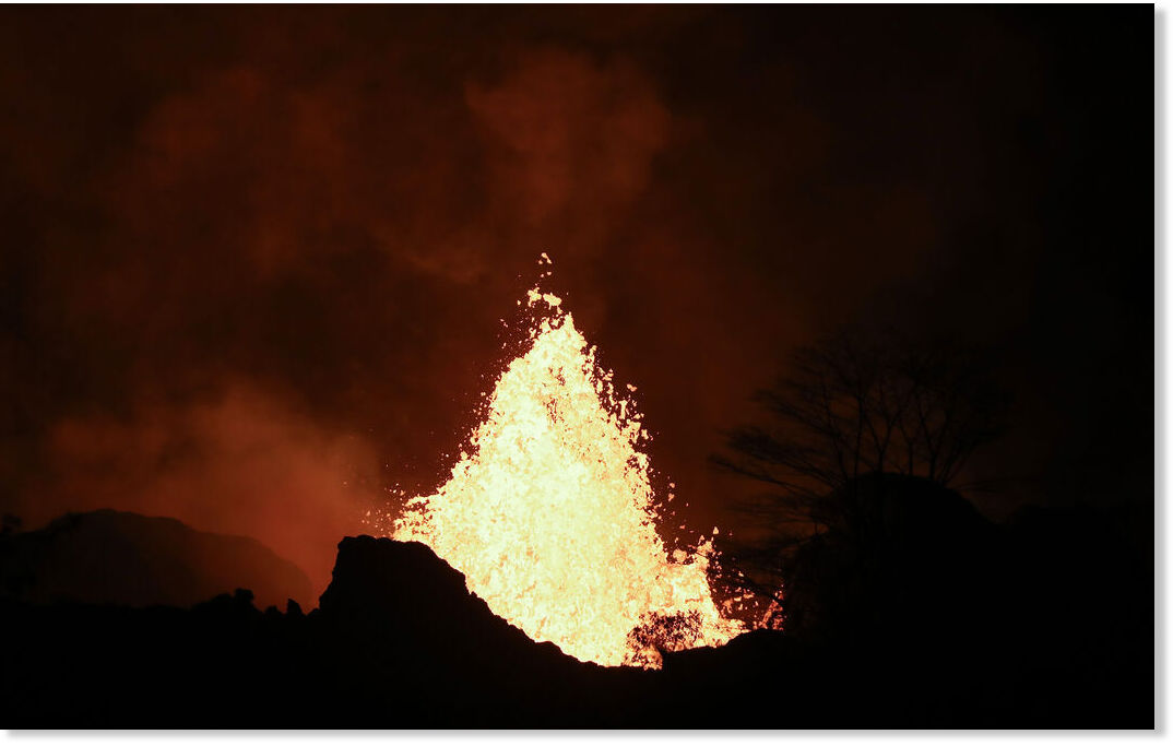
The Kilauea volcano in Hawaii has resumed its eruption, marking the fourth eruptive episode. Lava fountains have been observed reaching heights of up to 200 feet. The renewed activity has drawn attention from both locals and tourists, eager to witness the natural spectacle.
Kilauea, one of the most active volcanoes in the world, is located on the Big Island of Hawaii. It has been erupting intermittently for decades, with its most recent significant activity occurring in 2018. The current eruption is being closely monitored by the United States Geological Survey (USGS) and local authorities to ensure public safety.
The eruption has also sparked interest among scientists, who are studying the volcanic activity to better understand the processes driving Kilauea's eruptions. This research could provide valuable insights into volcanic behavior and improve future eruption predictions.
As the situation develops, authorities will continue to monitor the eruption and provide updates to ensure the safety of those on the island.
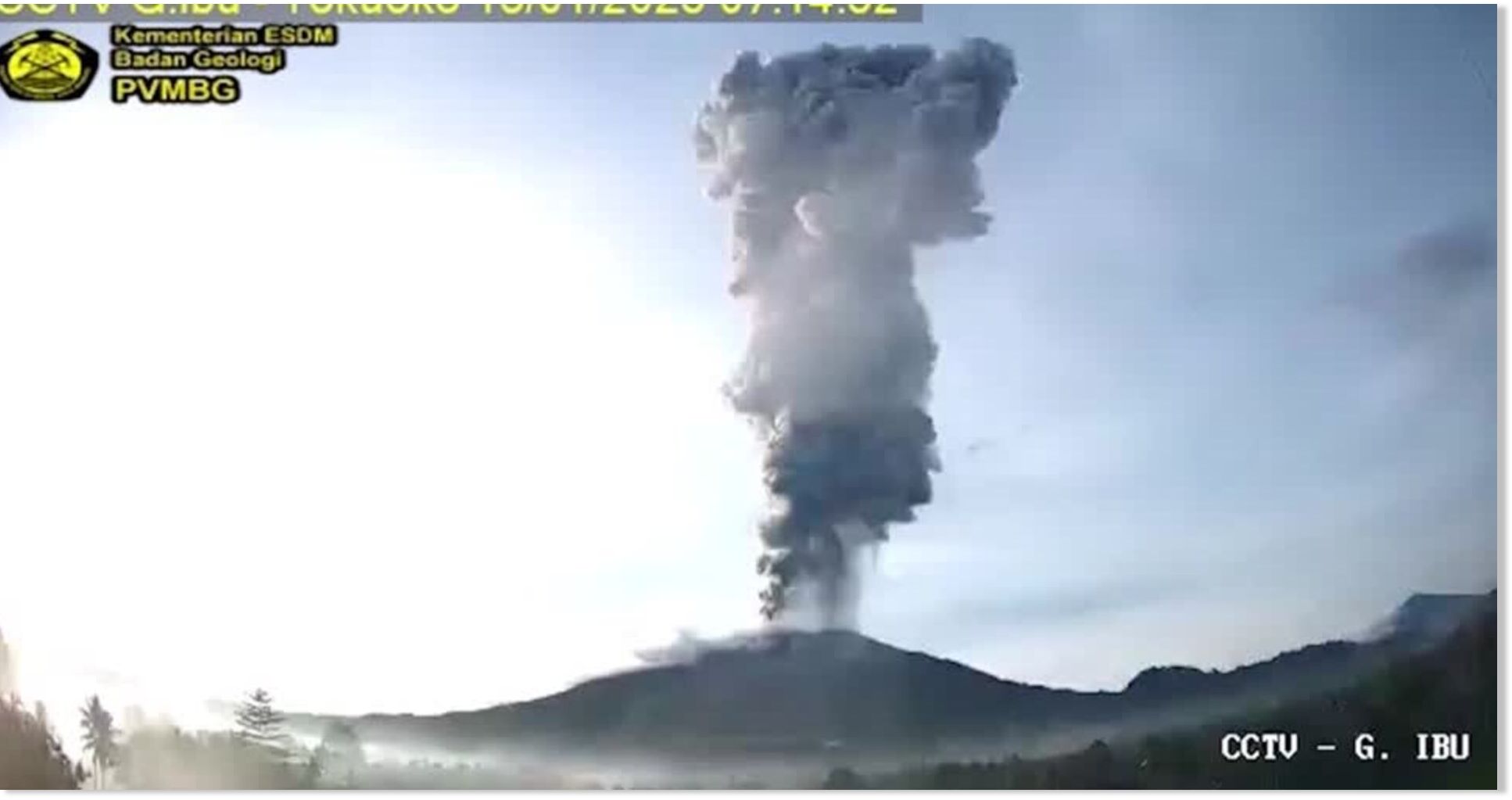
Authorities have begun evacuating 3,000 residents near the Mount Ibu volcano on Indonesia's eastern island of Halmahera, the disaster agency said on Thursday (January 16), after an eruption this week sent a cloud of thick grey ash as high as four-km (2.5-mile) into the sky.
Ibu erupted on Wednesday (January 15) morning for about two minutes, Indonesia's volcanology agency said, forcing authorities to raise the alert level in the surrounding areas to the most severe.
The evacuations started late on Wednesday for about 3,000 residents around the area who were being prioritized due to their proximity to the volcano, Abdul Muhari, a spokesperson for the country's disaster mitigation agency, told Reuters.
Ibu's activities follow a series of eruptions of different volcanoes in Indonesia, which sits on the Pacific "Ring of Fire" and has 127 active volcanoes.
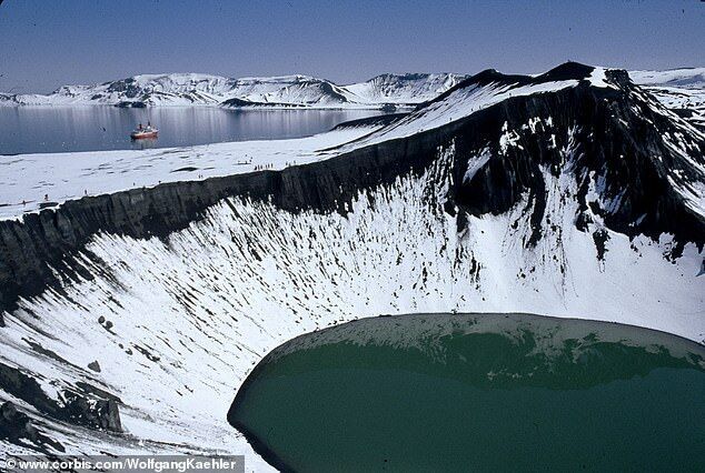
Experts are on red alert after uncovering a ticking time bomb in Antarctica that would reshape the continent and dramatically increase sea levels worldwide.
More than 100 volcanoes lie beneath the surface of the West Antarctic Ice Sheet, which is 'particularly vulnerable to collapse, yet its position atop an active volcanic rift is seldom considered,' the study noted.
Scientists have warned that as climate change causes the ice sheet to melt, this drives increased volcanic activity that speeds up melting at the surface, creating a 'positive feedback loop.'
As the ice sheet melts, the amount of mass pushing down on the surface decreases, which creates an uplifting effect in the subsurface.
Delon Porcalla, Bella Cariaso The Philippine Star Tue, 14 Jan 2025 14:29 UTC
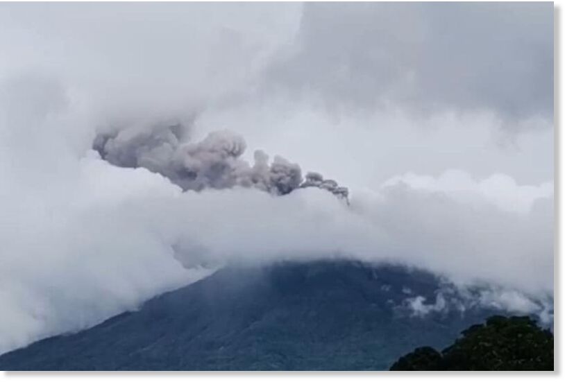
Kanlaon Volcano expels ash at 10:25 a.m. on January 8, 2025.
Amid the threat of another eruption, Kanlaon Volcano on Negros Island twice emitted ash yesterday, the Philippine Institute of Volcanology and Seismology said.
Phivolcs noted that ash emissions lasted 10 to 47 minutes, reaching as high as 500 meters with a west and west-southwest drift.
"This event generated grayish plumes that rose 500 meters above the crater before drifting west as recorded in the Mansalanao La Castellana station and Kanlaon Volcano Observatory in Canlaon City," the agency said.
Phivolcs measured the release of sulfur dioxide to be at 5,640 tons per day. Its observations centers recorded at least 22 volcanic earthquakes over a 24-hour period.
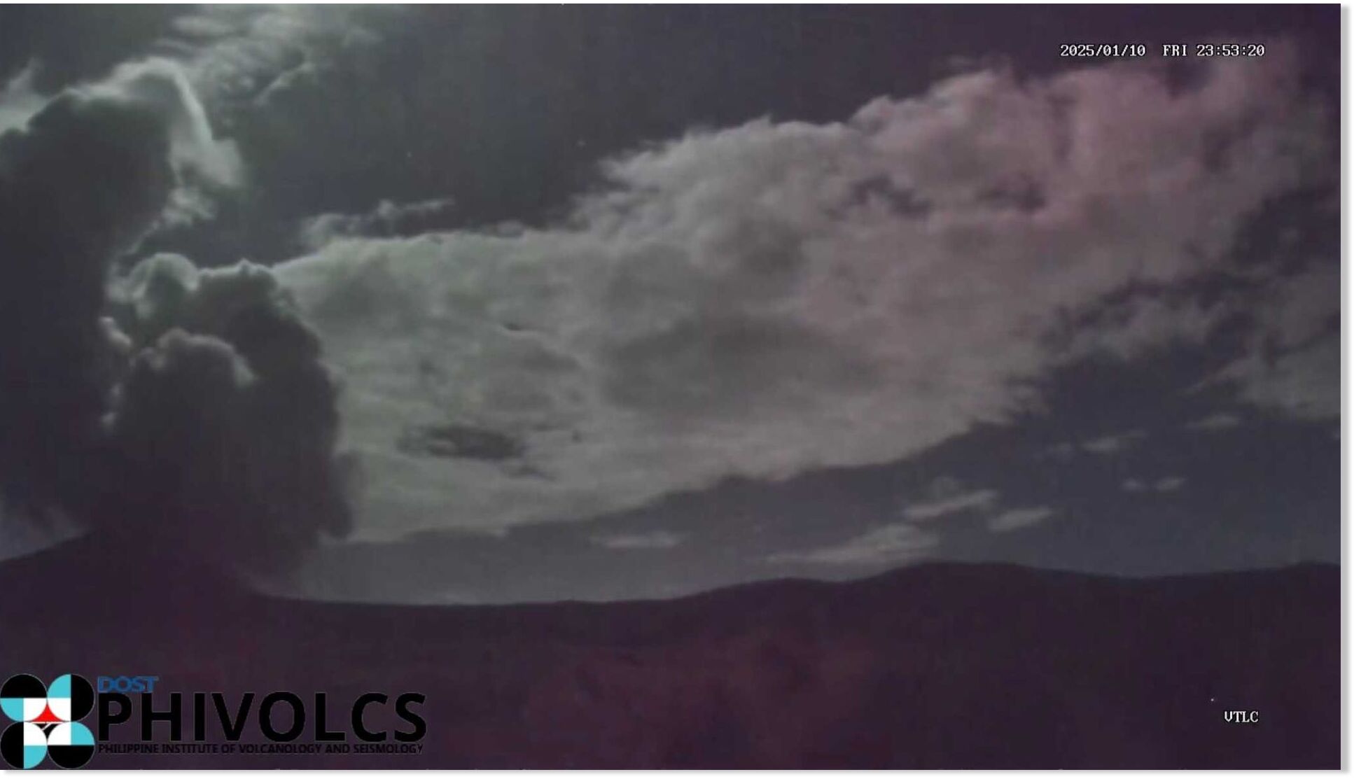
Taal Volcano in Batangas spewed a 900-meter plume late Friday night following a phreatic eruption, the Philippine Institute of Volcanology and Seismology (PHIVOLCS) said.
The phreatic eruption from Taal Volcano Island's Main Crater, which occurred at 11:51 p.m., was accompanied by a volcanic tremor that lasted three minutes.
Phreatic eruptions are steam-driven explosions that occur when water beneath the ground or on the surface is heated by magma, lava, hot rocks, or new volcanic deposits, according to PHIVOLCS.
Alert Level 1 (Low-level unrest) prevails over the volcano.
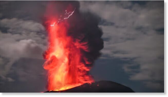
Mount Ibu Volcano sent a 5km high ash column above its crater when it erupted in Indonesia on Saturday night. Footage shows the hot lava flowing from its peak, as seen from a home in North Maluku on the evening of January 11.
Authorities recorded the eruption at 7:35 pm local time, with the ash column height reaching 5,325 metres with thick intensity leaning towards the west. The eruption lasted more than three minutes with a maximum amplitude of 28 mm.
Lava was ejected 2km from the centre with alert level 3 status. Locals and tourists are prevented from entering a 4km radius danger zone, while residents near the area are advised to use face masks and goggles.
Indonesia is in the Pacific Ring of Fire, a geologically active area with frequent earthquakes and volcanic activity. It has more than 130 active volcanoes, making it one of the most volcanically active countries in the world.
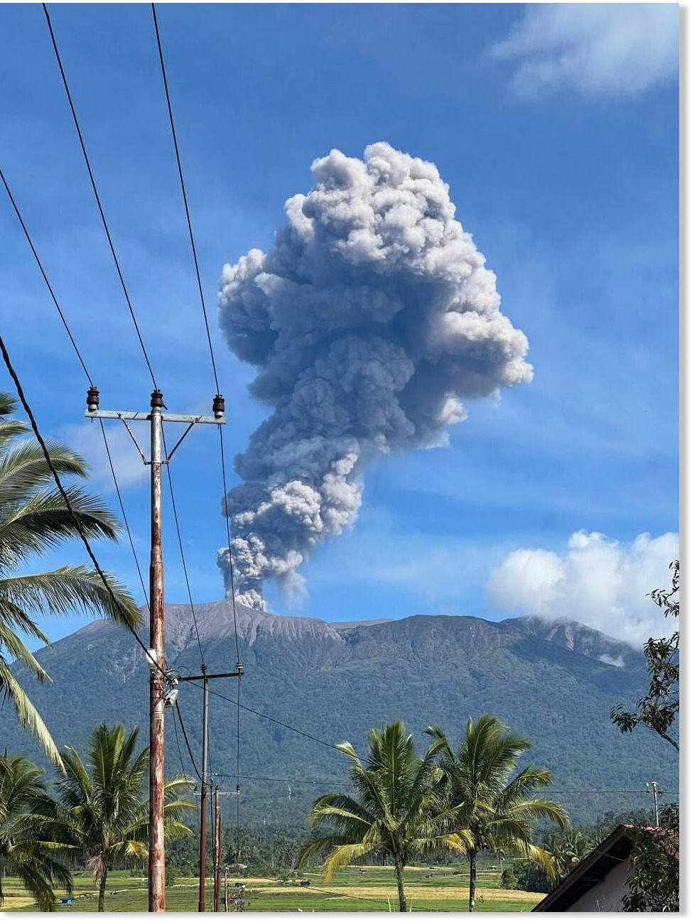
Mount Marapi in West Sumatra erupted again on Saturday morning, January 4, 2025, spewing a 1,000-meter-high ash column. One of the officers at the volcano's observation post, Trian Ahmadi, recorded the eruption.
"The ash column is observed to be gray, thick in intensity, and inclined to the north and northeast," he said in an official statement after the incident.
According to Trian, the volcano eruption was recorded on a seismogram with a maximum amplitude of 30.3 millimeters for 1 minute 40 seconds.
"The eruption is still ongoing as this report is being made," he said at 09:51, on Saturday.
He confirmed that Mount Marapi is still on alert. The monitoring team has asked locals, tourists, and climbers to stay away from the area within a 3km radius of the Verbeek crater.
People are urged to use masks covering the nose and mouth to avoid respiratory problems. People living high up in the valley and along the banks and rivers flowing from the summit of Mount Marapi are also advised to be aware of the threat of cold lava. "Especially during the rainy season," Trian said.