Earthquakes
S

Seismograph

China earthquake 'like being tossed by waves' as 126 dead and 155,000 homes damaged

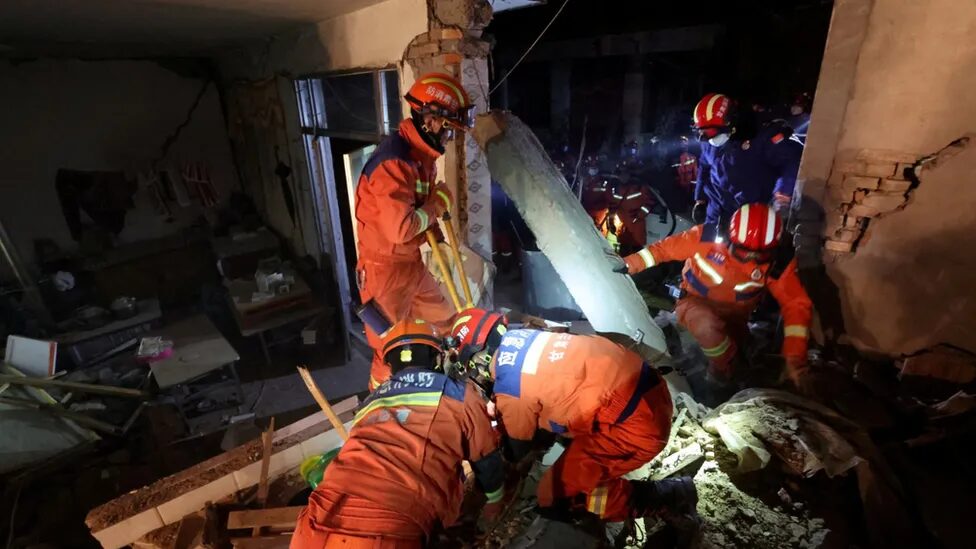
Rescuers in orange outfits climb through damaged buildings in Kangdiao village in Jishishan county
© ReutersRescuers in orange outfits climb through damaged buildings in Kangdiao village in Jishishan county
The deadliest earthquake in over a decade has killed 126 people and injured 700 in northwestern China, leaving rescue teams scrambling to reach survivors in freezing weather conditions.

The 6.2-magnitude earthquake struck at 11.59pm (4pm GMT) on Monday, the China Earthquake Networks Centre said, as residents in Gansu and neighbouring Qinghai provinces were sleeping or preparing to sleep.

It was followed by a second 5.5 magnitude earthquake hours later in neighbouring Xinjiang.

The earthquake triggered landslides and wrecked roads and infrastructure, snapping away communication, electricity and water lines in the region.

Thousands of survivors and rescue workers are bracing for a second night of sub-zero temperature as efforts to find missing people and survivors from the rubble ran into the evening.
Seismograph

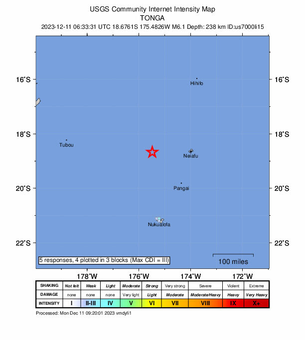
6.1 magnitude earthquake off Tonga

nnnnn
6.1 magnitude earthquake 158 km from Neiafu, Vava'u, Tonga

UTC time: Monday, December 11, 2023 06:33 AM
Your time: Monday, December 11, 2023 at 6:33 AM GMT
Magnitude Type: mww
USGS page: M 6.1 - 158 km W of Neiafu, Tonga
USGS status: Reviewed by a seismologist
Reports from the public: 5 people

238 km depth

Seismograph

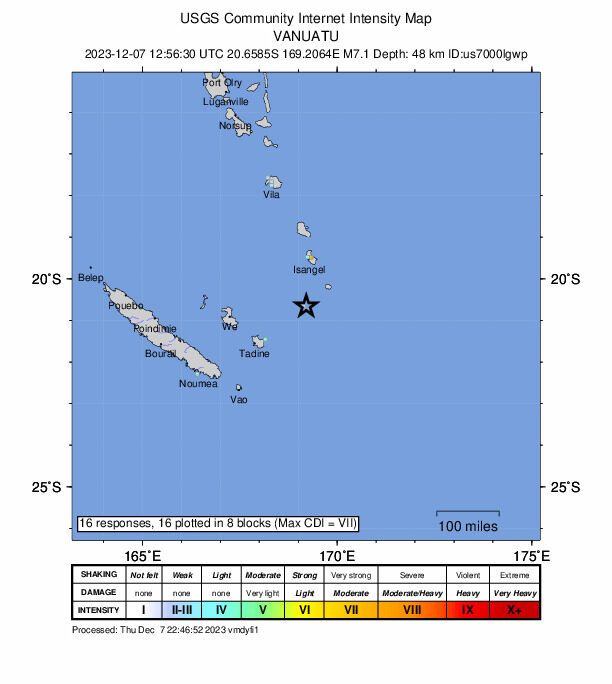
7.1 magnitude earthquake hits Vanuatu, triggers tsunami warning

nnnnnn
A 7.1 magnitude quake struck south of Vanuatu on Thursday, the United States Geological Survey said, triggering a tsunami warning.

USGS initially reported a magnitude of 7.3 and a depth of 35 kilometres, but soon revised its report.

The offshore quake hit at 1256 GMT at a depth of 48 kilometres (30 miles), about 123 kilometres south of the town of Isangel and 338 kilometres from the capital Port Vila, USGS said.

The Pacific Tsunami Warning Centre said "hazardous waves from this earthquake are possible within 300 kilometres of the epicenter along the coasts of Vanuatu and New Caledonia".

Seismograph

Magnitude 6.9 earthquake strikes off southern Philippines - 7th mag. 6+ in area within 30 hours

mmmm
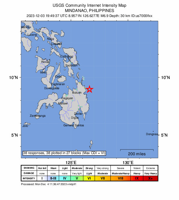
A magnitude 6.9 earthquake struck off the coast of the southern Philippines, following a series of strong quakes in the same area. Early morning on Monday, the 6.9 magnitude earthquake jolted the southern Philippines early Monday, the United States Geological Survey said.

Yesterday, a magnitude 6.6 earthquake and a deadly magnitude 7.6 quake Saturday struck in the same region.

At least two people were killed and several were injured after Saturday's quake, according to AFP news agency.

Saturday's quake triggered tsunami warnings across the Pacific region and sent residents along the east coast of Mindanao fleeing buildings, evacuating a hospital, and seeking higher ground.

Comment: For details of the other quakes, see: 7.6-magnitude earthquake strikes the Philippine Sea, 5 aftershocks of mag.6 or greater


Seismograph

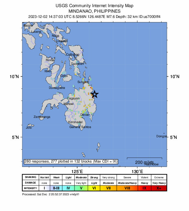
7.6-magnitude earthquake strikes the Philippine Sea, 5 aftershocks of mag.6 or greater

mmmm
A major, 7.6-magnitude earthquake struck in the Philippine Sea on Saturday, according to the United States Geological Survey.

The temblor happened at 10:37 p.m. Philippine time, data from the agency shows.

As seismologists review available data, they may revise the earthquake's reported magnitude. Additional information collected about the earthquake may also prompt U.S.G.S. scientists to update the shake-severity map.


Comment: Earthquake Track noted 5 aftershocks of mag.6 or greater, for details see here, here, here, here and here.


Seismograph

Shallow 6.5 magnitude earthquake strikes north of Papua New Guinea

BBBBBBB
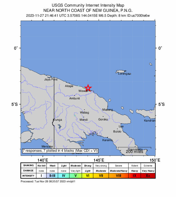
A shallow, 6.5-magnitude earthquake struck off the northern coast of Papua New Guinea on Tuesday, the US Geological Survey said, but no tsunami warning was issued.

The quake hit about 20 kilometres (12 miles) off the coast, a short distance from the town of Wewak, capital of the Pacific island state's East Sepik Province.

The epicentre was detected at an estimated depth of 12 kilometres (seven miles) at 8:46 am local time (2146 GMT Monday), the USGS said.

There is "no tsunami threat", the Pacific Tsunami Warning Centre said in a separate bulletin.

Seismograph

No tsunami threat from shallow magnitude 6.9 quake that shook Marianas Islands

mmmm
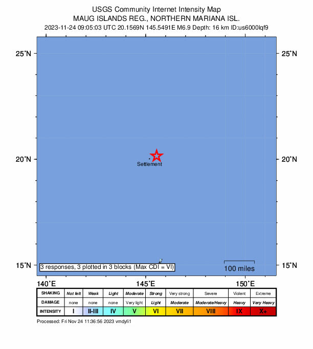
There is no threat of a tsunami in the Philippines after a magnitude 6.9 earthquake rocked the Mariana Islands in the northwestern part of Pacific Ocean, state seismologists said.

According to Philippine Institute of Volcanology and Seismology (Phivolcs), the earthquake in the Marianas had a depth of focus of 10 kilometers.

"No destructive tsunami threat exists based on available data," Phivolcs said.

"This is for information purposes only and there is no tsunami threat to the Philippines from this earthquake," it noted.

The agency added there are no recommended actions after the tremor.

Seismograph

Shallow magnitude 6.7 earthquake hits Vanuatu

mmmmm
A magnitude 6.7 earthquake struck northern Vanuatu on Wednesday, the United States Geological Survey said, but authorities said it was not expected to trigger a tsunami.

The quake had a depth of 22 kilometers (14 miles), hitting about 300 km north of the capital Port Vila at around 3:37 pm (0447 GMT).

Centered near a sparsely populated cluster of islands, the USGS said there was a "low likelihood of casualties and damage" from the tremor.

A hotel receptionist in Port Olry, some 98 kilometers (60 miles) from the epicenter, told AFP she felt a "little earthquake" and "saw the ground shaking" but was not aware of any damage.

Seismograph

Powerful 6.0 earthquake struck eastern side of Indonesia

mmmmm
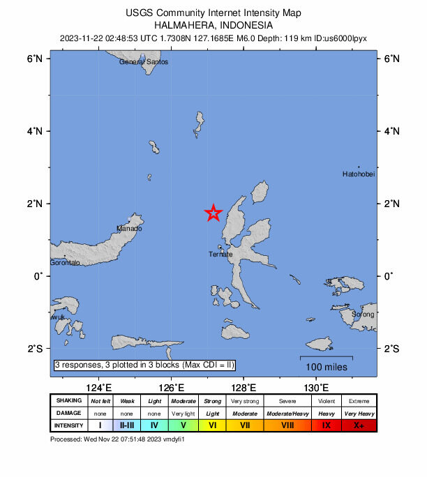
A powerful earthquake with a magnitude of 6.0 struck the eastern side of Indonesia on Wednesday, leaving authorities on alert but with no immediate reports of casualties or damages in the affected area.

The earthquake's epicenter was located 94 kilometers (58 miles) west of Tobelo in Indonesia's North Maluku province, and it occurred at a significant depth of 116 kilometers (72 miles).

Despite the strength of the quake, Indonesia's Meteorology, Climatology and Geophysical Agency reassured the public that there was no potential danger of a tsunami. However, they cautioned about the possibility of aftershocks, urging residents to remain vigilant in the aftermath of the seismic event.

Seismograph

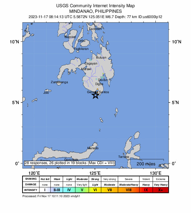
6.7 magnitude earthquake shakes southern Philippines: US Geological Survey

nnnnnnnnn
A strong magnitude 6.7 earthquake shook the southern Philippines on Friday, the US Geological Survey said, with local authorities warning of potential damage.

No tsunami threat was issued after the quake struck off Sarangani province on the main southern island of Mindanao at a depth of 78 kilometres (48 miles) at 0814 GMT, the USGS said in a statement.

There were no immediate reports of casualties but the quake was felt across a wide area of the mountainous island.