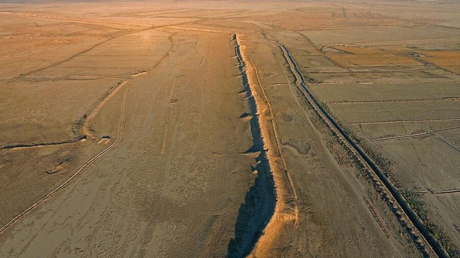
© Charax Spasinou Project, Stuart CampbellImpressive to this day: the wall of Alexandria.
Archaeologists working in southern Iraq have identified the site of Alexandria on the Tigris, a large port city founded in the late fourth century BCE during the campaigns of Alexander of Macedon. The ruins lie at Jebel Khayyaber, near the modern border with Iran. Surveys show a planned urban center that linked river traffic from Mesopotamia with sea routes through the Persian Gulf and trade networks reaching India and Central Asia.
Ancient authors described a place called Charax Spasinou near the head of the Persian Gulf. Scholars argued for decades about its position. In the 1960s, British researcher John Hansman studied Royal Air Force aerial photographs and noted a huge walled enclosure and traces of settlement in this area. Field research stalled soon after. The war between Iraq and Iran turned the border zone into a military landscape, and armed forces built installations across parts of the ruins.
Research teams returned in 2014. Local heritage officials guided visiting archaeologists to the site. What looked like a low ridge in a flat plain proved to be a city wall stretching more than one kilometer, with sections rising up to eight meters. The scale pointed to a major urban center.
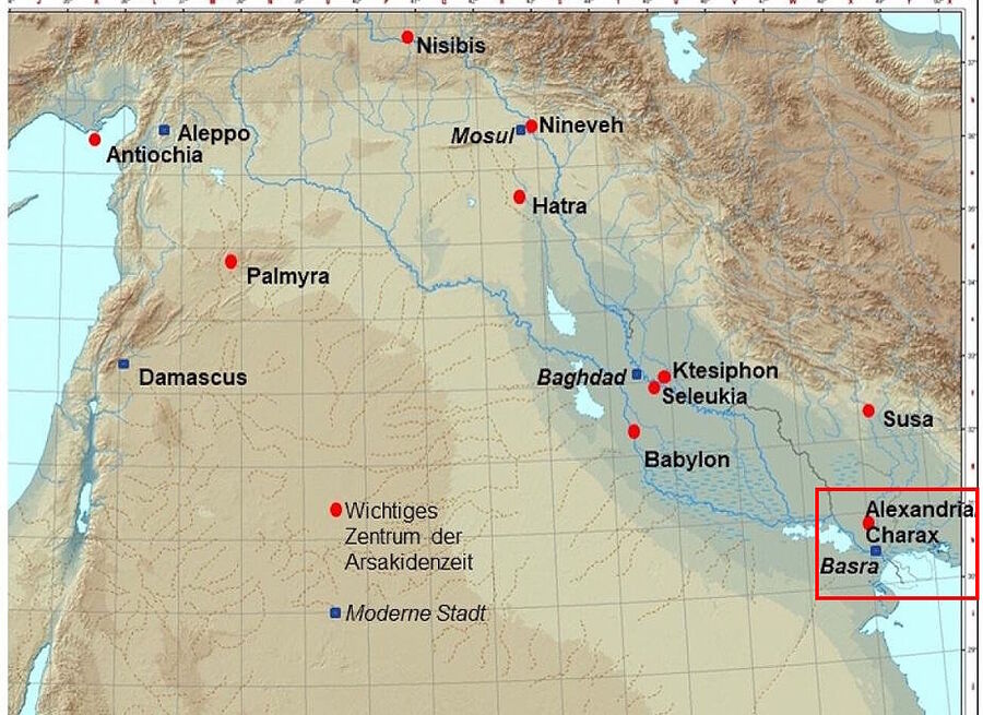
© Stefan R HauserLocation of Alexandria/Charax
Teams then carried out large-scale surface surveys. Researchers walked across more than 500 square kilometers and recorded dense scatters of pottery, brick fragments, and industrial debris. Thousands of drone photographs helped build a detailed terrain model. Geophysicists used magnetometers to map buried structures. The results outline a city laid out on a grid, with wide streets, large housing blocks, temple compounds, workshops with kilns, canals, and harbor basins. One district includes house blocks of exceptional size, larger than most known from other cities of the same era.
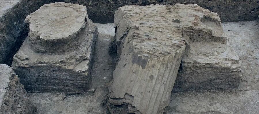
© Charax Spasinou Project 2022 (Robert Killick)Columns of the peristyle courtyard of the palace, 2018 in the ancient Alexandrian city of Charax Spasinou, now in modern Iraq .
Analysis of street alignments shows four main grid orientations. These patterns reflect different building phases and land-use zones. Residential quarters stand close to religious buildings. Industrial sectors cluster near former waterways. Another enclosed area lacks a street network and appears to mark a palace complex or garden district. Satellite imagery also reveals canals north of the city, linked to large agricultural fields which would have supported a substantial population.
Historical context explains the city's importance. Between about 300 BCE and 300 CE, long-distance trade expanded across the Indian Ocean and through overland routes into Central Asia. Goods such as spices, textiles, semi-precious stones, and metals moved toward major cities in Mesopotamia. Seleucia and later Ctesiphon, both on the Tigris, served as imperial capitals and large consumer markets. Ancient sources give population figures for Seleucia in the hundreds of thousands. A port at the junction of sea lanes and river transport offered an efficient transfer point for such trade.
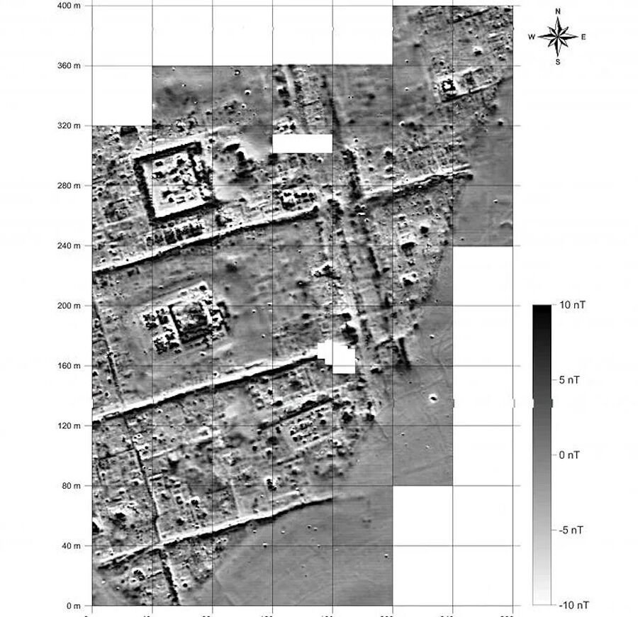
© Charax Spasinou Project 2016 (Jörg Fassbinder)Image obtained with the cesium magnetometer of a neighborhood with residential buildings and temples of Charax Spasinou.
Environmental change led to decline. Rivers in southern Mesopotamia shift course over time, while sediment pushes the Persian Gulf shoreline farther south. Geological cores and landscape studies indicate a westward movement of the Tigris by the third century CE. The harbor then lost direct access to the main channel, and the coastline lay far away. River shipping declined, and the economic base weakened. Most residents left, and urban life faded.
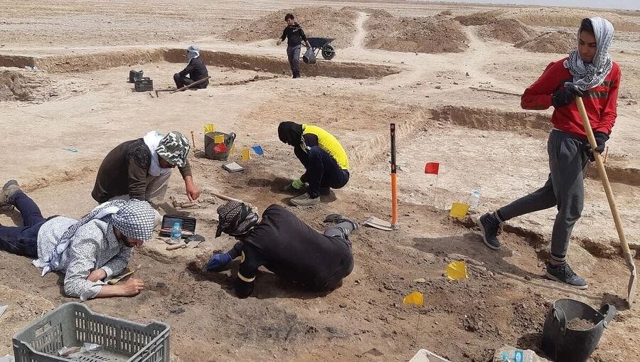
© Charax Spasinou Project 2022 (Stefan R Hauser)Excavation team working in the temple area of Charax Spasinou 2022.
Work at Jebel Khayyaber fills a gap in the history of Mesopotamia during centuries with limited written records. Ongoing projects aim to refine the city plan, date the construction phases, and link urban growth with trade and environmental change. Excavation will follow when funding and field conditions allow. Noninvasive research already places Alexandria on the Tigris among the largest known cities of the Hellenistic and Parthian Near East.
Dario Radley is one of the staff writers at Archaeology News online magazine. He joined the magazine in January 2022. Dario covers news and articles in archaeology, anthropology, paleontology & more






Reader Comments
Let me repeat that: land floats on the surface of Earth.
Things that are floating go up and down as well as back and forth. The so-called "scientists" who want you to believe in more or less water being responsible for land being above or below the surface keep themselves as well as the rest of is in the darkness.
Native American plains dwellers told stories that their fathers' fathers' fathers had seen the Rocky Mountains rise into the air. I don't think we should ignore those stories.