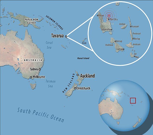
The quake was triggered at a depth of 56 miles (91 km) and was about 12 miles (19 km) north-west of Port-Olry, according to the US Geological Survey (USGS).
The Pacific Tsunami Warning Center said hazardous waves were possible for coasts located within 300 km of the epicentre.
USGS had initially put the magnitude at 7.1 and the depth at 51 miles, but these figures were later revised.
Vanuatu is a South Pacific Ocean nation comprised of dozens of small islands that stretch over 800 miles (1300 km).
The islands are known for their coral reefs, underwater caverns and abundance of shipwrecks, some of which are WWII era American battleships.


Reader Comments
to our Newsletter