The front is bringing an icy change to the weather, cooling Victoria, South Australia, NSW and the ACT.
Across the east, the wind chill factor will bring temperatures down by up to 10 degrees -- and the "apparent temperature" down even further.
Apparent temperature is the temperature you actually feel as opposed to the air temp. And the way you'll feel today, if you live anywhere east of WA and south of Queensland, is really cold.
The front passed through South Australia on Thursday, and while the showers have mostly cleared the state, bitterly cold temperatures persist all the way up to the Northern Territory border.
Victoria is now shivering too, with temps in the low teens (or lower) across most of the state. Significant rain has also fallen in many parts of the state overnight, for the first time all year.
Meanwhile, Melbourne is bracing for a wet weekend, with 35 millimetres of rain expected to fall over the next two days. The city's wettest day so far this year was in February and only recorded 11 millimetres.
Around midday, the system was moving through eastern NSW, with temps in Sydney set to drop as strong winds and rain showers lash the city.
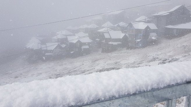
In the Australian Alps, the first significant snow of the year is falling. This was the scene at Mt Hotham in Victoria on Friday morning.
Belting down at Hotham this morning! Check our website https://t.co/L5lVvnlLfj for current road conditions, it will be slippery today. #mthotham #mounthotham #snow #winteriscoming #winter2019 pic.twitter.com/XEgMqLrMNP
— Mount Hotham RMB (@MtHotham_RMB) May 9, 2019
The #Snowflakes continue at Hotham today. #Winter is closing in! #coldsnap #chills #9NEWS #snow #snowing #snowreport pic.twitter.com/hCBQJ6ejOV
— Hotham (@_hotham) May 10, 2019
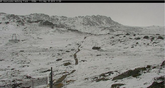
And here's the scene at the start of the Mt Kosciuszko track at the top of the Thredbo chairlift. Yeah, probably not the best day for a walk out to Kossie.


Reader Comments
to our Newsletter