There are a couple of regions in particular however, that are setting the bar high in terms of winter conditions. We're talking OVER 300 cm of snow already on the ground and windchills that are plunging into life-threatening territory. Find out what areas we're talking about, below.
RECORD SNOWFALL IN HAPPY VALLEY-GOOSE BAY, LABRADOR
We reported on this back in November, even before the official start to winter began, when Happy Valley-Goose Bay set records for a whopping 130+ cm of snow on the ground since the start of September. And while Labrador is by no means a stranger to some hefty snow fall, these pre-winter amounts felt excessive, even by the East Coast standard.
Take me down
— Nathan Coleman (@NateTWN) November 12, 2018
To the Labrador city
Where the snow is deep
And the wind ain't pretty https://t.co/CMDjQWZTrV
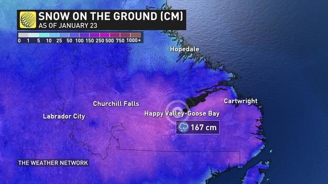
Now, as the town remains locked in an active storm track, additional records are being set with MORE than 350 cm of snow reported since October. That's over 11 feet of snow!
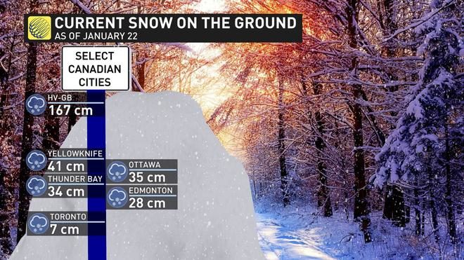
On January 22. a recorded snow depth of 167 cm was reported, making for the highest snow cover ever for that date.
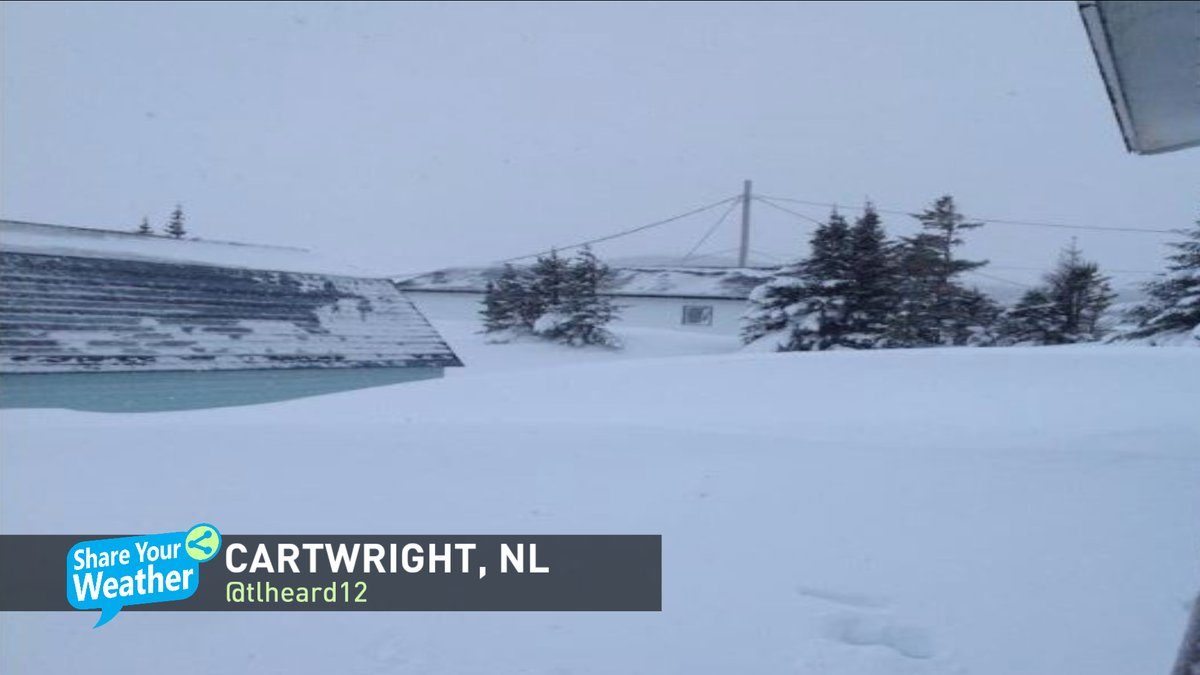
#Labrador knows snow!! #HappyValleyGooseBay, NL which recorded 59.2 cm in the past 2 days, has already seen 357.6 cm of snow since October. The picture below is from #Cartwright, NL & under that is an SUV & a shed! 📸 by @tlheard12. Track your weather on @weathernetwork pic.twitter.com/fJhWvPdnQC
— Chris Murphy TWN (@MurphTWN) January 23, 2019
"And so far, 2019 is the fourth highest snow depth recorded for the area since records began in 1955," says Weather Network meteorologist Matt Grinter.
It's safe to say Happy Valley-Goose Bay is on track to see one of its snowiest January's in history.
"The snowiest January to date is from 1985 when 235.1 cm of snow was reported," Grinter adds.
EXTREME COLD WARNING FOR -60 WINDCHILLS
The excessive and relentless snow is one way to describe a wild and extreme winter in Canada, but what about an extended period with windchill values of -65? A multi-day episode of "very cold windchills" has currently prompted extreme cold warnings across parts of Nunavut. These are temperatures so cold that frostbite could develop within a matter of just minutes.
If you watch @weathernetwork you know by know that #Purple on the map = #Cold! But what about #White? This is next level #frigid. Core temperatures within here are colder than -40°C but with the wind chill, feeling like -60...MINUS 60 this morning! Bundle up against #Frostbite pic.twitter.com/lzttQpBaWa
— Chris Murphy TWN (@MurphTWN) January 23, 2019
"Extreme wind chill values of -55 to -65 over Kivalliq and the Melville Peninsula continue as a ridge of high pressure settles over the region," says Environment Canada in the warning. "Wind chill values will generally remain in this range through the remainder of the week and potentially into the weekend," says Environment."


Reader Comments
to our Newsletter