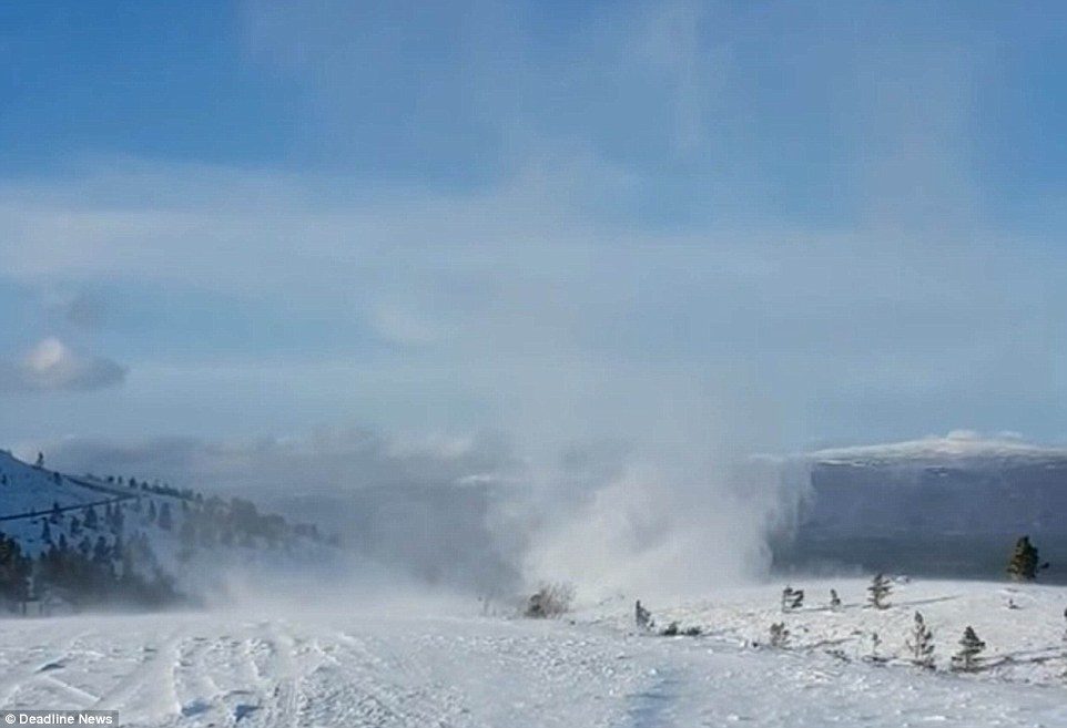
Skiers and walkers were dwarfed on Cairngorm Mountain near Aviemore by the stunning spiralling pillar of snow - also known as a 'willy willy' - which disappeared as quickly as it appeared.
It comes as Britain faces being plunged into a cold snap over the next 10 days as temperatures drop below -10C, with many parts of the country already hit by snow and flooding affecting the roads and railways.
James Madden, of Exacta Weather, said eastern and south-eastern parts will be the first to see wintry showers as temperatures drop.
He told The Express: 'There will be widespread frosts and ice problems.
'By the end of the week and into the weekend we could see snow popping up almost anywhere.'
Up to two inches of snow is expected to fall over Scotland today - while there will be more flurries of the white stuff towards the end of the week, particularly in the East, where it might be cold enough to accumulate.
The phenomenon in Scotland - spotted by Lynn Godfrey on Monday of last week - typically forms when a cold air mass passes over a warmer surface, heated by sunlight. Wind shear then causes the rising air to spin.
Ms Godfrey, 49, of Newmains, North Lanarkshire, said: 'We were in Aviemore on holiday. We came for the dog sled rally and stayed an extra week for the walking.
'We have two malamutes, a malamute/German shepherd and a labrador with us, so we walk constantly. It was so windy, our van was almost blown over. I've never seen anything so beautiful but so scary before.'
Met Office meteorologist Emma Sharples said the formation of the 'willy-willy' can be caused by a variety of factors. She added: 'It's fairly rare to see the formation on snow.
'It's probably captured on camera less because there's not as many people up in the mountains, but they usually form in deserts or semi-arid ground, not normally on snow.'
According to the Met Office, the air temperature at the nearby car park on the mountain was around 3C with the wind speed in nearby Aviemore blowing at around 8mph (5 knots).
This week, forecasters expect temperatures to fall as low as -10C in the North of England and -5C in the South from tomorrow, before biting wind and widespread frosts make it feel particularly cold on Saturday and Sunday.
The Government has a level two cold weather alert in place until the weekend which warns of an 80 per cent chance of severe cold weather in the next five days that will present increased health risks to vulnerable patients.
The alert warns of a plunge in temperatures from tomorrow with sharp overnight frosts and low daytime temperatures, along with brisk easterly winds and a risk of snow mainly in eastern and northern counties.
What is a willy-willy?The rest of the article can be viewed here.
The phenomenon is also known as a 'dust devil' and is usually an upward spiralling, dust-filled air vortex.
They are normally about 10ft in diameter at the base, then narrow for a short distance before expanding.
They mainly occur in desert areas where the ground is dry and there are high surface temperatures.
A willy-willy's initial rotation may be caused by irregularities in the surface.
Unlike tornadoes, they grow upwards from the ground - rather than down from clouds.
They only last for a few minutes because cool air is sucked into the base of the rising vortex, cooling the ground and cutting off its heat supply.
The term 'willy-willy' originates in Australia and thought to come from an Aboriginal language. They can also be called 'whirly-whirlies'.
Source: Met Office


Reader Comments
to our Newsletter