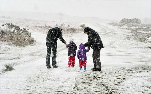
Britain could be facing the coldest May for 100 years, with snow, bit
© Tim Ireland/PAA family walk in the snow in the Brecon Beacons, south Wales
The winter weather follows a wet start to April, with the threat of floods and storms to come over the next few days.
The Met Office has issued weather warnings for the South West, London, South East, Wales and the West of England due to flooding on roads and 60mph winds.
Hail storms are expected across the country and it is feared windows could be broken by giant hail, up to 1cm thick. In the north and Scotland temperatures could fall to -2C.
Despite the ongoing drought, heavy downpours could cause localised flooding, even in areas where there is hosepipe ban in place.
Independent forecaster WeatherAction has also predicted the next month will be the "coldest or near coldest for 100 years" in the East of England, with cold northwesterly winds.
Cairngorm ski resort in Scotland is open, although most of the other centres remain closed, as snow falls on the high ground.
An unsettled front coming in from the Atlantic is causing the combination of storms and sunshine across most the county.
The heaviest rain will be in the west at the beginning of the week before the Atlantic weather system moves over the east of the country bringing downpours to the drought-stricken areas of the UK.
Most of the east of England is in drought, from the Humber down to the Kent coast, and across the Midlands and the South West. Seven water companies in the south and east have brought in hosepipe bans.
Another wet weather front is expected next week, bringing yet more rain and the chance of one of the wettest Aprils on record, after the driest March for 59 years.
At the halfway point for the month 41.7mm, had fallen, 60 per cent of what would normally be expected. The average UK rainfall for April is 69.6mm.
The wettest April on record was in 2000 when 120.3mm fell and the tenth rainiest year on record was 96.7mm in 1961, meaning this year has a chance of being in the top ten.
Over the next few days up to 30mm could fall in the worst-hit areas in Dorset, Hampshire, the Midlands, and Wales.
It is certainly wetter than last year, the driest April on record, when just 13mm fell.
It is also cooler than usual. The normal maximum average temperature for April is 13C in the South East and 11C in Scotland. But over the next week it will be around 10C in the South East and 8C in Scotland.
Dave Britton, of the Met Office, said there could be localised flooding caused by the thundery downpours.
The Environment Agency has already warned that flash floods could be worse than usual because the ground is so dry because of the drought.
He said it was too early to say if the month as a whole will break records, although it will be cooler and wetter than normal.
"It will take more than one month of above average rainfall to alleviate some of the very dry conditions we have experienced over the last 24 months in some parts of the country," he said.
At this time of year most of the rain is sucked up by growing plants or evaporates because it is warm. The Environment Agency say that months of rain is needed to refill aquifers and reservoirs. Groundwater supplies, that feed rivers and mains supplies, usually rely on prolonged winter rainfall to fill up.
Reader Comments
to our Newsletter