22/07-08:17 UTC : Felt reports from the epicenter area. "It was very bad in itezhi tezhi, some buildings have developed cracks.Thanks heavens that no damage was done to humans so that we can VOTE (ER: there are soon elections in Zambia)." "The tremor was at 15:56 hours. Two of my office glass panes cracked."
22/07-08:06 UTC : In local media a fierce discussion is going on to find out why this earthquake happened. Some people blame the Itezhi Tezhi Dam project. Below are 2 people with a diffrent opinion on the origin of this earthquake.
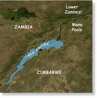
Lemekani Phiri : "The tremor was located in Itezhi-Tezhi district. This is due to the man-made lake there. The weight of the new water body and lubrication of formerly idle faults by the water most likely caused it. And yes, Zambia has the ability to measure (so called Richter scale) and accurately locate the quake. Check with the Geological Survey Zambia. There have been such tremors infrequently since the completion of the lake construction."
"We've always have tremors in Zambia even before the Kariba was made. Its just that they are not as often as those in Asia and South Europe. In Zambia they are like a comet, a rare phenomenon. How do you explain the one that took place in Mocambique and Zim? I think it has something to do with the rift valley. The only advice I can give is for those building houses to put up strong ones. Let's take a leaf from Japan. Thank God no major damages nor serious injuries reported."22/07-07:58 UTC : Zambiawatchdog says that Monze, Choma and Kalomo were affected by the quake. They are also reporting that no damage or injuries were reported.
"9:07 UTC : The following Felt report comes from Arno Mulimba, who works in the Kafua National Park :
"I was working in the workshop,the suddenly there was vibration from the workshop shade and capt quiet after about 10 sec. At first i thought it was Plane heading to the air strip. 10 minutes later i got back to my office and started chatting to my friend from the south of the park. She told me her side of the story. Thereafter connected everything together. One of the chiefs in the kitchen was chopping tomatoes on the chopping board and narrates that suddenly the tomatoes on the table started shaking and didn't know what was happening. Till i told them that is was earthquake. It was quiet An experience."

14:35 UTC : Other seismological data for this earthquake : EMSC : 5.3 @ a depth of 10 km GFZ : 5.2 @ a depth of 30 km
14:33 UTC : Only 10 km from the epicenter of this earthquake is the Itezhi Tezhi Dam. The Itezhi-Tezhi Dam on the Kafue River in west-central Zambia was built between 1974 and 1977 at the Itezhi-Tezhi Gap, in a range of hills through which the river had eroded a narrow valley, leading to the broad expanse of the wetlands known as the Kafue Flats. A small town has sprewn up near the dam (source Wikipedia).
14:30 UTC : Kafue National Park, located near the epicenter, is the largest national park in Zambia, covering an area of about 22,400 km² (similar in size to Wales or Massachusetts). It is the second largest park in Africa and is home to over 55 different species of animals. The park is named for the Kafue River. It stretches over three provinces: North Western, Central and Southern. The main access is via the Great West Road from Lusaka to Mongu which crosses the park north of its centre. Seasonal dirt roads also link from Kalomo and Namwala in the south and south-east, and Kasempa in the north (source Wikipedia).
Moderate shallow earthquake in a location with very few prior earthquakes. Earthquake-Report.com calls this earthquake moderately dangerous as the houses are not prepared to resist earthquakes and as the precise epicenter has an error margin.
Most important Earthquake Data:
Magnitude : 5.2 UTC Time : Thursday, July 21, 2011 at 13:55:55 UTC
Local time at epicenter : Thursday, July 21, 2011 at 03:55:55 PM at epicenter
Depth (Hypocenter) : 13.5 km (8.4 miles)
Geo-location(s) : 224 km (139 miles) N (6°) from Livingstone, Zambia
239 km (148 miles) W (260°) from LUSAKA, Zambia


Reader Comments
to our Newsletter