Floods
S


Boat

A rising Lake Erie closes streets, ferry, leaves debris

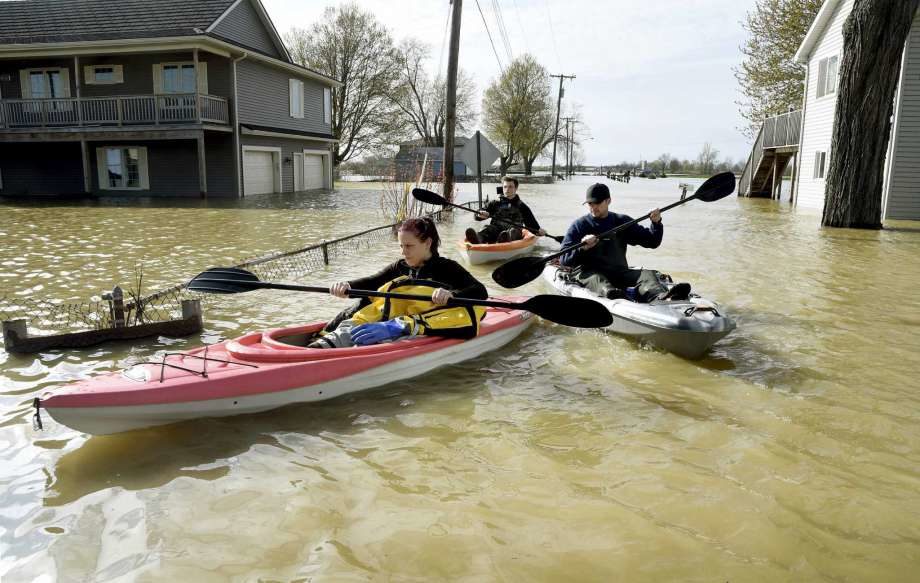
In this Wednesday, May 8, 2019 photo, Estral Beach Firefighters Courtney Millar, Eric Bruley, and Chase Baldwin kayak down Lakeshore Dr.
© Tom Hawley/The Monroe NewsIn this Wednesday, May 8, 2019 photo, Estral Beach Firefighters Courtney Millar, Eric Bruley, and Chase Baldwin kayak down Lakeshore Dr. in the south end of Estral Beach in Berlin Township, Mich., to see if anyone needs to be evacuated while also checking the floodwaters.
Floodwaters spilling over western Lake Erie's shoreline have swamped streets, shut down ferries and left behind dangerous debris during the past month. Now residents are bracing for more problems.

All the Great Lakes have been rising for several years and now are seeing an increase from winter's melting snow and recent heavy rains.

Lake Erie's water levels are expected to topple records this summer, according to the U.S. Army Corps of Engineers. The lake is 26 inches (66 centimeters) over its long-term average.

Storms with high winds this spring already have led to flooding along the Ohio shoreline.


Cloud Precipitation

Ice Age Farmer Report: Australia's GrainCorp implodes - Europe decimated by frosts AGAIN - Are you paying attention?

Angel Fire Resort
Angel Fire Resort
Cracks are appearing in the edifice of modern agriculture: Australia's biggest grain producer's revenue collapses after horrific crop losses.

Study confirms 90% of people still believe the CO2/global warming hoax -- humanity is walking unaware into #GlobalCooling in the #GrandSolarMinimum.

Christian breaks it down, encourages you to grow your own food, and--by all means--spread the word.


Sources

Attention

Rising Mississippi River prompts historic opening of Bonnet Carré Spillway near New Orleans

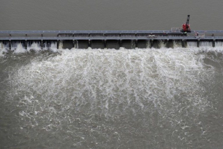
Workers open bays of the Bonnet Carré Spillway
© AP Photo/Gerald HerbertWorkers open bays of the Bonnet Carré Spillway, to divert rising water from the Mississippi River to Lake Pontchartrain, upriver from New Orleans, in Norco, Louisiana, on Friday, May 10, 2019.
As the Mississippi River continues to rise, officials opened the Bonnet Carré Spillway on Friday. Never before has the spillway been opened twice in the same year.

The Army Corps of Engineers opened the Bonnet Carré Spillway Friday afternoon, May 10. This is the fourteenth operation of the structure since 1937, and the first time it has been opened twice during the same high-water event. The spillway was first opened this year on Feb. 27.

The decision to open Bonnet Carré was issued by Maj. Gen. Richard G. Kaiser, commander of the Mississippi Valley Division in Vicksburg, Mississippi.

Maj. Gen. Richard "Rick" Kaiser, Commander, Mississippi Valley Division (US Army Corps of Engineers) and President of the Mississippi River Commission, briefed the public on the opening of the Bonnet Carre' Spillway.

"This is the wettest we've been in 124 years," said Maj. Kaiser.


The spillway, located about 12 miles west of New Orleans, diverts floodwaters from the Mississippi River to the Gulf of Mexico via farmlands and Lake Pontchartrain instead of passing near New Orleans and other river communities.
Comment: Historic Mississippi River flooding could extend into June, experts warn


Cloud Precipitation

Over a foot of rain falls in southern U.S. as severe weather heads toward East Coast

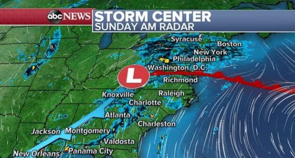
The radar on Sunday morning shows showers stretching from the Northeast down to the Deep South.
A storm system plaguing parts of the southern U.S. for almost a week brought nearly 13 inches of rain to southern Mississippi on Saturday, causing widespread flash flooding and prompting a flash flood emergency on Saturday evening.

Six states have seen locations with over 6 inches of rain in the last week: Texas, Louisiana, Arkansas, Oklahoma, Kansas and Mississippi.

There were also at least 47 reports of severe weather from Louisiana to Virginia, including two reported tornadoes in the latter.


Cloud Precipitation

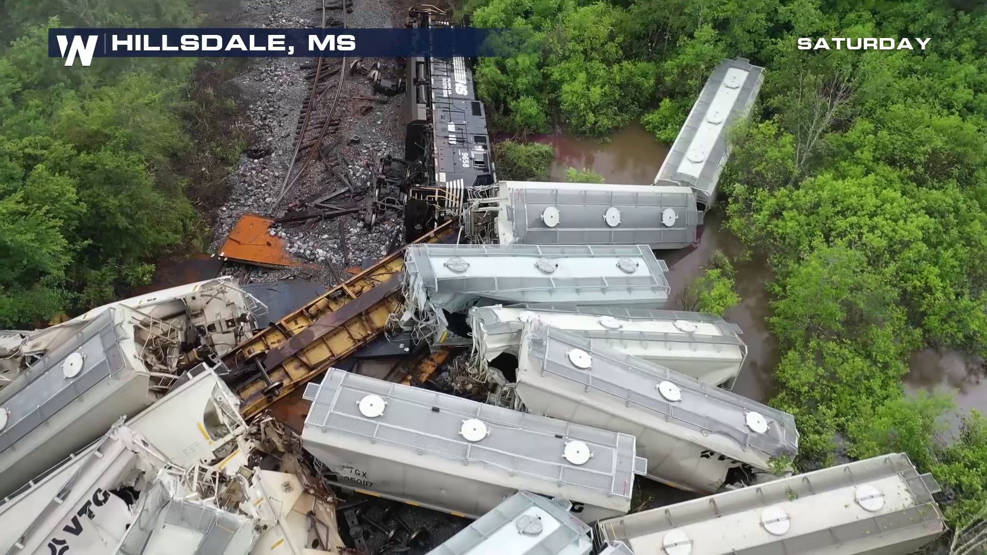
Train derails in Mississippi during flash floods

Train derails in Mississippi

Heavy rain in Mississippi leads to multiple water rescues, washed out roadways and a train derailment on Saturday.

The flooding has been most severe in the Hillsdale community, in southwest Mississippi, where the train derailment occurred. A flash flood warning was also issued for the area Saturday afternoon after several inches of rain fell in a short period of time.

Flooding is believed to be the cause of the train derailment, according to the Pearl River County Sheriff's Office. The Sheriff's department confirmed to WeatherNation that there is not believed to be a hazmat situation at the scene. In addition, there have been no reports of injuries, according to the local sheriff's office.

WeatherNation has a crew on scene who documented the aftermath of the derailment. Watch the video below:


Cloud Precipitation

Wettest 12 months in U.S. history

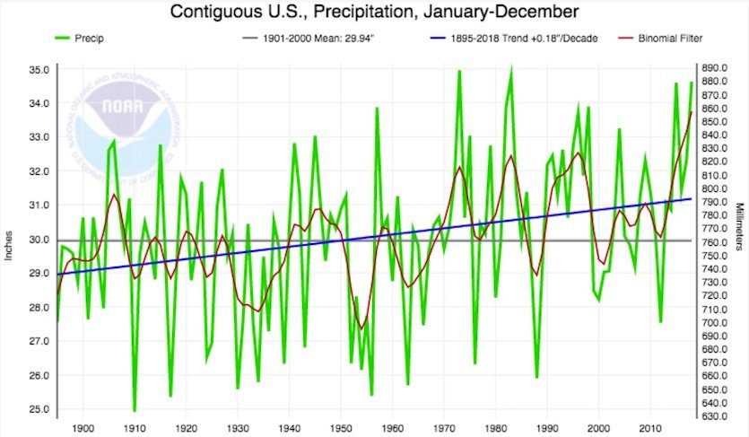
Annual precipitation across the contiguous U.S.
© NOAA/NCEI.Annual precipitation across the contiguous U.S. has increased by about 7% over the past century. Blue bar shows the linear increase since 1895, while the red curve is a smoothed version of the year-to-year numbers in green. When averaged over running four-year periods (not shown), the past four years are the wettest on record for the contiguous U.S.
The 12 months ending in April 2019 were the wettest year-long period in U.S. records going back to 1895, according to the monthly U.S. climate summary issued Wednesday by the NOAA National Centers for Environmental Information. Averaged across the contiguous U.S., the total of 36.20" made the period from May 2018 to April 2019 the first year-long span ever to top 36". The old record for any 12-month period was 35.78", from April 2015 to March 2016.

Given the fierce drought-related impacts of the 2010s—including multiple deadly wildfire disasters from Tennessee to California—it may seem a bit counterintuitive that the nation has actually been getting wetter overall. Across the contiguous U.S., average yearly precipitation has risen by about 2" over the past century, from around 29" to just over 31" (see Figure 1). For the entire nation, including Alaska and Hawaii, precipitation increased by about 4% in the period from 1901 to 2015, according to the U.S. National Assessment.

Comment: For additional information on the seasonal and regional details read more here . The article does however does include some rather tiresome man-made global warming propaganda.

Also of relevance: Ice Age Farmer Report: "Wettest Winter Ever" - Farmers Desperate - Massive Solar Storm Warning

2018 was wettest year on record in over 2 dozen cities in the East, Midwest, including Washington D.C. and Pittsburgh


Cloud Precipitation

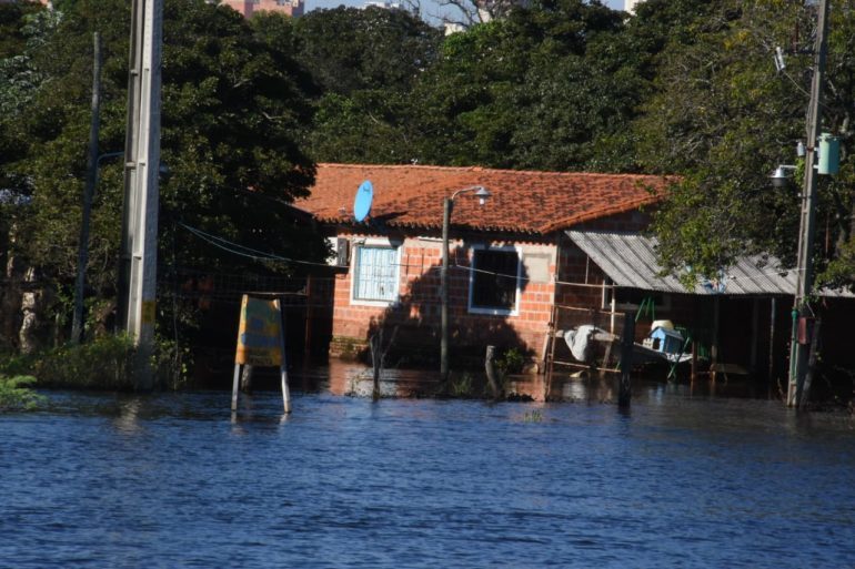
Emergency declared after floods worsen in the south of Paraguay

Flooding along the Paraguay River in Asunción, Paraguay, 2019.
© Government of AsunciónFlooding along the Paraguay River in Asunción, Paraguay, 2019.
The government of Ñeembucú Department in Paraguay declared a state of emergency on Wednesday 08 May, 2019, after the flood situation worsened in southern areas of the country.

Heavy rainfall over recent days have increased river levels, including the Paraguay River at Pilar, the capital of Neembucu Department. As of 08 May, the river stood at 7.93 metres, well above alert level (7 metres) and close to critical level (8 metres).

The government is distributing food and relief supplies to around 1,000 affected families in San Juan in Ñeembucú. Supplies will also be distributed in the districts of Guazucuá and Tacuaras. Other affected areas include Villa Oliva, Villa Franca, Alberdi and parts of Pilar.


Cloud Precipitation

Adapt 2030 Ice Age Report: Brutal winter exit & cold start to spring 2019

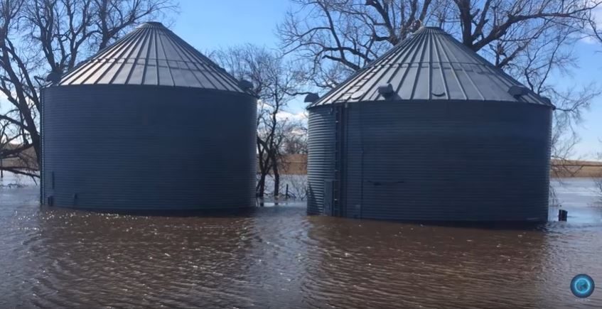
Nebraska grain bins flooded
© YouTube/Adapt 2030 (screen capture)
Extreme cold and floods events leading into spring 2019 have left parts of our globe unable to plant this years crops, how did we go from all time record cold to all time record floods, here is what the corporate media overlooked along the way into spring of 2019.


Cloud Precipitation

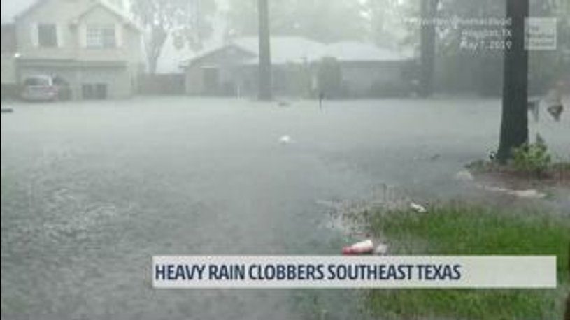
Flash floods prompt emergency rescues and evacuations in Texas and Kansas

rain
Storms and heavy rain have again caused flash flooding in parts of the USA. This is the second spate of flash flooding in the last few days.

Emergency workers carried out dozens of high water rescues in areas around Houston, Texas, after flooding from 07 May, 2019. Storms have also brought heavy rain and flash flooding to parts of Kansas, where some homes have been evacuated.

Texas

Some areas of Houston recorded almost 10 inches (254 mm) of rain in 24 hours to early 08 May, 2019. National Weather Service (NWS) Houston said rainfall rates in areas over Fort Bend, Brazoria and Galveston counties were around 2 to 3 inches per hour.

Firefighters and police worked to evacuate some homes and rescue people from vehicles on impassable roads, in particular in areas around Kingwood in northeast Houston, and Sugar Land, situated to the southwest of the city in Fort Bend County.


Info

Ice Age Farmer Report: Zharkova Warns: PREPARE for Grand Solar Minimum (SC25/26)

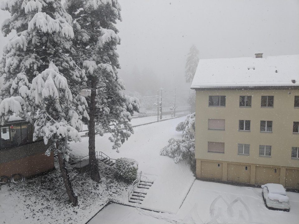
snow
Cold, wet conditions prevail across the Northern Hemisphere, preventing farmers from planting. As Valentina Zharkova warns in a recent interview: prepare now for the cooling ahead, particularly the minimum between solar cycles 25 and 26 (if we make it that long!). Start growing, and spread the word.


Sources