Extreme Temperatures
S


Attention

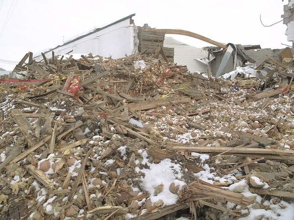
100 million pounds of spoiled onions disposed of in Idaho and Oregon

Most of the 100 million pounds of onions ruined in Idaho and Eastern Oregon this winter have been properly disposed of.
The Idaho-Oregon onion industry has managed to dispose of virtually all of the estimated 100 million pounds of onions that were lost this winter when dozens of sheds collapsed under the weight of unprecedented snow and ice.

Both states extended their deadlines for disposal of cull onions from March 15 to April 15 this year and most of the onions were properly disposed of before that date, officials in both states said.

With the deadline looming last week and a lot of onions still not disposed of, the state of Oregon gave the Lytle Boulevard landfill in Malheur County emergency permission to build another trench to handle the onslaught of culls.

"They significantly ramped up (the amount of onions they were taking) and pretty much everything is disposed of at this point," Lindsay Eng, director of certification programs for the Oregon Department of Agriculture, said April 20.
Bizarro Earth

Time to defund the weather-forecasting rent-seekers

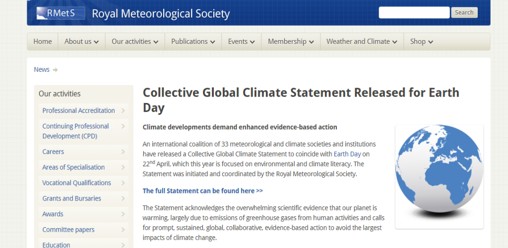
collective global warming statement
For Totalitarianism Day (formerly Earth Day), over three dozen weather forecasting organizations have issued a joint (or, in their revealing word, "Collective") "Global Climate Statement". It has not exactly made headlines: even the Mainstream media are tired of yet another pietistic, self-serving demand that more taxpayers' money should be sent in the direction of yet another generously-proportioned trough in which the rent-seekers keep their snouts.

Cloud Precipitation

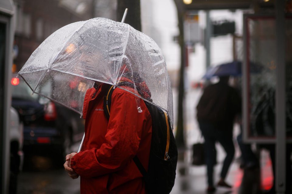
Sunless in Seattle, WA - Two rainfall records smashed

seattle
© Erika Schultz/The Seattle TimesJeremy Kahn waits for the bus in the rain in West Seattle last month.
Only eight sunny days since October 1, 2016

Between Oct. 1, 2016 and April 25, 2017, a whopping 44.69 inches of precipitation had been measured at Seattle-Tacoma International Airport. This toppled the previous October-through-April record for the city set just one year ago and is far, far above - almost 14 inches above - the average for those seven months combined - more than 44 percent above average.

What's more, the Emerald City recorded 144 days of measurable precipitation during that period, smashing the previous record of 137 days set in both 2010-2011 and 1998-1999. There has been at least .01 inch of precipitation at SeaTac Airport for 70 percent of the days since Oct. 1, far surpassing the roughly 53 percent of wet days in a typical October through April, according to National Weather Service 30-year average statistics.

Other parts of the West also experienced historic precipitation during this period. Through Monday, SeaTac Airport has managed a total of eight "sunny days" - defined as a daily average sky cover of 30 percent or less - since Oct. 1.

This means that Seattle rainfall records have broken in four of the last 18 years. And remember, Seattle just endured its coldest winter on record.

Hmmm. Is this just a coincidence, or are we beginning to see a pattern here?

Snowflake Cold

Hard freeze in France - Some vineyards totally destroyed

france vineyards
© Christian Hartmann/Reuters Workers and wine growers light heaters early in the morning to protect vineyards from frost damage outside Chablis.
Hard freezes in some of France's famous wine-making regions, including Champagne, Bordeaux and Burgundy, have caused extensive damage.

Temperatures plunged in all three regions last week, sometimes to below -7C (19°F).

In the Bugey region near Lyon, winemakers said the damage was extensive, with some vineyards totally destroyed.

"Frost destroyed everything - shoots are dead," Julien Hubail, expert at the Bugey wine union, said. "In winemakers' memory it had never happened, no one had ever experienced such a severe freeze."

Snowflake Cold

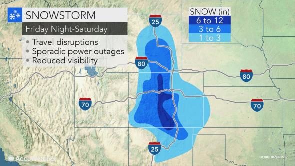
No April showers? Up to 2 feet of snow to hit Rockies - in late April!

colrado snow april 2017
A Winter storm moving across Colorado will bring heavy snow and gusty winds from Friday evening into Saturday night.

National Weather Service Pueblo CO Apr 27 2017 -

Winter Storm Watch from Friday evening through late Saturday night:

* Location...Lake county, western Chaffee county Between 9000 and 11000 feet, Sangre de Cristo mountains, western Mosquito Range and eastern Chaffee County above 9000 feet, La Garita mountains, eastern San Juan Mountains, northwestern Fremont county above 8500 feet, Wet Mountain Valley below 8500 feet, Wet Mountains, Teller county, Rampart Range and Pike's Peak region, northern El Paso county, the upper Huerfano River Basin below 7500 Feet and western Las Animas County below 7500 Feet.

* Snow Accumulation...Total snow accumulation in excess of 8 inches will be possible, with the potential for 1 to 2 feet over the higher elevations of the the eastern mountains.

* Wind...North to northeast winds 15 to 25 mph with locally
higher wind gusts.

* Impact...Snow and blowing snow at times is expected to create hazardous weather and travel conditions in the watch area. In addition, heavy wet snow will be capable of producing tree and powerline damage.

Bizarro Earth

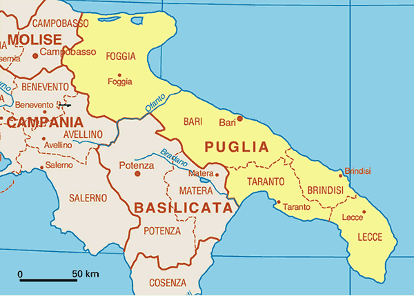
Bad weather in Italy causes damage to crops in the south

puglia italy region
A producer from Puglia reports that "the cold front that, all of a sudden hit the Canosa and Cerignola areas, damaged apricots and peaches, which were also affected by the hailstorms, as well as vegetables such as tomatoes."

"The consequences are not immediately recognisable, as a few days must pass. The growth of grafted peach trees has stopped due to the low temperatures and vines show signs of burning."

Stone fruit production has halved all over Italy and the producer reports good market price prospects. "We need to be careful, though, as it all depends on how things will evolve over the next few days. There is a lot of damage and, if the weather goes as forecast, we only have to hope that there will be no hailstorms."

Additional images

Snowflake

Snow in Canada leaves 2 million crop acres stuck on prairie fields

Unharvested acres must come off field before spring planting.
© Dusty CraigUnharvested acres must come off field before spring planting.
April snowfall in parts of Canada's prairies has halted efforts to harvest more than 2 million acres (809,370 hectares) of grain leftover from 2016, delaying spring planting in some areas by at least two weeks.

In Alberta alone, there's as many as 1.5 million acres that remain unharvested, and gathering has been hampered by light snow falling daily in central and northern areas, according to James Wright, a risk analyst with the province's Agriculture Financial Services Corporation. Snow and cool weather have also slowed progress in Saskatchewan, where more than 1 million metric tons of grain is still sitting on fields from last year's harvest after excess moisture made fields too wet to combine, according to the province's agriculture ministry.

"If you have to harvest, plus you have to seed, it's going to be a real time crunch," Errol Anderson, the president of ProMarket Wire in Calgary, said by phone. "These delays are a minimum two weeks, but it's almost throwing the province back the better part of a month."

Igloo

Climate Weirding

boy who cried wolf
Expect the dialogue to once again morph into something seemingly more nefarious and/or insidious, switching from global warming - > climate change - > climate "weirding":

In a recent segment, weather.com began the switch-over. The quotes and alliteration are as follows ...
"It has been punctuated this week by a weird, long plume of moisture spanning almost the entire Pacific Ocean Basin, piped into the West Coast, including Seattle, from near the Philippines.

"If that [heavy precipitation as far south as northern California] isn't depressing enough ...

"But this nearly seven-month stretch has challenged the patience of even long-time residents ..."
Inspiring, isn't it? Woe. Angst. Hang-wringing. "Weird". Unusual. Depressing. In the literary realm, word choices designed to elicit a specific response or emotion is known as connotation. Among the AGW crowd, it almost always takes the form of hyperbole—extravagant exaggeration meant to sway the casual reader to the perils of climate change.

The Weather Channel has become one of the most perversely egregious media outlets to employ the tactic. As if ordinary day-to-day follies of weather weren't dramatic enough, they have progressed to narrating their dialogue as though every event is now highly unusual, and often try tying specific weather events to human-induced climate change.

Ice Cube

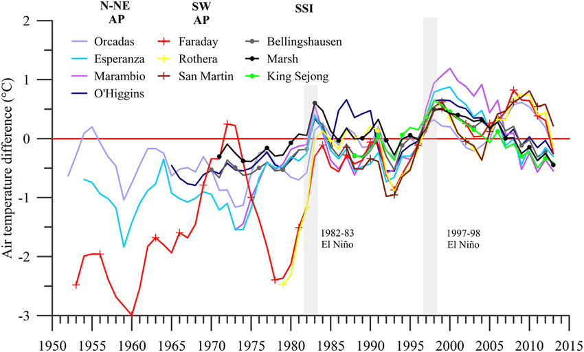
Oops, Warmists just lost the Antarctic peninsula - it is now cooling

graph for arctic peninsula
A warming trend of 0.32 °C/decade during 1979 - 1997 to a cooling trend of − 0.47 °C/decade during 1999 - 2014.

Remember the much ballyhooed paper that made the cover of Nature, Steig et al, "Warming of the Antarctic ice-sheet surface since the 1957 International Geophysical Year", Nature, Jan 22, 2009 that included some conspicuously errant Mannian math from the master of making trends out of noisy data himself? Well, that just went south, literally.

And it just isn't because the Steig et al. paper was wrong, as proven by three climate skeptics that submitted their own rebuttal, no, it's because mother nature herself reversed the trend in actual temperature data in the Antarctic peninsula, and that one place where it was warming, was smeared over the entire continent by Mannian math to make it appear the whole of the Antarctic was warming.

Snowflake

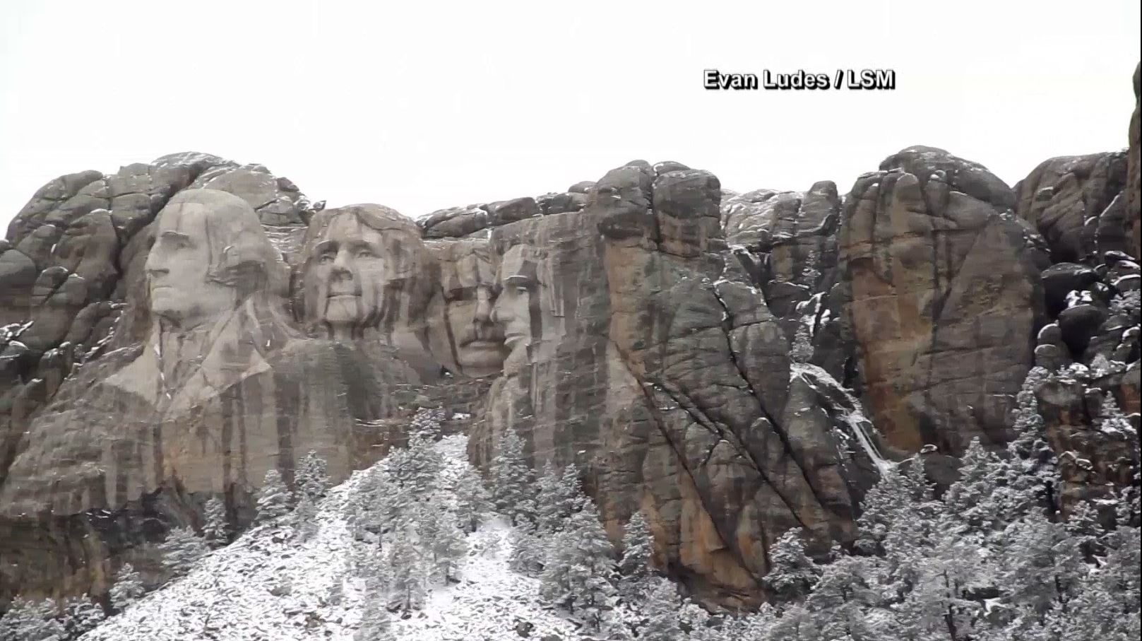
Areas of South Dakota blanketed with late spring snow

Snow covering up our famous presidents atop Mt. Rushmore.
After enjoying temperatures in the 70s over the weekend, South Dakota is digging out from under a fresh blanket of snow.

The late spring snow storm even hit some famous presidents.

Mount Rushmore national memorial saw snow accumulations of around half a foot Monday evening.

Icicles could even been seen dripping off the giant presidents noses and eyebrows.