Earthquakes
S


Bizarro Earth

Easter Island Region - Earthquake Magnitude 6.0

Easter Island Quake_010311
© USGSEarthquake Location
Date-Time:
Tuesday, March 01, 2011 at 00:53:46 UTC

Monday, February 28, 2011 at 05:53:46 PM at epicenter
Time of Earthquake in other Time Zones

Location:
29.605°S, 112.107°W

Depth:
10 km (6.2 miles) set by location program

Region:
EASTER ISLAND REGION

Distances:
377 km (234 miles) SW of Hanga Roa, Easter Island

3931 km (2441 miles) W of SANTIAGO, Region Metropolitana, Chile

Bizarro Earth

US: Arkansas Has Largest Earthquake in 35 years

Arkansas Quake
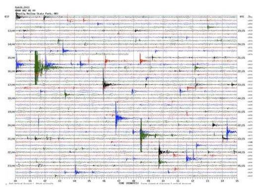
© Arkansas Geological SurveyIn this image provided by the Arkansas Geological Survey near Greenbrier, Ark., Thursday, Feb. 17, 2011, a seismic chart illustrating earthquake activity at Woolly Hollow State Park from noon to midnight on Feb. 16, is shown.
Greenbrier - Residents of the small north-central Arkansas town of Greenbrier said Monday they're unsettled by the fact that they never know if or when the next earthquake is going to strike, especially after being woken up by the largest quake to hit the state in decades.

The U.S. Geological Survey recorded the quake at 11 p.m. Sunday, centered beneath the ground about four miles northeast of Greenbrier. It was the largest of more than 800 quakes to strike the area since September in what is now being called the Guy-Greenbrier earthquake swarm.

"You don't know what to expect. It's unnerving," said Corinne Tarkington, an employee at a local flower and gift shop. "I woke up last night to the sound of my house shaking."

What woke Tarkington was a magnitude 4.7 earthquake - the largest to hit the state in 35 years. No injuries or major damage have been reported, but the escalation in the severity of quakes in and around the small north-central Arkansas town has many residents on edge. Some said they're seeing gradual damage to their homes, such as cracks in walls and driveways.

"We probably had 40 to 50 calls last night," Greenbrier police Sgt. Rick Woody said, noting that the tone of the calls had changed. After previous quakes, most callers simply wanted to find out if a loud noise they'd heard was an earthquake, he said.

Evil Rays

Devastation in New Zealand quake on par with Haiti: ex-PM

Image
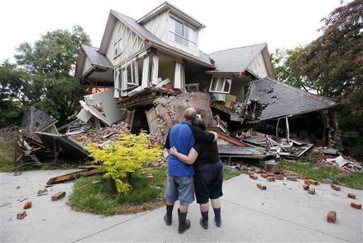
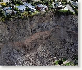
© Agence France-PresseLuxury houses teeter on the edge after landslides in Redcliffs near Christchurch on February 27, 2011, after a 6.3 earthquake devastated New Zealand's second city and surrounding towns on February 22. The quake caused more damage than the 7.1 magnitude quake that hit the city on September 4, 2010 and has killed at least 146 people.
The scale of devastation in quake-hit Christchurch is comparable with the destruction wreaked in the 2010 Haiti earthquake, New Zealand's former premier Helen Clark said Monday, as rescuers prepared for the final death toll to rise above 200.

The stark assessment came with much of the city lying in ruins after last Tuesday's 6.3-magnitude quake caused widespread death and destruction, toppling buildings and tearing up roads.

"The building damage I've seen compared with Haiti," Clark, who now heads the United Nations Development Program, told Radio New Zealand Monday, referring to the massive quake which killed at least 220,000 in the Caribbean island in January last year.

"Let there be no mistake, New Zealand has suffered a tragedy of monumental proportions and it's going to require every ounce of recovery in this country to push through from this," she added.

Radar

Chile: Earthquake Magnitude 6 Marks Anniversary of Fatal 8.8 Quake

Image
© USGS
A 6.0 magnitude quake has struck the Bio-Bio region of Chile, exactly one year after a fatal 8.8 magnitude quake devastated the region, according to the U.S. Geological Survey (USGS).

The quake hit 23 miles south of Concepcion and 291 miles south south-west of Santiago at a depth of 10.4 miles. It struck at around 10.30 p.m. local time. There have been no reports of damage or injuries yet.

Earlier in the day, the anniversary of the 2010 earthquake was commemorated, led by President Sebastian Piñera. Across the nation, candles were lit and prayers raised in memory of the dead, according to BBC News. One minute's silence was observed at the precise moment the earthquake had struck.

The February 2010 earthquake was accompanied by a tsunami, killing more than 500 people, and leaving hundreds of thousands more homeless.

Bizarro Earth

US: 4.7-magnitude earthquake hits central Arkansas

Image
© USGS
A 4.7-magnitude earthquake struck central Arkansas just after 11 p.m. Sunday (12 a.m. ET Monday), the United States Geological Survey said. There were no immediate reports of damage or injuries. The quake's epicenter was 37 miles from Little Rock, Arkansas, USGS said. CNN affiliate KARK received calls from a number of viewers who reported feeling the impact of the quake and seeing items on their walls shake.

From USGS:

Date-Time:
Monday, February 28, 2011 at 05:00:50 UTC

Sunday, February 27, 2011 at 11:00:50 PM at epicenter

Time of Earthquake in other Time Zones

Location:
35.265°N, 92.344°W

Depth:
3.8 km (2.4 miles)

Region:
ARKANSAS

Distances:
6 km (4 miles) NE (46°) from Greenbrier, AR

7 km (4 miles) S (187°) from Guy, AR

9 km (6 miles) SE (128°) from Twin Groves, AR

22 km (14 miles) NNE (27°) from Conway, AR

59 km (37 miles) N (359°) from Little Rock, AR

418 km (260 miles) SSW (207°) from St. Louis, MO

Radar

Philippines: 13 lahar-related 'quakes' rock Mount Bulusan area

Image
At least 13 volcanic quakes were recorded around restive Bulusan Volcano in Sorsogon in the last 24 hours, state volcanologists said Monday morning.

The Philippine Institute of Volcanology and Seismology said the quakes were "lahar-related" - a day after lahar flows affected water supply in parts of Sorsogon.

"Bulusan Volcano's seismic network recorded 13 lahar-related seismic signals during the past 24 hours. Steaming activity was not observed due to thick clouds covering the active vents and summit crater. Continuous heavy rain over Bulusan Volcano yesterday saturated loosely deposited ash and rock fragments and generated small lahar flows to roll down the slopes of the volcano then flowed along river channels," Phivolcs said on its website.

It said channel-confined lahar flows were observed along Cogon and Monbon river channels.

Other than that, it said no other significant volcanic activity was observed since the last ash explosion on Feb. 21.

Radar

Iceland: Four day long earthquake swarm intensifies at Krísuvík volcano

Image
Picture is from Icelandic Met Office graphic web tool.
While this earthquake swarm in Krísuvík volcano does not appear to be big in size. It is clear that was rather long and might even be ongoing. But it is interesting how long this earthquake swarm did last. So far the time is about 2 days. It is impossible to know if the earthquake swarm is over or not. Current number of earthquakes is about 60 earthquakes so far.

The earthquakes are on North-South fault line according to the visual evidence. Depth of the earthquakes is from 12 km and up to 3 km at the moment. It is hard to know at the moment if this is due to magma inflow under Krísuvík volcano or just normal tectonic activity along the rift zone in Reykjanes.

Icelandic news about this earthquake swarm.

Hrina smáskjálfta í Krýsuvík (Vísir.is, Icelandic)

Bizarro Earth

No Power, No Shower as New Zealand Quake Toll Rises to 113

Image
© The Associated Press
The neighborhood's toilet is a portable one out on Keller Street. The water supply is cut, making showers and clean laundry distant dreams. Resident stay fresh with bottles of hand sanitizer, and they're running low.

"Don't stand too close to anyone," Judy Prime said with a chuckle as she took a break from shoveling huge piles of wet sludge out of her garage in the shattered Christchurch suburb of Avonside.

The days since Tuesday's massive earthquake rumbled through Christchurch, killing at least 113 and toppling buildings, have brought a level of misery unusual for the residents of this modern city of 350,000. Water and power supplies to thousands have been cut, and many have been forced to sleep in their cars or tents as their unstable houses sway with the relentless aftershocks.

Many Christchurch residents first started getting used to some deprivation five months ago, when an earlier quake struck the city. Now, life is even worse.

Tuesday's temblor brought a fresh surge of water up through cracks in the yards of Prime and her neighbors along Keller Street. Most houses on the street suffered damage, and many will need to be demolished.

Prime, 66, has spent each night sleeping on a rubber mat under the dining room table, worried that aftershocks will send parts of her home crashing down. Every evening, she and her neighbors gather in her back yard to share beers and barbecue the meat from her freezer - still good, because it was encased in thick ice when the power went out.
Bizarro Earth

Hawaii Earthquake Jolts Honolulu: Signs of Geological Change in Hawaii?

Hawaii Quake
© The Extinction Protocol
Honolulu - A small earthquake hit Hawaii on Thursday, with a jolt felt across Honolulu.

The U.S. Geological Survey said the magnitude 3.6 temblor struck at 2:12 p.m., about 12 miles deep in the Kaiwi Channel, between the islands of Oahu and Molokai.

There were no immediate reports of injuries or damage. No tsunami was generated.

The quake that lasted for several seconds shook homes and people throughout Oahu, from high-rise buildings in downtown Honolulu to the tourist district of Waikiki. People about 160 miles away on Maui reported feeling the quake, the USGS said.

Katrina Woodcock felt it while sitting at her desk on the 7th floor of a downtown Honolulu office building. The shaking lasted for about five seconds or so, and only one other person in her office noticed the earthquake, she said.

"I felt like it was shaking, and I was like, 'What is that, is our building falling?" she said.

Earthquakes are common in Hawaii with events occurring almost daily. Most are small and centered around the Big Island, where most of the state's seismic and volcanic activity takes place.

Bizarro Earth

Two Quakes Wiggle Yellowstone

Aerial of Excelsior Geyser Crater
© Jim Peaco/NPSAerial of Excelsior Geyser Crater & Grand Prismatic Spring
Two earthquakes of the same magnitude - 2.2 on the Richter scale - struck Yellowstone Park this week.

The first was at 9:34 pm Thursday, February 24, 48 miles east of Island Park. The next was at 5:04 am Friday, February 25, 32 miles east-northeast of Island Park.

According to the Yellowstone Volcano Observatory's January report, there were 57 earthquakes in the park in January this year. The largest was a magnitude 2.4 event on January 25 at 9:51 pm, about 6 miles north northwest of West Yellowstone. No earthquake swarms were noted in January 2011.

Analysis of the Yellowstone GPS data shows that the period of accelerated Yellowstone caldera uplift, beginning in 2004, has stopped. Some GPS stations exhibit little change and others reflect slight subsidence, according to the report.