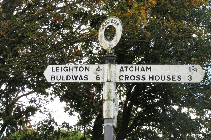
It's blowy on the B4380 to Buildwas. A keen wind whipping across the floodplain from Shrewsbury flaps a misarranged saddle bag strap against my back wheel. As I cross the river Severn at Atcham, and bend right down the back road past Wroxeter, a black cloud delivers the first dribbles of rain.
England's place names are a treasure trove of hidden history - if only we could find the key. Shrewsbury: recorded in the 10th century as Scrobbesbyrig, the name's origin is as uncertain as its pronunciation today, but possibly means "the fortified place in the scrub". Atcham: a contraction of Attingham, "the homestead of Eata's children", a puzzling reference to an obscure 7th-century saint from England's far north. Wroxeter: origin disputed, but a rare Roman place name survival, as befits the site of what was Roman Britain's fourth largest town. Buildwas: we'll get to that.
In the title of one of her books, Margaret Gelling, the doyenne of English toponymists, called place names "signposts to the past". I'm cycling the road to Buildwas because they could be signposts to the future, too.
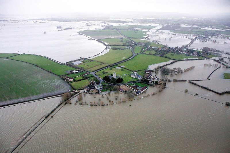
I take refuge from the now intense, globular rain in the shadow of a large hedge on a bluff overlooking the floodplain just beyond Eyton - a homestead on a raised promontory - on Severn. Britain is a wet island, and it's getting wetter. This is just a passing autumn shower, but as global temperatures rise, the paths of the most severe Atlantic storms are hitting the western shores of Britain and Ireland more frequently, often England's soggy place names could predict the climate future large quantities of rain in short periods.
Just before Christmas 2015, Storm Desmond broke the UK's two-day rainfall record, and caused flooding and disruption over much of the country. Similar extreme rainfall had already hit parts of the country in the summer of 2007 and in the 2009 to 2010 and 2013 to 2014 winter seasons. The UK Environment Agency estimates that one in six households and businesses in England are now at risk of flooding.
Warm and stormy
This sequence of events is without parallel in the 300 or so years the UK has had consistent weather records, but a historical precedent can be found if you go back far enough. Various strands of evidence point to a sustained period of warming across England between the 7th and the 10th centuries that brought more storminess with it. "The Anglo-Saxons also experienced a lot of extreme weather events like Storm Desmond," says landscape historian Richard Jones of the University of Leicester, UK.
Comment: And we suppose that this warming over between the 7th and 10th centuries was also caused by human activity?
This happens to be when most English place names were coined. When the Severn flooded in 2007, it struck Jones that these names hold clues to the flood risks that prevailed at a time of rapid climate change - and perhaps highlight the increasing risk we face as we move into a similar regime today. "I realised there was a relationship between those places suffering the most and water-related names," he says. "It intrigued me - and I did nothing about it."
That changed in 2014, when winter floods hit the Somerset Levels in south-west England. "I was struck by the plight of the village of Muchelney," says Jones. "People were saying, I can't believe it's turned into a big island. But it's in the name." Ey, as also in Eyton, is a common Anglo-Saxon place name element meaning just that: an island or raised promontory (see "Five flood-prone names").
That was the genesis of a research project called "Flood and flow": a confluence of historians, place name specialists and archaeologists that aimed to investigate the connections between place names and flood risk, and what that might tell us about the effects of climate change and other human activities.
It's a division of labour: the toponymists identify place names of interest, and the archaeologists go digging there to see what they can find. A technique known as optically stimulated luminescence allows them to date when a layer of soil in a core dug out from a riverbank or floodplain at a place of interest last saw sunlight - and so when, approximately, it was laid down in a flood. That can be used in tandem with information on the chemical composition of the soil, its magnetic properties and the granularity of the deposits - clay and silt from quieter floods, coarser material from highly energetic flash flooding - to build up a picture of flood intensity over time. "We can look at the physical sequence of flooding against the coining of names, and find place names that warn explicitly against flood or types of flood," says Ben Pears of the University of Southampton, UK, an archaeologist on the project.
The wases are a case in point. English place names do not often include the element was, so it was an ideal sample for the team to start its investigations. It has a very specific meaning - one pinned down by Gelling as "alluvial land by a meandering river that floods and drains quickly". One example is Wasperton, a tiny village just south of Warwick in the English Midlands. Cores extracted there show sequences of very quick flooding laying down lots of coarse sediment before disappearing quickly again. Here, there's a double clue in the name: "perton" indicates a place with a pear orchard. "Pears don't like waterlogged soil," says Pears.
Buildwas has perhaps the most spectacular site of all the wases, situated where the widely meandering Severn enters the confines of Ironbridge Gorge. It's looking soggy when I arrive, although the river doesn't seem inclined to burst its banks after just one October shower. But the secrets lie in the soil. Information the team has extracted from soil cores there show a dramatic flood event in the late Roman period; frequent, more moderate flooding from the 8th to the 10th centuries; and another distinct flooding maximum at the start of the 10th century, just when the name was being coined. "If Buildwas had been established in the 12th century it would have been highly unlikely to have got the name it did," says Jones.
Meanders of history
Is it a surprise that places with watery names are more prone to flooding? It's a fair enough question, says Jones. But the intriguing thing revealed by the digs is just how nuanced the information contained in place names can be. "How do places flood? Fast? Slow? Does the inundated water sit there, or drain away quite rapidly?" he says. "We can start to map this kind of historical evidence with what we see today." What's more, later medieval mapping and manorial records naming small areas and even specific fields could allow us to build up fine-grained maps of historical, and contemporary, flood risk.
"Place names became redundant because we stopped paying attention to them," says Jones. In the cooler late medieval and early modern periods, they were no longer describing rivers as they were - so we started building on floodplains. "But in the past two decades they are describing how the rivers behave again," says Jones. "It's very exciting." It's not just river behaviour, either. Forest and tree-related names might help inform strategies for rewooding, for example, or river-related names tell us about former sinuosity for remeandering, again to reduce flood risk.
In the end it's just about reconnecting us with a source of knowledge we've been living with for hundreds of years, but whose value we had forgotten, says Pears. "We spoke to a farmer in Buildwas, and he knew that the water didn't stay long when it floods, but he didn't know it was already in the name."
Five flood-prone names
ey - island, area of raised ground in wet country
This is one of the most common reliably wet Anglo-Saxon place-name elements, with examples including Bermondsey, Chertsey, Hackney and Witney.
slaep - slippery place
Perhaps understandably, few of these places have achieved greatness, although a sprinkling of Slaptons, Islip near Oxford and possibly Ruislip in Greater London indicate places where you should watch your step.
hamm - land surrounded by water or marsh
Frustratingly close to a simple "ham", meaning a homestead or settlement, this element has long been misidentified, leading one eminent toponymist to describe it as a "long-suffering" place-name element. Reasonably certain instances include Chippenham, Evesham, Fulham, Twickenham and Southampton.
holmr - inland promontory, raised ground in marsh
Confusingly, over the years often also corrupted to "ham", this is actually an Old Norse element similar in meaning to "ey". Prominent examples are Durham and Oldham.
sloh - muddy place, mire
As in Slough.


Reader Comments