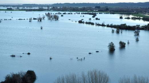
© SkynewsThe Somerset Levels have seen weeks of flooding this winter.
After an exceptionally mild December and early January forecasters warn a cold spell could bring snow in some areasBritain looks set for a distinctly colder end to January with the possibility of snow, widespread frost and cold winds.
After saturated southern England is hit by further flooding this weekend, low pressure will start to bring change across the UK next week.
The change comes as a "major incident" was declared on the Somerset Levels which have seen weeks of severe flooding and remain underwater.
The Somerset Levels is a rural area running south from the Mendip Hills to the Blackdown Hills.
Sedgemoor District Council chief executive Kerry Rickards said: "With significant rainfall expected over the coming days we feel this situation needs to be escalated as a major incident."
The council said it would continue to provide practical support to residents whose properties are flooded or are predicted to flood.
Next week's drop in temperature will come as a shock following a wet but exceptionally mild December and January, Presenter Isobel Lang, said.
"The low bringing us rain this weekend will slip away southwards allowing significantly colder air to seep west and southwestwards across us on a biting east or northeast wind.
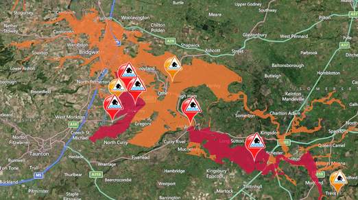
© Environmental AgencySomerset flood warnings (red) and alerts (orange).
"It will be a shock to the system after a mild December, the mildest since 1988, and a mild first half of January with a mean UK temperature up to January 15 of 5.1C, which is 1.5C above average.
"Snow is likely, especially over hills, with more widespread frosts too."
But Lang said the change looked unlikely to last.
"At this stage the Atlantic influence still looks strong and it could be that the cold air pushes back into continental Europe again by the end of the week," he said
The Met Office has warned of a wet and windy Sunday.
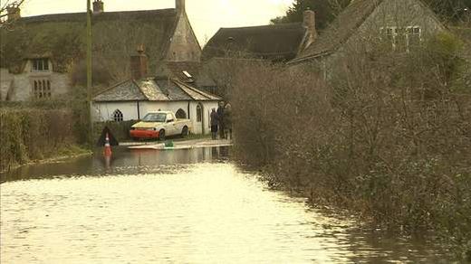
© SkynewsMuchelney village in Somerset has been cut off by floods for three weeks.
It will then turn colder and "increasingly wintry, particularly across northeastern parts", its UK five-day forecast reads.
Its summary for the 10 days from Tuesday warns of biting easterly winds and temperatures near or just below normal.
The change to weather more like the January we expect comes after weeks of rainfall that have left large areas of the UK waterlogged.
The Environment Agency has 10 flood warnings in place in southwest and southeast England and 91 lower level flood alerts in place, mainly in the southeast and southwest but also in other parts of England and Wales.
The UK has largely escaped a big freeze this winter, unlike the United States which saw a polar vortex bringing some of the lowest temperatures ever seen across many states followed by heavy snow this week.


Reader Comments
to our Newsletter