
Extreme Temperatures
S


Snowflake

Unusual North Dakota snow storm cripples corn and soybean harvests

chart
"The normal temperature (east central North Dakota) on Oct. 11 is 49F, while the observed average temperature the day the storm hit was 31F. This represents an event in the 90th percentile so, temperatures in this range can occur around once per decade. However, the combination of cold with a winter storm is much more rare. The last instance of such a snowstorm this early was Oct. 9, 2005 in North Dakota. Prior to that event, it had been 130 years so, the cold plus snow is something that only happens once or twice a century," said Isaac Hankes, Weather Research Analyst.

"Starting late last Thursday, a historical blizzard enveloped the U.S. Northern Plains and northern portions of the Midwest, leaving 2-20 inches (5-50 cm) of snow covering the eastern half of North Dakota, and the northern halves of South Dakota and Minnesota. Additionally, sustained hard freeze conditions were felt in southern Minnesota, northwestern Iowa and portions of Nebraska.

Snowflake Cold

Record cold in Transbaikal Territory, Russia

frost
Several settlements report record cold.

On the night of October 12, in most settlements of the Trans-Baikal Territory, the temperature dropped below a 10-degree mark.

In the village of Nerchinsky Zavod, located southeast of the regional center of Chita, the temperature dropped to -14.2°C, the previous record, -12.9°C, was noted in 1903.

Snowflake

Ice Age Farmer Report: ALERT - Fall Blizzard Risks 10-20% US Acres?

BLIZZRAD
The early fall blizzard punctuates what has been the worst growing season in American history.

Record late plantings imply crops are too immature to make it through this early winter, as the growing seasons shrink on both sides. Up to 10-20% of the US Corn crop is at risk by some estimates, as the USDA numbers/narrative diverge further from reality, tensions are rising, and efforts to hide the truth are escalating. Things are going to get worse before they get better. Prepare.


Sources

Snowflake

It's a record-snowy start for the Northern Rockies and Plains and winter is still over 2 months away

October 2019 Blizzard
October 2019 blizzard
Just three weeks into autumn, a pair of unusually strong early season snowstorms delivered the the snowiest start to the season on record to parts of the northern Rockies and Northern Plains.

By season, we mean that time of year between the first snow of fall and last snow of spring.

And so far, it's been a busy start.

A late September snowstorm buried parts of the far northern Rockies in up to 4 feet of snow.

Last week's storm, named Winter Storm Aubrey by The Weather Channel, dumped up to 30 inches of snow and brought blizzard conditions to parts of North Dakota.


Sun

Preparing for the inevitable solar storm

Lagrange Points
© NASA/ WMAP Science Team​Diagram of the Lagrange points associated with the Sun-Earth system.
Let's consider the following scenario - the Earth is at risk for a disruptive event. This event has, conservatively, about a 0.2% chance of happening on any given year. But that is the most conservative estimate, at the high end it could be more like 12% over the next decade. Either way the chance of this type of event happening in the 21st century is quite high, and no matter what it is inevitable.

The result will likely be taking out power grids, possibly world wide in a worst-case scenario. Reasonable recovery will take about a year, with full recovery taking about a decade. Just imagine what would happen if we lost our power grid for a year. No digital banking, no internet, no household power. The most conservative estimate of how much such an event would cost is $2 trillion dollars, but experts are increasingly leaning toward $20 trillion as being a closer estimate (and this figure will only go up in the future).

So here's my question - what do you think we should spend now to avoid a high probability of civilization collapse over the next century costing tens of trillions of dollars and growing? I am not talking about global warming, or environmental degradation, the death of the bees, an asteroid strike, or massive crop failure. I am talking about a coronal mass ejection (CME) - a solar storm.

A CME is actually the greatest threat to civilization that we face, in terms of probability and effect. In fact I think we are underestimating the chaos that a worst-case scenario would cause. Imagine going without power for a year. I know, there are people around the world who live without power, and the residents of Peurto Rico recently experienced something similar. But if this happened on a global scale, there's no one coming with aid. Global infrastructures on which we all depend would collapse. How many people would starve or freeze? How much wood would be burned to keep warm or cook until the power comes back on? There are so many downstream effects that we cannot anticipate.
Snowflake

Blizzard brings more than 2 feet of early snow to North Dakota towns

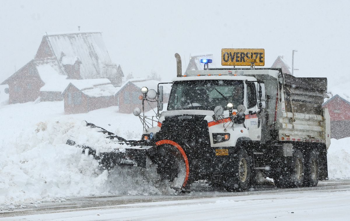
The North Dakota Highway Patrol posted a photo from 8 a.m. Friday showing road conditions on Hwy 20 2 miles south of Devils Lake.
A fall blizzard continued to hammer eastern and central North Dakota late this week and some areas have reported staggering amounts of snowfall.

Snow began accumulating in towns across North Dakota Thursday morning as storm developed over the state. More than 48 hours later, some areas are reporting more than 2 feet of snow.


Cloud Lightning

Was that lightning? Rare thundersnow seen in southern Manitoba

Thundersnow Oct. 11 2019.
© Global NewsThundersnow Oct. 11 2019.
Thunderstorms are common in the prairies, but thundersnow? That doesn't happen very often.

But the rare weather phenomenon has been part of the early blast of winter pummeling southern Manitoba.

Thunderstorm activity associated with a Colorado Low's winter storm began Friday morning close to the American border.

Around the Vita area, thunderstorm activity was observed and radar imagery shows thunderstorms taking place in an area of mixed precipitation or ice pellets and snow as well.

These thunderstorms continued and moved further north.


Comment: Also filmed further south recently in Nebraska:


Ice Cube

Record-setting blizzard set to blast American midwest

Blizzard
© Gizmodo Australia
The American midwest is skipping autumn and heading right to winter to end the week.

A potentially record-setting blizzard is bearing down on the region and could dump snow from Colorado to Minnesota. The Dakotas sit near the epicentre of the storm and could see up to three feet of October snow (yes, you read that right).

Add in gusty winds and you have a recipe for life-threatening conditions. For a region that's already dealt with one freak early season snowstorm, the latest blast of winter is hardly welcome.

Snow has already fallen across parts of the Rockies and Front Range as of Thursday late morning. Multiple accidents and pileups have been reported in the Denver metro area. Highways have been shut down as police struggle to respond amid worsening conditions.

After topping out at 27 degrees Celsius on Thursday, Denver will struggle to reach freezing on Friday. As of mid-afternoon local time, temperatures hovered at just -5 degrees Celsius with a wind chill of -10 degrees Celsius.

The chaos in Colorado is just a preview of what's to come, though. As the storm pushes eastward, frigid air will continue to drop out of Canada and sweep across the Midwest. Along with rapidly dropping temperatures, the storm will usher in winds upwards of 100km/h and heavy snow.

Snowflake

Over a foot of new snow blankets parts of Alaska

Jim Meehan with state DOT/PF plows
© Bill Roth/ADNJim Meehan with state DOT/PF plows the parking lot between Hatcher Pass Lodge and Independence Mine on Wednesday, Oct. 9, 2019. This area has received more than twenty inches of snow in the past week.
A weather system bringing snow to the Susitna Valley created "very difficult driving conditions" north of Talkeetna overnight into Thursday, according to the Alaska Department of Transportation.

A weather spotter at Chulitna reported snow tapering off as of Thursday morning but about 16 inches on the ground, according to the National Weather Service. Another spotter at Hatcher Pass Lodge said that much new snow had fallen near Independence Mine but it was still coming down heavily as of midmorning.

The National Weather Service canceled a winter weather advisory for the Susitna Valley — including the communities of Talkeetna, Willow and Cantwell — that called for 2 to 4 inches more snow and total storm accumulation of 6 to 16 inches with the highest amounts from Chulitna to Broad Pass at Mile 201 of the Parks Highway.


Snowflake Cold

Vancouver, Canada saw coldest day in 122 years

Vancouver fall day
© Shutterstock
The Metro Vancouver weather forecast calls for another chilly night after temperatures broke a weather record that is over 100 years old.

Today's record was set after the city saw an unusually cold yesterday on Wednesday, Oct. 9. In fact, Vancouver hadn't seen an Oct. 9 this cold since 1935 - a whopping 84 years ago. Back then, temperatures dipped to 1.1°C. Prior to that, temperatures dipped to zero degrees in 1916.

Now, Vancouver saw temperatures dip to a freezing -0.7°C on Oct. 10, and temperatures are expected to fall to 1°C or even lower tonight.

Vancouver Is Awesome spoke to Armel Castellan, Meteorologist, Environment Canada, who explained why the temperatures dipped so low, as well as what we can expect in the days to come.

"Vancouver's previous record for Oct. 10 was set in 1916 when temperatures dipped to -0.6°C," reports Castellan. "So we beat it by -0.1 degrees."

While that may not seem like much, Castellan notes that it is very unusual for temperatures to dip into the minuses in the first two weeks of October. He says that this has only happened 19 times in over 100 years. Further, there hasn't been an Oct. 10 this cold on record since the records began in 1897.

Comment: Meanwhile a "potentially historic" fall snowstorm is set to hit a large stretch of the US.