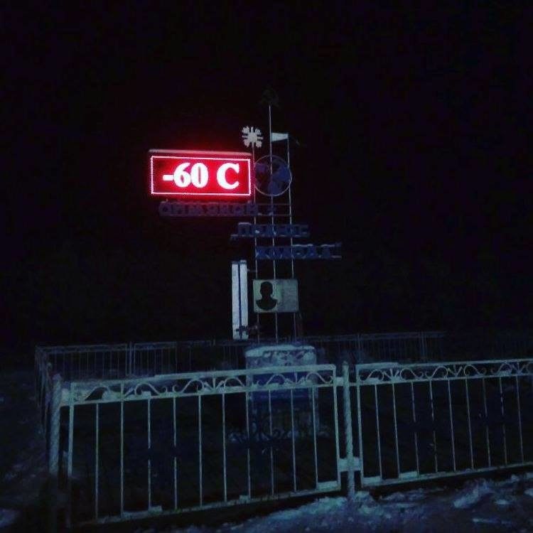
A low temperature of minus 69 degrees [fahrenheit] was recorded early Tuesday in Delyankir, Russia. This is colder than the all-time record lows in every U.S. state except Utah (-69 degrees), Montana (-70 degrees) and Alaska (-80 degrees).
If that wasn't incredible enough, the daytime high in Delyankir Tuesday failed to rise above -60 degrees.
Oymyakon, Russia, plummeted to minus 66 degrees. This region is generally regarded as the coldest inhabited place on the Earth.
The mercury has dipped into the minus 50s or colder eight days in a row in Oymyakon through Wednesday.
Temperatures this extreme are par for the course in this area during the heart of winter, but it's significantly colder than the average November low of close to minus 40.
Current Temperatures
On Feb. 6, 1933, a weather observer in Oymyakon, Russia, measured a temperature of minus 89.8 degrees - a full 10 degrees colder than the U.S.'s record-cold temperature of minus 79.8 degrees at Prospect Creek, Alaska, on Jan. 23, 1971.
Incidentally, the record-coldest temperature measured on Earth was at the Russian South Pole research station of Vostok, Antarctica (minus 128.6 degrees), on July 21, 1983.
According to Weather Underground's Christopher Burt, unofficial temperatures as cold as minus 108 degrees have been measured in Oymyakon. There is also no record of temperatures rising above zero degrees between Dec. 1 and March 1, Burt added.
Even Alaska's coldest interior valleys may only suffer through temperatures in the minus 40s or colder for a week or two before there's a "warmer" break. There's no such luck in a Siberian winter.
Why is it so cold for such an extended period of time in Oymyakon?
- River valley: Cold air is denser and, therefore, settles into the lower elevations at night.
- Surrounded by mountains: Cold air drains down the slopes of the mountains and is trapped in the valley. The mountains form a U-shape, with the open side of the letter "U" pointed north.
- Far northern latitude: At roughly 63 degrees north latitude, there are only about 3 hours of sunshine around the winter solstice.
- Persistent snow cover: While precipitation is generally light in the moisture-starved frigid-cold air mass, what snow does fall stays put, reflecting the sun's limited energy.
A weather pattern change a week to 10 days from now could cause some air from near the Arctic Circle to spill into the central and eastern U.S.
A southward dip in the jet stream sandwiched between two northward jet stream bulges may allow colder air to dive south across the central and eastern states as we approach the second weekend in December.
While the air mass won't be anywhere near as cold as Siberia is currently experiencing, it will certainly feel much more like winter east of the Rockies as we approach the second weekend of December.
Comment: All over the world we are seeing a disruption to the seasonal weather patterns, such as earlier and more intense winters:
- Snow expected in France as polar air heads south on first official day of winter
- Early snowfall leaves 12 foot snow base on mountains in Alaska (VIDEO)
- First snow of winter hits Ben Nevis, Scotland; less than 2 weeks after summer ends
- Mauna Kea in Hawaii covered with up to 8 inches of unseasonal snow
- Arctic sea ice advances further each year, and this years growth is faster than expected
- Northern Hemisphere sets new, all-time record cold temperature: -96.1°F In Oymyakon Siberia !! (2013)


Reader Comments
to our Newsletter