Wildfires
S


Fire

California wildfires triggers evacuation orders for Malibu, Ventura counties

Malibu Wildfire
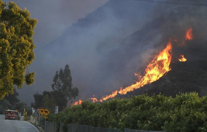
© Associated Press/Marcio Jose SanchezA wildfire comes down from a hilltop Thursday, Nov. 8, 2018, near Newbury Park, Calif. The Ventura County Fire Department has ordered evacuation of some communities in the path of the fire, which erupted a few miles from the site of Wednesday night's deadly mass shooting at a Thousand Oaks bar.
The Latest on Southern California wildfires (all times local):

7:25 a.m.

A raging Southern California wildfire has triggered a mandatory evacuation order for the entire beachside city of Malibu.

The fire broke out Thursday northwest of Los Angeles and roared southward, jumping the U.S. 101 freeway early Friday and sweeping into the Santa Monica Mountains.

Malibu has about 13,000 residents and lies along 21 miles (34 kilometers) of coast at the southern foot of the mountain range.

The Los Angeles County Fire Department tweets that the fire is headed to the ocean, punctuating the message with the declaration: "Imminent threat!"

Fire

Tens of thousands of Butte County residents flee fast-moving wildfire in northern California

wildfire butte county california
© ABC7's / Laura AnthonyAll of Paradise, a town of about 27,000 people 180 miles (290 kilometers) northeast of San Francisco, was ordered to evacuate
The Camp Fire burning in Butte County has torched at least 8,000 acres.Authorities in Northern California have ordered mandatory evacuations in a rural area where a wildfire has grown to 5,000 acres amid hot and windy weather.

Tens of thousands of people were ordered to evacuate a fast-moving wildfire that exploded in size Thursday, threatening several Northern California communities and forcing panicked residents to race to help neighbors who had to drive through walls of flames to escape.

The Camp Fire burning in Butte County has torched at least 8,000 acres as of Thursday afternoon, according to Cal Fire. It was not immediately known if there were injuries or fatalities.

"It's a very dangerous and very serious situation," Butte County Sheriff Kory Honea told The Associated Press. "I'm driving through fire as we speak. We're doing everything we can to get people out of the affected areas."


Fire

Wildfire kills at least seven people in South Africa

fire
At least seven people have been killed in a raging fire along South Africa's popular Garden Route in the Western Cape province, officials say.

A pregnant woman, two toddlers, and a baby are among the fatalities.

"The fire remains active on the slopes," Lauren Howard from Working on Fire said about their operation in the mountainous suburb.

The Garden Route is a 300km (185 mile) scenic stretch of road popular with tourists.

It is not clear whether any foreign nationals have been affected by the fires.

George city officials say at least 200 residents have been moved to a hall and that three suburbs, housing more than 1,500 people, have been evacuated as a precaution.


Bizarro Earth

Moving to higher ground: Flooding along the US' coastal areas is fueling a mass migration inland

climate migrants

Comment: The following article is awash in global warming hysteria and its predicted catastrophes. Just remember when reading this that although sea levels have been slightly rising, that trend may be reversing. Ice is now growing at both poles (except for areas such as West Antarctica, where undersea volcanoes are providing a heat source) and scientists have noted that the earth is undergoing a major cooling event; many are warning that we are facing an impending ice age. Yes, coastal areas are flooding (and so are other areas). These 'once in a lifetime' floods that are becoming increasingly common along with other extreme weather patterns have nothing to do with rising CO2 levels or man-made global warming, but are part of a natural cyclical pattern. For a much more comprehensive explanation of these changes, read Earth Changes and the Human-Cosmic Connection - a review can be found here.


After her house flooded for the third year in a row, Elizabeth Boineau was ready to flee. She packed her possessions into dozens of boxes, tried not to think of the mold and mildew-covered furniture and retreated to a second-floor condo that should be beyond the reach of pounding rains and swelling seas.

Boineau is leaving behind a handsome, early 20th-century house in Charleston, South Carolina, the shutters painted in the city's eponymous shade of deep green. Last year, after Hurricane Irma introduced 8in of water into a home Boineau was still patching up from the last flood, local authorities agreed this historic slice of Charleston could be torn down.

"I was sloshing through the water with my puppy dog, debris was everywhere," she said. "I feel completely sunken. It would cost me around $500,000 to raise the house, demolish the first floor. I'm going to rent a place instead, on higher ground."

Millions of Americans will confront similarly hard choices as climate change conjures up brutal storms, flooding rains, receding coastlines and punishing heat. Many are already opting to shift to less perilous areas of the same city, or to havens in other states. Whole towns from Alaska to Louisiana are looking to relocate, in their entirety, to safer ground.
Comment: People might want to consider moving away from low-lying coastal areas due to the threat of extreme storms, but as mentioned above there is no evidence to suggest that 'global warming' is behind these weather patterns. Extremes of both heat and cold have been witnessed and are all part of a natural process that cannot be halted by ludicrous schemes to reduce greenhouse gasses.


Fire

Video shows fire tornado in British Columbia, Canada

BC fire tornado
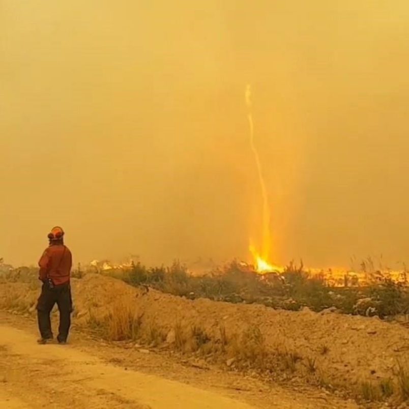
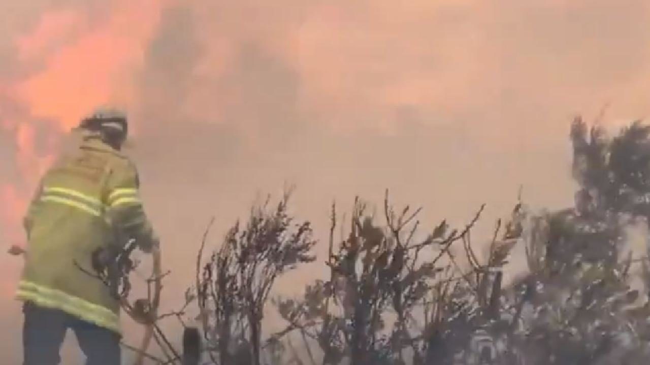
© THE CANADIAN PRESS/HO-Instagram-Mary SchidlowskyBC Wildfire Service crews encounter a "fire whirl" while fighting a wildfire near Vanderhoof, B.C. on Aug. 19.
For some B.C. residents it may seem like the wildfire season is over for this year, but fire crews are still battling blazes across the province.

Video captured and posted to social media shows firefighters dealing with a huge blaze near Vanderhoof on Aug. 19, including a fire whirl or fire tornado.

The firefighters were battling the Chutanli Lake wildfire, currently estimated at 20,813 hectares. It is now 95 per cent contained.

The video, posted on Instagram, was shot by a wildland firefighter, who is part of the Mackenzie Unit Crew.

"Fire tornado destroyed our line," she writes. "It threw burning logs across our guard for 45 minutes and pulled our hose 100-plus [feet] in the air before melting it. That's definitely a first."

In the video, a firefighter can be seen grabbing their hose, which is being pulled high into the air by the fire. A second firefighter rushes in to help.


Comment: Also in British Columbia, Canada this week, according to reports and footage sent to Environment Canada, there is a possibility that an extremely rare tornado formed near Hayward Lake in Lower Mainland, B.C. on September 16. If confirmed, this will be the 5th tornado in British Columbia over the past 15 years.

An increasing number of waterspouts, 'firenados' and dust-devils also made their appearance around the world this August. Once a rare phenomenon, waterspouts are increasingly common these days in some areas. At the same time, vortexes of water, fire and dust are appearing in very unusual places.
SOTT Earth Changes Summary - August 2018: Extreme Weather, Planetary Upheaval, Meteor Fireballs


Fire

2018 now worst fire season on record for British Columbia as state of emergency extended

More of B.C. has burned in wildfires in 2018 than any year on record.
© CONAFOR/TwitterMore of B.C. has burned in wildfires in 2018 than any year on record.
Close to 13,000 sq km of province has burned, breaking record set in 2017

The B.C. government has extended the provincial state of emergency because of wildfires that have now burned more area than any other season on record.

As of Tuesday, more than 12,984 square kilometres of the province had burned, pushing past the previous record set just one year earlier.

As 534 fires continued to burn on Wednesday morning, the province announced that it has extended the state of emergency through to the end of the day on Sept. 12. About 3,200 people have been removed because of the wildfires, and another 21,800 are on alert.

Fire

NOAA interactive map shows almost two million acres of land is on fire across the United States

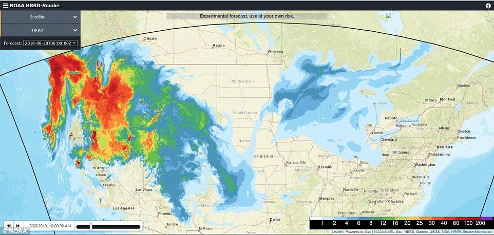
The experimental map created by the NOAA shows the current movement of the smoke across the U.S. This map (10am EDT on August 20, 2018) comes from NOAA and is an experimental model showing both upper level on near-surface smoke.
The full extent of the wildfires ravaging the West Coast of the US has been revealed.

An experimental map created by the NOAA shows the current movement of the smoke across the U.S.

The West Coast of the United States is shrouded in smoke from the 110 large fires (this does not include smaller fires within each complex of fires) that have erupted across the region during this fire season.

Over 1.9 million acres are or have been ablaze, and smoke from these fires have traveled along the west to east jet stream and are bringing that smoke across the country as far as the East Coast,' NASA said.

Fire

800 bushfires reported burning across Queensland, Australia

bushfire
Firecrews are continuing to battle a bushfire at North Deep Creek north of Gympie.

Earlier residents were told to get ready to leave their homes, but the bushfire warning level has since been downgraded to advice.

Queensland Fire and Emergency Services are reminding people to keep up-to-date with the latest information and decide what actions to take if the situation changes

About 6.45pm Monday, the blaze was burning close to Young Rd and Gardener Rd and travelling in an easterly direction from Young Rd.


Fire

Smoke from British Columbia's raging wildfires turns day into night

wildfires prince george BC Aug 2018
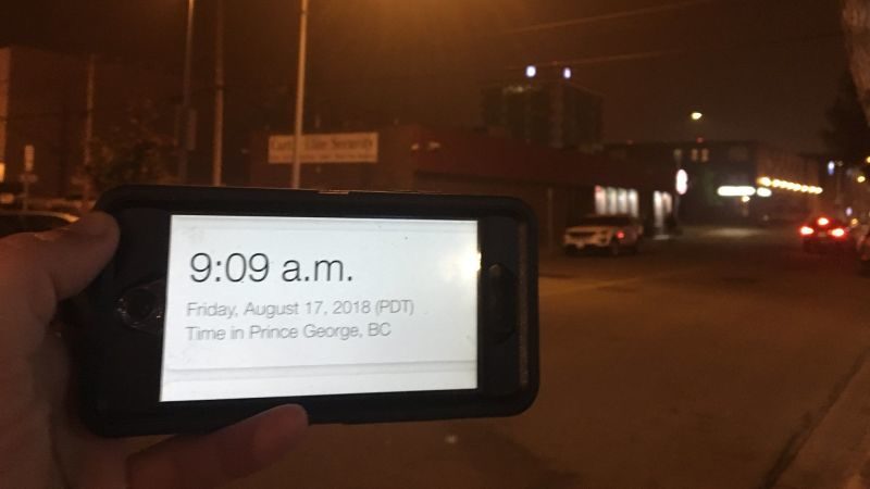
© Richard Zussman (Global News)Freaky orange skies have been the norm as a result of BC's raging wildfires, the smoke became so thick on Friday that it turned the morning sky inky black well after sunrise.
Just when you think this wildfire season can't get worse, something new comes along to remind you this year is truly one of rare horrors.

Residents of Prince George, British Columbia-a small city 325 miles north of Vancouver-awoke to a sky seemingly devoid of sunlight. The city sits just to the east of British Columbia's raging wildfires, which have sent smoke all the way across the Atlantic. To get there, the smoke has to pass over Prince George. Freaky orange skies have been the norm as a result, but the smoke became so thick on Friday that it turned the morning sky inky black well after sunrise.

Residents turned their headlights on for the morning commute as the halogen glow of streetlights continued to illuminate the road. Even for a town that has been blanketed in smoke for more than a week, the scene was a first of its kind. In my years of covering climate change and the wildfires that accompany it, I can't recall seeing anything quite like it myself.

Fire

Video shows gigantic fire tornado that killed firefighter in Redding, California

wildfire
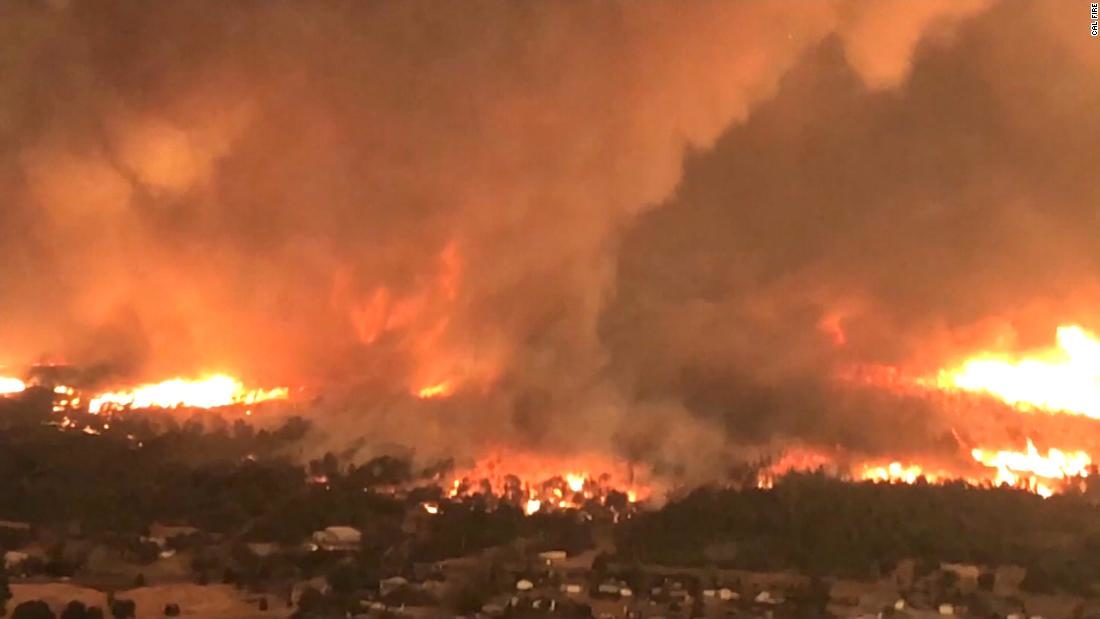
Recently released video from Cal Fire shows the most intense tornado ever in California history that trapped and killed a firefighter in Redding last month.

37-year-old Jeremiah "Jeremy" Stoke was a longtime Redding Fire Department veteran. According to Cal fire, on July 26th, he was driving his truck in northwest Redding and helping evacuate residents from the Carr Fire when he got into trouble.

Stoke radioed out a mayday call, saying he was getting burned over. Then his transmissions abruptly stopped.

The fire tornado exploded in the middle of what was already a gigantic and devastating wildfire.