Extreme Temperatures
S


Snowflake

Heavy snow, strong winds to blow across North East coast, U.S.

snow
© Postmedia News files
Boston - Heavy snow and strong winds may blow across the Northeastern coast Sunday and drop as much as 10 inches on parts of the region still buried by last week's storm.

A winter storm warning is in effect for the Boston area, where the National Weather Service said 4 to 8 inches of snow could fall by Sunday night. Snow up to 8 inches also is forecast for Cape Cod, Martha's Vineyard and Nantucket.

Strong winds are expected to accompany the snow, gusting up to 55 mph. The weather service said that by evening, temperatures with the wind chill could feel like minus 1.

Early Sunday, New York officials issued a high-wind warning for the Tappan Zee Bridge, reducing the speed limit to 35 mph and prohibiting empty trailers and motorcycles on the bridge. All trucks, trailers, and buses were advised to consider an alternate route.

Snowflake

Pyrenees ski resorts top world snow charts with over 7 meters (23 feet) of snowfall in one month

Image
Cauterets in Hautes-Pyrenees, where ski lifts are almost buried under snow.
Road and lift closures. Evacuations and residents confined to their homes. The storms that have brought over 7 meters of snow to the Pyrenees since the New Year don't seem to be putting a smile on ski resort director's faces. Quite the opposite in fact. Some are asking if they were not better off with last season's snow drought. Yesterday at Mourtis, a resort where skiers are more familiar with grass and mud, the piste bashers were running non-stop and the upper lifts have barely opened all week. The diesel bill is eye-watering.

Noël Lacaze, director at Peyragudes, says that avalanche control work has been non-stop. "We've already used 900 kg of explosives, we've never done that before, that's between 15,000 to 20,000 euros alone". Add to that overtime plus the work clearing roofs and roads as well as additional heating costs and Lacuze thinks snowmaking might be cheaper than dealing with the effects of too much snow. Last season at Barèges there were less than 10 PIDAs organized (general avalanche control days), this season they are already approaching 20. Bernard Malus, director of le Grand Tormalet (Barèges-la Mongie-pic du Midi) says that in recent season they've invested heavily in snow making not avalanche control infrastructure. "This winter has taught us we've got to put money into remote avalanche control systems, a more performant Gazex network, it will cost around 3 million euros". Lacaze says that the investment in advanced ski lifts over recent years in the Pyrenees has had an effect "chair lifts are not more fragile but the depart and arrival areas are more complex to clear and secure, with drag lifts things were easier".

Snowflake

Time lapse video of the 2013 Snowpocalypse in the Northeast

This is fun to watch. It is a time lapse video of the Snowpocalypse in Hartford, CT. Clearly, you can see the posited global warming influences having an effect. /sarcasm


Snowflake

U.S. Northeast digs out from blizzard; new storm brews in Plains

time square snow clearing
© REUTERS/Eric ThayerWorkers clear snow at Times Square in New York, February 9, 2013. A blizzard pummeled the Northeastern United States, killing at least one person, leaving hundreds of thousands without power and disrupting thousands of flights, media and officials said.
The U.S. Northeast started digging itself out on Sunday after a blizzard dumped up to 40 inches (1 meter) of snow with hurricane force winds, killing at least nine people and leaving hundreds of thousands without power.

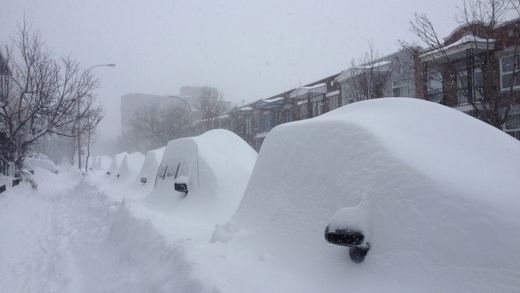
New York City trucks plowed through residential streets, leaving hundreds, if not thousands, of motorists to dig their buried vehicles out from mountains of snow.

"I give up," Giovanni Marchenna, 52, of Manhattan said with a laugh.

"Looks like I'll be taking the subway to work until the snow melts," he added, noting he spent more than an hour shoveling snow.

Utility companies reported that some 350,000 customers were still without electricity across nine states after the wet, heavy snow brought down tree branches and power lines. About 700,000 homes and businesses were without power at one point on Saturday.

Air traffic began to return to normal on Sunday after some 5,800 flights were canceled on Friday and Saturday, according to Flightaware, a flight tracking service.

Bradley International Airport in Windsor Locks, Connecticut, and New York state's Long Island MacArthur Airport reopened on Sunday morning. Both had been closed on Saturday.

Snowflake

Blizzard hammers U.S. Northeast, five dead, 700,000 lose power

Blizzard
© Reuters/Carlo AllegriPeople arrive with their children and toboggans to a snowy Central Park in New York February 9, 2013. A blizzard packing hurricane-force winds pummeled the northeastern United States on Saturday, killing at least one person, leaving about 600,000 customers without power and disrupting thousands of flights.
A record-breaking blizzard packing hurricane-force winds hammered the northeastern United States on Saturday, cutting power to 700,000 homes and businesses, shutting down travel and leaving at least five people dead.

The mammoth storm that stretched from the Great Lakes to the Atlantic dumped more than 3 feet of snow across the Northeast, the National Weather Service said.

Coastal blizzard and flood warnings were in effect, but Massachusetts and Connecticut lifted vehicle travel bans as the storm slowly moved eastward on Saturday afternoon.

Stratford, Connecticut, Mayor John Harkins said he had never seen such a heavy snowfall, with rates reaching 6 inches an hour.

"Even the plows are getting stuck," Harkins told local WTNH television.

The storm centered its fury on Connecticut, Rhode Island and Massachusetts, with the highest snowfall total, 38 inches, in Milford, Connecticut.

Snowflake

Power out for thousands, evacuations expected as blizzard's impact begins to be felt

Image
A National Weather Service map showing projected snowfall totals from the blizzard.
A potentially historic blizzard swept into Massachusetts today and is expected to dump more than 2 feet of snow, whip winds up to 70 miles per hour, and batter the coast with giant waves.

Roads are emptying out now as drivers heed an order issued by Governor Deval Patrick that all vehicles be parked by 4 p.m. Sideways-blowing snow is adding to the falling darkness.

More than 5,000 power outages have already been reported as winds down tree limbs and wires.

In Marshfield, officials said they expected to ask shorefront residents to evacuate themselves because of concerns about storm-driven tides tonight and Saturday morning.

Igloo

Heaviest snowfall in many years hits Polish-Slovakian border

Due to heavy snowfall a state of emergency was imposed in 20 towns at the Polish-Slovakian Border, near to Orava. Last night it was seen 75 cm of snow!

More than 1200 residents of the region were left without electricity after heavy snowfall knocked out power lines and substations.

I've never seen such big flakes of snow. They are as big as the coin two euros. Within 24 hours as much snow fell as usual throughout the winter. Snow cover in some places more than five feet, the governor said.

Plows can not keep up with snow removal routes.

Source: WP.PL (In Polish)

Cloud Precipitation

Major snowstorm in Ontario causes flight cancellations, school closings

snowstorm toronto
© Chris Young /The Globe and MailA woman walks down a residential street as snow falls in Toronto on Friday, February 8, 2013.
The worst of a winter storm into southern Ontario landed during morning rush hour, covering the region in a white shroud of snow flurries and sleet, forcing schools to close and disrupting land and air traffic. (For a list of school closures, transit delays and flight information,click here.)

Other vehicles were reported to be stuck in snowbanks, in ditches or blocking lanes after spinning out of control. At the Bayview entrance of the southbound Don Valley Parkway, cars had trouble negotiating the icy in-ramp. The DVP's Bayview off-ramp was reported to be closed because of slippery conditions. On Highway 401, the eastbound collector off-ramp at Allen Road was also closed because of the road conditions.

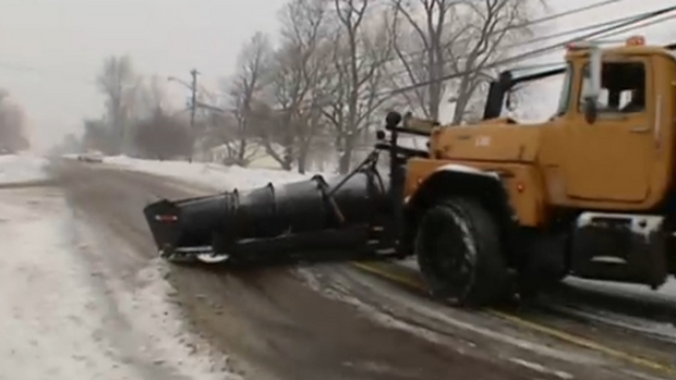
On the Queen Elizabeth Way, near Fort Erie, a snowplow fell into a ditch and, a few kilometres further north, a salter truck had rolled.

More than 150 highway car collisions had been reported, said Ontario Provincial Police Sergeant Dave Woodford.

There were only minor injuries, mostly from fender benders, he said.

Snowflake

NASA's satellite view of massive Nor'easter - frontal system stretching from Canada through the Ohio and Tennessee valleys, into the Gulf of Mexico

A massive winter storm is coming together as two low pressure systems are merging over the U.S. East Coast. A satellite image from NOAA's GOES-13 satellite on Feb. 8 shows a western frontal system approaching the coastal low pressure area.

Image
© NASA
The satellite image, captured at 9:01 a.m. EST, shows clouds associated with the western frontal system stretching from Canada through the Ohio and Tennessee valleys, into the Gulf of Mexico. The comma-shaped low pressure system located over the Atlantic, east of Virginia, is forecast to merge with the front and create a powerful nor'easter. The National Weather Service expects the merged storm to move northeast and drop between two to three feet of snow in parts of New England.

Snowflake Cold

Southern Ontario braces for biggest snowstorm in years

Image
© CBC News
The Friday morning commute is looking to be an ugly one for Southern Ontario as the Alberta Clipper swinging through the area today is amplified by moisture from another storm system moving up from the United States.

"It might be the biggest storm since 2011," said Rob Khun, a severe weather meteorologist with Environment Canada, referring to the March 2011 storm that dumped 12.5 cm of snow on the GTA.

Snow from the storm system has begun to fall in southwestern Ontario this morning as the Alberta Clipper tracks through the area, and it should arrive in the GTA by this afternoon. This will leave about 2 cm of accumulation on the ground, however the added moisture arriving from the south this evening will turn this to heavy snowfall overnight and into Friday morning.

Total accumulations for southern Ontario are expected to be between 15 and 25 cm of snow, and strong winds will add blowing snow to the mix, making for hazardous driving conditions tonight, through the Friday morning commute, and possibly into tomorrow afternoon as well.

Eastern Ontario is expected to be even harder hit, as snowfall accumulations already forecast to be up to 25 cm from the Alberta Clipper are pushed up to 35 cm or higher by the approaching storm from the south and local amplification due to winds blowing in off of Lake Ontario.

Environment Canada has issued Snowfall Warnings from London-Essex to Kingston-Prince Edward regions, and from Niagara region up into Grey-Bruce along the shores of Lake Huron and Georgian Bay.