Earthquakes
S


Seismograph

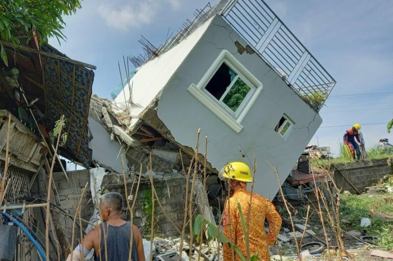
At least 4 dead, 60 hurt as shallow magnitude 7 earthquake hits northern Philippines

A handout photo made available by the Bureau
© Bureau of Fire Protection (BFP)/EPAA handout photo made available by the Bureau of Fire Protection (BFP) shows a collapsed building following an earthquake that Abra province in the Philippines main island of Luzon
Shallow quake was measured at above 7 magnitude and collapsed buildings near the epicentre in northern Abra province.

At least four people have died and 60 others were injured by a powerful earthquake in the northern Philippines, the country's interior minister has said.

The 8:43am (00:43 GMT) quake on Wednesday struck the mountainous and lightly populated province of Abra on Luzon, the country's main and most populous island, causing small landslides and collapsing some houses. The tremors caused high-rise towers to shake more than 400km (249 miles) away in the capital, Manila, which is located on the south of the island.

The earthquake was measured at a preliminary magnitude of 7.1 by the US Geological Survey (USGS), 7.2 by the European Mediterranean Seismological Centre (EMSC) and 7.3 by the Philippines Institute of Volcanology and Seismology (Phivolcs).

Phivolcs later revised the magnitude down to 7.0. Still, the earthquake was strongest to have hit the Philippines in years.


Fire

This week in volcano news: Tsurumidake alert level raised - Raung gas emissions

volcano
In the last week, the alert level was raised at the Tsurumidake volcano which more than 100,000 people live in close proximity to. Also, the Raung volcano produced an earthquake swarm which was associated with an increase in sulfur dioxide emissions. Clearly, magma is present at depth. And, also in Japan, the Tomachidake volcano is showing signs of unrest. This video will discuss these volcano related news stories, as told and analyzed by a volcanologist.


Seismograph

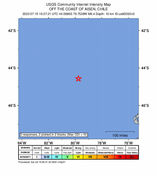
Shallow 6.4-magnitude earthquake hits off the coast of Chile

maps
An earthquake with a magnitude of 6.4 jolted Off the coast of Aisen, Chile at 19:37:21 GMT on Friday, the U.S. Geological Survey said.

The epicenter, with a depth of 10.0 km, was initially determined to be at 44.5696 degrees south latitude and 79.7528 degrees west longitude.

Seismograph

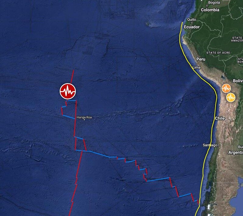
Shallow 6.8 magnitude earthquake in Easter Island region

quake
6.8 magnitude earthquake

UTC time: Tuesday, July 12, 2022 19:17 PM
Your time: Tuesday, July 12, 2022 at 8:17 PM GMT+1
Magnitude Type: mww
USGS page: M 6.8 - Easter Island region
USGS status: Reviewed by a seismologist
Reports from the public: 1 person

10 km depth

Seismograph

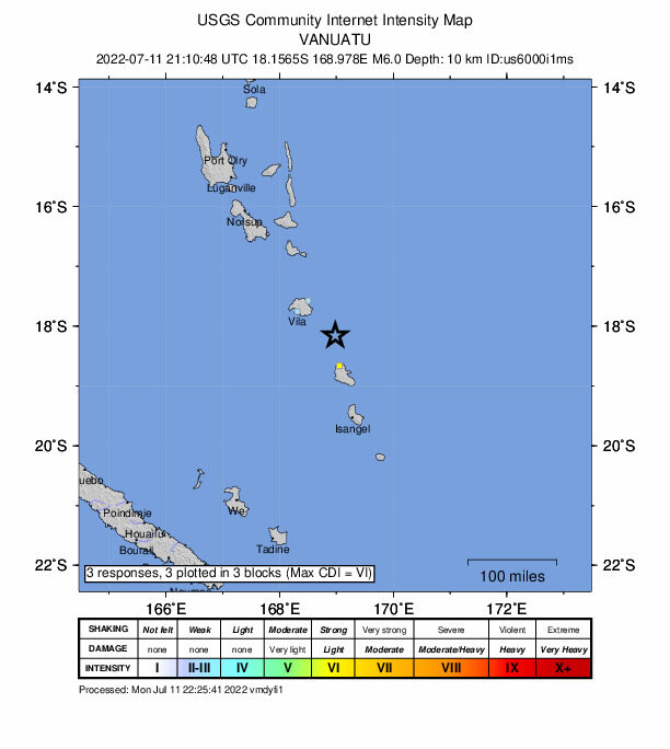
Shallow 6.0 magnitude earthquake off Vanuatu

quake
UTC time: Monday, July 11, 2022 21:10 PM
Your time: Monday, July 11, 2022 at 10:10 PM GMT+1
Magnitude Type: mww
USGS page: M 6.0 - 84 km ESE of Port-Vila, Vanuatu
USGS status: Reviewed by a seismologist
Reports from the public: 3 people

10 km depth

Fire

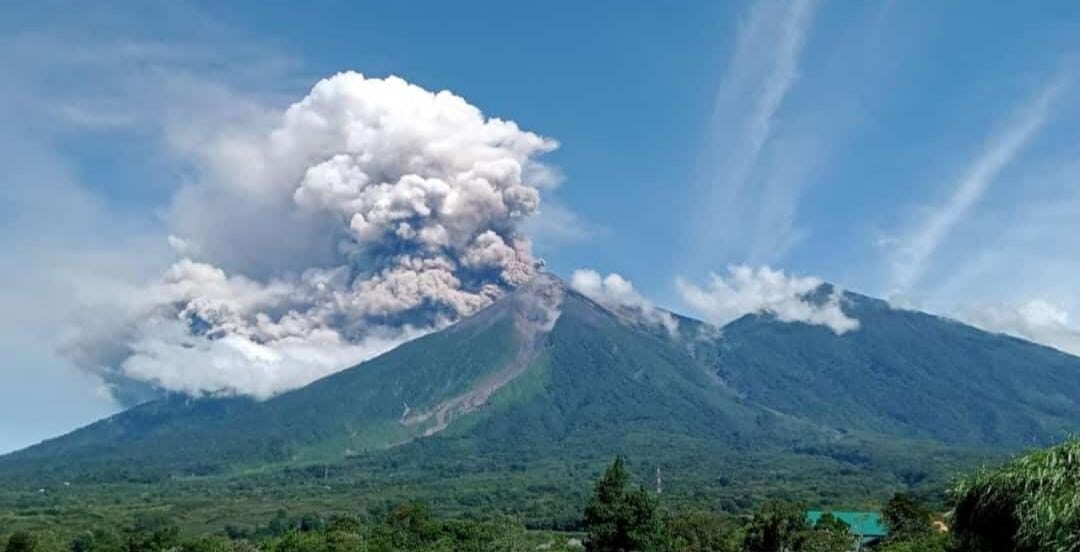
This week in volcano news: Fuego erupts, warning on Kanlaon

Volcán de Fuego, Guatemala
This week there were several major news stories related to volcanoes. In Guatemala, Volcan Fuego produced a long duration pyroclastic flow which travelled 6 kilometers away from its summit. It stopped only a short distance from a local town.

Meanwhile, in the Philippines, the Phivolcs disaster agency released a special warning regarding the Kanlaon volcano. And, in Alaska, two volcanoes which have each not erupted in about a century produced a several thousand foot tall plume of ash.

This video will discuss these volcano related news stories, as told and analyzed by a volcanologist.


Seismograph

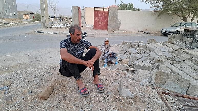
At least five people killed in magnitude 6 earthquake in Iran

People sit by the rubble amidst destruction in the aftermath of a 6.0 magnitude earthquake in Iran's southern Hormozgan province on 2 July.
© AFPPeople sit by the rubble amidst destruction in the aftermath of a 6.0 magnitude earthquake in Iran's southern Hormozgan province on 2 July.
At least five people were killed and dozens more injured in a shallow magnitude 6 earthquake that shook southern Iran early Saturday, according to an initial report by the state news agency Irna.

According to state television, 49 people were injured in three successive earthquakes that shook the southern province of Hormozgan, including the worst-hit village of Sayeh Khosh.

The first earthquake occurred at about 02:00 local time (21:30 GMT) with a magnitude of 6 at a depth of 16 km, according to the US Seismological Institute (USGS).

It was followed by two other aftershocks, two hours later, with a magnitude of 5.7 and 6, at a depth of 10 km.

According to television footage, several residential buildings collapsed in Sayeh Khosh and the town was plunged into darkness following a power failure.


Seismograph

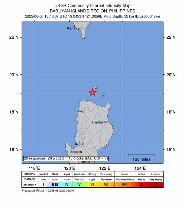
6.0-magnitude earthquake rattles northern Philippines

maps
An earthquake with a magnitude of 6.0 rattled Cagayan province in the northern Philippines before dawn on Friday, the Philippine Institute of Volcanology and Seismology said.

The institute said the quake, which occurred at 2:40 a.m. local time, hit at a depth of 27 km, about 27 km southeast of Dalupiri Island in Calayan town.

The tremor was also felt in nearby provinces, including Apayao and Ilocos Sur on the main Luzon island. The institute said the tectonic quake will trigger aftershocks but can not cause damage.

The Philippines has frequent seismic activity due to its location along the Pacific "Ring of Fire." (ANI/Xinhua)

Fire

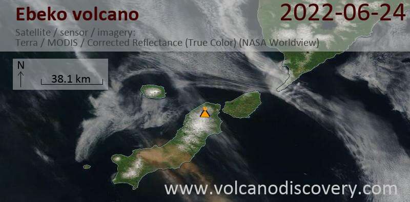
This week in volcano news: Supervolcano earthquake swarm - Ebeko erupts

Ebeko
In the last week, an earthquake swam began underneath the dangerous Long Valley supervolcano in California. In less than a week more than 400 quakes occurred at shallow depths. Meanwhile in Vanuatu, the Ambrym volcano is showing signs of unrest and is likely to produce a significant flank eruption in the near future. And, in the Kuril Islands, two volcanoes began new eruptions on the island of Paramushir. This video will discuss these volcano related news stories, as told and analyzed by a volcanologist.


Info

Serious issues with plate tectonics

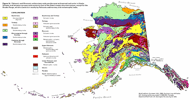
Geological map of Alaska showing various exotic terranes.
© USGSGeological map of Alaska showing various exotic terranes.
David Pratt's publication in the year 2000 enumerates multiple problems affecting the theory of plate tectonics and seafloor spreading.

The above schematic of Alaska reveals regions of rock strata that appear to have "accreted" to an original craton. Southern Alaska is composed of fragments in all shapes and sizes, each one telling its own tale. They are all "exotic terranes", formed at different places and times. How they were transported to their present location, and why some are rotated with respect to adjoining terranes is a mystery.

Some exotic terranes arrived from regions on the other side of the world, while others are from nearby locations. They are each quite different from one another in their characteristics, representing strata from many so-called "geologic ages". There are deposits from the Quaternary period lying in proximity to those from the Cambrian and Mesozoic periods. Those epochs represent hundreds of millions of years. If the theory of continental movement is correct, then "collisions" between landmasses took place more than a dozen times in Alaska. However, each terrane is not arranged side-by-side with its neighbor, they are intermixed with each other, as the schematic reveals.

Another puzzling aspect to the terrane lithography is that some of it is oceanic crust, while some is continental. Some terranes appear to be from volcanic islands. Others appear to be the remains of continental shelves from South America. Less than one percent of Alaska is thought to be from the "original" North American continent.

In the Journal of Scientific Exploration, Vol. 14, No. 3, pages 307-352, David Pratt took issue with the theory of tectonic displacement of continental and ocean floor structure. As he wrote: "The classical model of thin lithospheric plates moving over a global asthenosphere is shown to be implausible."