Earth ChangesS


Cloud Lightning

US: Another deadly outbreak as tornadoes rip through Oklahoma City

Tornado North Dallas
The risk of tornadoes with Joplin between the highest risks through Wednesday.
Tornadoes will continue into tonight across parts of eastern Oklahoma and northern Texas as the deadly outbreak continues. At least 4 people have been killed by tornadoes and many more are missing as the tornadoes ripped through central Oklahoma. The suburbs of Oklahoma city were hit hard by tornadoes that have been estimated to be EF4. Damage from local TV stations show all that is left of homes is the foundations.

Info

Iceland volcano: Air passenger rights

Image
The eruption has led to some disruption with the picture changing regularly
The latest volcanic eruption in Iceland has caused a number of flight cancellations with the threat of further disruption if the ash cloud spreads into the UK and, possibly, other parts of Europe.

So what the rights of those passengers who may be forced to cancel holidays?

Attention

Iceland Ash Cloud Reaches Scandinavia

Image
© Agence France-Presse / Sigurlaug LinnetA cloud of smoke and ash is seen over the Grimsvoetn volcano on Iceland on May 21, 2011.
Ash from Iceland's erupting volcano reached Scandinavia Tuesday causing minor air traffic disruptions in Norway and closing a small part of Denmark's airspace, officials said.

On Tuesday morning, the ash blew in over Norway's southwestern towns of Karmoey and Stavanger before blowing back out to sea, the country's airport operator Avinor said.

In Denmark, a small zone of airspace in the northwest over the North Sea was closed from 0600 to 1200 GMT but has no real impact on air traffic, said Jan Eliassen, a spokesman for Danish air traffic control Naviair.

"According to the last estimates, the ash is of such a density that we thought it necessary to close a small part of Danish airspace over the North Sea, but it will not affect (air) traffic," he said.

The closure was up to an altitude of 6,000 metres (nearly 20,000 feet), and Eliassen explained that most aircraft in the region fly above that altitude.

Info

Ash Cloud Forces Barcelona to Leave Early for Champions League Final

Image
© David Ramos/Getty ImagesAndrés Iniesta and Victor Valdes in training for Barcelona's Champions League final against Manchester United.
Barcelona will travel to London on Tuesday evening because of fears of volcanic ash from Iceland drifting towards England ahead of Saturday's Champions League final.

The Spanish champions were due to head to England on Thursday for this weekend's showpiece at Wembley against Manchester United but have opted to arrive two days ahead of schedule. The club said: "To avoid possible disruption due to ash from the volcano Grimsvotn, the Barça first team will travel to London today at 22:00hrs."

The Barça spokesman, Toni Freixa, will appear at a press conference at Camp Nou at 5pm local time to provide further information to supporters. The eruption of Grimsvotn has led to airlines cancelling flights to and from Irish and Scottish airports.

The Barcelona coach, Pep Guardiola, said on Monday that his team were prepared to alter their travel plans to reach the European final if obliged to do so. Guardiola spoke of his concerns over disruption that could be caused to the fans - many of whom will travel on the day of the match - and promised the Catalan club would take every precaution.

Cloud Lightning

US: 29,000 without power after storm slams southeast Michigan

Image
© David Guralnick / The Detroit NewsTom Micoli checks out a maple tree downed Monday by a storm on Burnside in Detroit. The harsh weather snapped tree limbs and knocked down wires around the Metro area, leaving thousands without power.
The severe weather that knocked out power to thousands, toppled tree limbs and felled power lines may have fizzled out Monday night, but that doesn't mean Metro Detroit is done with wet weather through the start of the holiday weekend.

"It looks like it's going to continue to be rainy for this week," said Amos Dodson, a meteorologist for the National Weather Service.

NWS said there's a 30 percent chance of showers today, with highs in the 60s and lows in the 40s. Another system brings showers and thunderstorms Wednesday, and rain is also in the forecast through Friday

Cloud Lightning

US: In Minneapolis, storm toll quietly rises

Joplin, Mo., continues to dig out from the massive tornado that blasted the city Sunday, but it wasn't the only city hit hard that day. Minneapolis-based Finance and Commerce reports that officials there are dealing with a "very preliminary" estimate of $166 million in damage to homes, buildings and infrastructure.


Info

US: Heavy Rains Cause Major Flooding Across Northeast Oklahoma


Heavy rains have caused major flooding in many locations across Northeast Oklahoma.

Nearly ten inches of rain have fallen near Vinita. That's where SkyNews6 found three men rescuing a woman in a stranded vehicle. The video shows one man breaking a window to help get the woman out. The men then helped her wade through the water to safety.

News On 6 reporter Ashli Sims captured video of flooding along I-44 southwest of Miami. Flooding forced Miami Public Schools to cancel classes Tuesday.

Rising waters also caused problems in Muskogee. The Muskogee Police Department told News On 6 officers performed several vehicle rescues Monday evening.

Cherokee County Emergency Management said it had also received reports of significant flooding. Officials there said at least three water rescues were performed Monday, but no one was injured. Power lines and trees are down across Cherokee County.

Cloud Lightning

Philippines: Update Chedeng picks up strength as it nears land; storm warnings up

Image
© Graphics from http://www.pagasa.dost.gov.phPAGASA-DOST MTSAT-EIR Satellite Image for 5 a.m., 25 May 2011
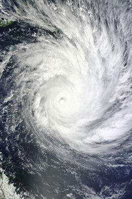
Tropical Storm Chedeng continued to bear down on the Philippines with greater force Tuesday, compelling the weather bureau to issue warnings in seven provinces in the Bicol and Eastern Visayas regions that were already beginning to feel the effects of the country's third cyclone this year.

As of 10 a.m. Tuesday, the Philippine Atmospheric, Geophysical, and Astronomical Services Administration (Pagasa) said, Chedeng was located 490 kilometers east of Borongan, Eastern Samar, with maximum sustained winds of 105 kilometers per hour near the center and gusting up to 135 kph.

Umbrella

US: Flooding grows near Brownville; rain begins in west

Image
Umbrellas were the order of the day for Nebraskans from west to east Tuesday, with heavy rain predicted across much of the state. Some storms could also turn severe, with large hail possible and some isolated tornadoes in far southeast Nebraska, the National Weather Service said.

Already Tuesday morning, 1.25 inches of rain had fallen in Red Cloud near the Kansas border. And overnight rains added as much as 2 inches of rain to already soggy soil in southwest and west-central Nebraska.

Rain totals included: Imperial, 2.04 inches; Wauneta, 1.94; Wellfleet, 1.17; Hayes Center, 1.09; Curtis, 0.97; Moorefield, 0.92; Swan Lake, 0.75; Oshkosh, 0.73; North Platte, 0.71.

The North Platte area is under a flood warning and flash flood watch, bracing for 2-4 more inches of rain. The North Platte River is already at a record level, with overflows expected to increase at least through Friday.

Cloud Lightning

US: Climatologist warns of potential floods

A rogue jet stream is responsible for causing severe weather since the fall - including Sunday's devastating tornado in Joplin, Mo. - and could trigger severe flooding in the West, a JPL climatologist warned Monday.

Bill Patzert of the NASA's Jet Propulsion Laboratory in La Ca ada Flintridge said he is "extremely anxious" about the possibility of floods that could arrive in late spring and early summer in the West.

"Especially on the Sacramento and San Joaquin rivers" and the upper Colorado River, he said.