Earth ChangesS

Bad Guys

Floods at China Mines Trap '40'

Image
© BBC
Rescuers in southern China are trying to reach more than 40 workers in two coal mines after one pit was flooded and the other caved in.

They are venting explosive gas and pumping water from a mine in Guangxi region, where three miners died.

Flooding has continued to hamper rescue work at the other mine in the neighbouring province of Guizhou.

China's mines are the world's deadliest; more than 2,600 miners died in accidents in 2009 alone.

Heavy rain was said to have caused the latest accidents.

Cloud Lightning

Minnesota, US: National Weather Service: Tornado, Downburst Hit St. Cloud Metro

Image
© Jodie PecheSkies over Whitney Park in north St. Cloud.
The National Weather Service says it was a weak tornado in Waite Park and a downburst north of Downtown St. Cloud Friday night that did much of the damage in the St. Cloud area.

According to the NWS, a tornado touched down just north of the Interstate 94 and Highway 23 intersection, moved northeast at around 65 mph and dissipated in Waite Park, some 2.3 miles later. The NWS says the tornado was as big as 30 yards wide as it broke or toppled trees in its path, touching down in five distinct locations along its path. All of this happened from around 6:23 to 6:26 p.m. Friday.

Meanwhile, downburst winds of 65 to 70 miles an hour hit north of downtown St. Cloud, toppling hundreds of trees which landed on houses, sheds and vehicles.

The NWS says the damage from the downburst was far more widespread and significant than from the tornado.

Alarm Clock

Minnesota, US: Weather Service Confirms Tornado Touchdown in Douglas County

Image
© Jed CarlsonPeople work to clean up debris Saturday afternoon at a home off Ramel Road in Solon Springs. The mobile home had been moved off its foundation and many trees and items outside where uprooted and overturned in the storm on Friday evening.
The National Weather Service in Duluth confirmed late Saturday that a tornado touched down near Solon Springs during the severe storms that moved across the region Friday night.

According to a preliminary survey report, the most significant damage observed by the Weather Service survey team was EF2 on the 0-5 Enhanced Fujita scale, with peak winds estimated at 120 to 130 mph.

The path of the tornado was estimated at 2.9 miles, with a width of 300 yards, stretching from 3.6 miles southwest of Solon Springs to 1.3 miles west of Solon Springs. The tornado was on the ground for about three minutes, from 7:51 p.m. to 7:54 p.m. There were a few injuries from the tornado, but no fatalities.

The Weather Service reported that the tornado shifted a manufactured home off its foundation and rotated it about 30 degrees from its original orientation, and then destroyed a wood-frame home along Ramel Road. Some debris from the second home was found 1/3 of a mile away.

Alarm Clock

North Dakota, US: Deluge Puts Flood Control in Spotlight

Army Corps of Engineers Faces Criticism After Record Inundation Along Missouri River; Reservoir System Under Strain

Riverdale - The U.S. Army Corps of Engineers opened Garrison Dam more than 56 years ago - the two-and-a-half mile-wide centerpiece of a plan to tame the mighty Missouri River.

This year's record flooding, which forced the Corps for the first time to open the dam's colossal emergency spillway and launch a months-long flood fight stretching over 1,700 of the river's 2,300 miles, has many people questioning whether the Corps remains in control of the river.

"We've had highs and lows in the past, but we've never had the highs like we've got with the flooding now," said Terry Focke, 63 years old, a fishing guide in nearby Pick City, N.D., for 20 years. He said his business is off 70% this year because high water has closed every boat ramp within 100 miles.

This year's deluge is also forcing a rethink of decades-old ways of battling floods on the Mississippi, Missouri and other major U.S. rivers.

On the Mississippi, the Corps is looking at a $1 billion-$2 billion repair bill to restore levees, floodways and river-navigation features that faced their biggest test since the current flood-control system was designed in the late 1920s.

Engineers are also assessing whether they need to make changes to the system, such as adding a new floodway - an area set aside for agriculture or other uses that can also be used as a relief valve when flooding is severe.

Cloud Lightning

Colorado, US: Lightning Suspected in Northeast Denver Home Explosion

Image
© Jordan Steffen/The Denver PostThe scene at 4524 Eureka Court in Denver, late Friday morning.
Lightning is suspected in a Thursday night explosion that ignited a devastating fire at a northeast Denver home.

About 11:30 p.m., firefighters were called to 4524 Eureka Court, said Todd Bower, deputy chief of the Denver Fire Department.

Firefighters quickly extinguished the blaze, and none of the three people inside the home was injured.

The cause of the explosion has yet to be determined, but investigators think it may have been the result of lightning striking the attached garage, Bower said.

The bolt of lightning likely caused several propane tanks in the garage to ignite and explode.

On Friday morning, a charred car remained under rubble that was once the garage of the burned home. All that was left of the south side of the home was a skeleton of wood and black ash.

Bizarro Earth

U.S.: Fairfield Township deals with sinkhole

Image
© Scripps Media, Inc.
Fairfield, Ohio - Butler County Road Engineers are trying to deal with a sinkhole that has formed at the intersection of Hamilton-Mason Road and Morris Road in Fairfield Township.

They say a water main break has caused the sinkhole sometime early Saturday. They've placed road closure signs and barricades at the intersection to turn motorists away. Engineers say the intersection will be closed until repairs are made sometime in the next week.

The fire department says the sinkhole has taken a fire hydrant out of service and the hole will have an impact on safety services and convenience to residents in the area.

It's recommended that if you drive through the area that you seek an alternate route.

Radar

US: Small 3.3 Magnitude Earthquake Strikes Southwest of Provo

A small earthquake has hit Utah County, with the 3.3 magnitude temblor striking close to Santaquin.

No damages or injuries have been reported. According to the U.S. Geological Survey, several people in Santaquin immediately reported feeling the quake.

The USGS reports that the quake, which was less than a mile deep, struck at 9:26 p.m. Monday.

The quake was centered 4 miles south-southwest of Santaquin and 23 miles south-southwest of Provo.

Source: The Associated Press

Radar

New Zealand: No Damage From Strong 6.5 Magnitude Quake

Image
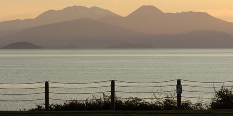
© NZPA/Ross SetfordA 6.5-magnitude quake centered near Lake Taupo is the largest to hit the area in years and was widely felt, but there have been no reports of any damage.
A 6.5 magnitude earthquake west of Taupo this afternoon was felt widely through the North and South islands, but no damage has been reported.

The quake, which struck at 3.36pm, was centred 150km deep, 30km west of Taupo.

The deep rolling earthquake was felt throughout the lower North Island and as far south as Christchurch.

GNS volcanologist Brad Scott said although the earthquake was centred near Taupo it would have been felt more strongly along the East Coast, particularly the Napier through Wellington region, because of its depth.

Today's earthquake was fairly typical movement, he told Radio New Zealand.

"We would typically have maybe two or three events around maybe 5.5 and 6 (magnitude) at about 150-200km depth a year under the North Island. It's slightly larger than average but it's kind of what we really expect."

It would generate some aftershocks "but at that depth and being smaller than the main shock they are very unlikely to be noticed", he said.

Bookshelves swayed but no books were dislodged at Wellington Central Library, while John Key's press secretary, Lesley Hamilton, said the quake was felt strongly on the ninth floor of the Beehive.

Bizarro Earth

The Decline of Agriculture?

Image
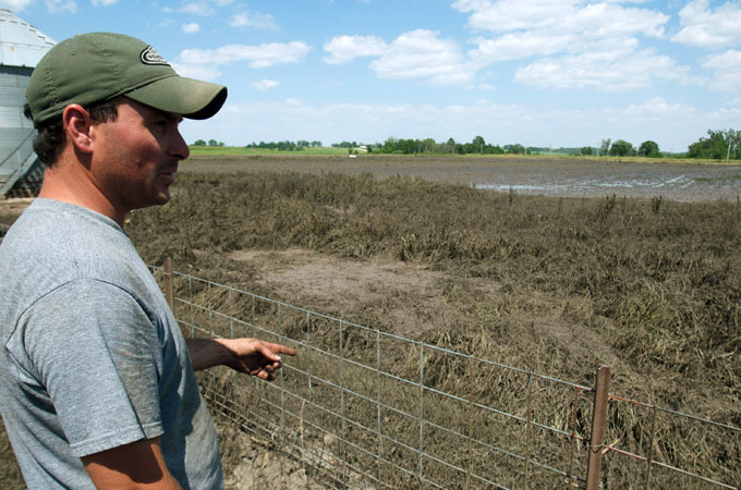
© Gallo / Getty ImagesFlooding ravaged farms in the midwest United States this June, causing many crops to be los
Climate change induced extreme weather events and shifting weather patterns are challenging farmer's ability to feed us.

Wendy Johnston with Oakwyn Farms in Athens, West Virginia, is deeply concerned about how shifting weather patterns are impacting farmers' ability to feed the global population.

"This year we're off to a slow start," Johnston, who farms 40 hectares, told Al Jazeera. "Last year in April we were able to plant, but this year we even had rain, cold and snow a few days in April. The weather has become very unpredictable, and that's the real problem."

Climate change is making farming more difficult for her, and she wonders how much worse things will become.

On March 31, The Food and Agriculture Organisation (FAO) warned of "potentially catastrophic" impacts on food production from slow-onset climate changes that are expected to increasingly hit the developing world.

The report filed with the United Nations Framework Convention on Climate Change, warned that food production systems and the ecosystems they depend on are highly sensitive to climate variability and change.

Changes in temperature, precipitation, and related outbreaks of pest and diseases could reduce production, the report said. Those particularly vulnerable are poor people in countries that rely on food imports, although climate change events are already driving up food costs around the globe, including in developed countries.

April broke many weather-related monthly records in the US, including 292 tornadoes and 5,400 extreme weather events, which combined to cause 337 deaths.
Bizarro Earth

Australia: Victoria's Overdue for Volcano - Warning

Mt. Kooroocheang
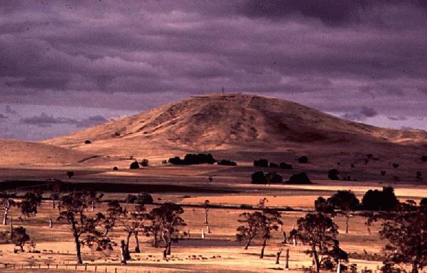
© Museum Victoria, AustraliaMt. Kooroocheang is a composite scoria/lava volcano 14km northeast of Creswick, Victoria. At 230m high it is one of the largest volcanoes in Central Victoria.

Scientist have told a conference it is only a matter of time before volcanoes erupt in Victoria, and warned there is no disaster plan for when it happens.

According to scientists at Melbourne University, a series of volcanoes in Victoria's west are well overdue to erupt.

Eruptions should occur in the region about every 2000 years, but the south-east of the country hasn't experienced any volcanic activity since Mt Gambier erupted over 5000 years ago.

Earth Sciences Professor Bernie Joyce said this means the chance of an eruption is high, and that while the scale of any activity is hard to predict, it "could cause devastation to thousands of people".

It isn't the eruption that would necessarily do the damage, Prof Joyce said, but if rising magma meets ground water it could cause steam explosions that would blanket the state in volcanic ash, leading to widespread disruptions to critical infrastructure and transport.