Secret HistoryS


Sherlock

11th-century stone tower excavated in Bac Ninh Vietnam

Image
© File PhotoThe foundation of a tower has been excavated at the site of Dam Pagoda.
The foundation of an 11th-century stone tower has been unearthed at Dam Pagoda in the northern city of Bac Ninh, 30km northeast of Ha Noi, revealing complex features of Buddhist architecture of the period.

Located on the southern side of Lam Son Mountain, construction of Dam Pagoda was begun in 1086 under the reign of Ly Nhan Tong and completed in 1094.

It was one of the leading examples of Buddhist architecture in the north during the Tran (1225-1400) and Le (1428-1788) dynasties. In the Tran dynasty, the pagoda consisted of 12 buildings while in the Le dynasty, it was expanded to over 100 rooms.

According to researcher Le Dinh Phung, who directed the excavation, the foundation formed a square measuring 8.4m by 8.4m. The missing tower was assumed to face east to a height of 1.56m and built with stones decorated in wave patterns.

It may have carried Buddha statue on top to face the remaining stone column at the pagoda, Phung said.

Upon excavating the foundation and a site of 300sq.m, archaeologists found building materials from the Ly, Tran and Le dynasties and concluded that Dam Pagoda was an architectural complex of four layers covering an area of over 7,500sq.m following the slope of Lam Son Mountain.

Blackbox

Vikings Navigated With Translucent Crystals?

Image
© The Natural History Museum / AlaIcelandic spar (pictured) may have helped Vikings navigate.
Vikings may have navigated by looking through a type of crystal called Icelandic spar, a new study suggests.

In some Icelandic sagas - embellished stories of Viking life - sailors relied on so-called sunstones to locate the sun's position and steer their ships on cloudy days. (See Iceland photos submitted by readers like you.)

The stone would've worked by detecting a property of sunlight called polarization.

Polarization is when light - which normally radiates randomly from its source - encounters something, such as a shiny surface or fog, that causes the rays to assume a particular orientation.

Due to this property, as sunlight moves through the atmosphere, the resulting polarization gives away the direction of the original source of the light.

Detecting light's polarization is a natural ability of some animals, such as bees. (See "'Weird Beastie' Shrimp Have Super-Vision.")

In 1969, a Danish archaeologist suggested real-life Vikings might have used sunstones to detect polarized light, using the stones to supplement sundials, stars, and other navigational aids.

Since then, researchers have been probing how such a sunstone might have worked. On that point, though, the sagas were silent.

Sherlock

Israeli experts decode only Arabic Crusader inscription ever found

Archaeologists have deciphered a grey marble slab whose 800 year old Arabic inscription makes it the only Crusader artefact in that language ever found in the Middle East, the Israel Antiquities Authority (IAA) said Monday.

The inscription bears the name of Holy Roman Emperor Frederick II, and the date '1229 of the Incarnation of our Lord Jesus the Messiah,' leading the IAA to proclaim it 'a rare archaeological find.'

The inscription was found years ago on a wall in Tel Aviv, near adjacent Jaffa, but thought to have been from the Ottoman Period, and so not given priority by archaeologists.

Only when they began deciphering it, did they realise the inscription dated from the Crusader period of the Middle Ages, Professor Moshe Sharon, of the Hebrew University of Jerusalem, said.

Frederick II, who led the Sixth Crusade (1228-29) fortified the castle of Jaffa and left in its walls two inscriptions, one in Latin and the other in Arabic.

'The Arabic inscription was drafted by Frederick's officials, or possibly even the emperor himself, and it is the one which has been now deciphered,' said Sharon, one of the two archaeologists who deciphered the inscription.

Info

Ice Age Hominins and Their Adaptability to Climate Change

Early Hominins
© Michael Barton/Arizona State UniversityComputer agents (colored dots) simulating prehistoric hunter-gatherer groups are superimposed over a map of Late Pleistocene western Eurasia. Gray shows Pleistocene land area with lowered sea levels, black lines show modern coastlines, white areas show ice sheets. The blue dots represent groups of “modern” humans, red dots represent groups of Neanderthals, and yellow dots represent groups with biological mixtures of modern and Neanderthal genes. This is a snapshot of the simulation after hundreds of cycles in which the hunter-gather groups have higher mobility in response to changing glacial climate. The data and corresponding analyses were cited by archeologists from Arizona State University and the University of Colorado Denver in findings published in the December issue of the journal Human Ecology, available online Nov. 17.
Complex computational modeling provides clues to Neanderthal extinction

Computational modeling that examines evidence of how hominin groups evolved culturally and biologically in response to climate change during the last Ice Age also bears new insights into the extinction of Neanderthals. Details of the complex modeling experiments conducted at Arizona State University and the University of Colorado Denver will be published in the December issue of the journal Human Ecology, available online Nov. 17.

"To better understand human ecology, and especially how human culture and biology co-evolved among hunter-gatherers in the Late Pleistocene of Western Eurasia (ca. 128,000-11,500 years ago) we designed theoretical and methodological frameworks that incorporated feedback across three evolutionary systems: biological, cultural and environmental," said Michael Barton, a pioneer in the area of archaeological applications of computational modeling at Arizona State University.

Question

How did Eskimos get hold of a bronze 'buckle' 1,400 years ago?

Eskimo bronze buckle dig
© APMystery find: University of Coloardo researchers excavate the 1,000-year-old Inupiat Eskimo home at Cape Espenberg where the 'buckle' was discovered
The buckle may have been brought by Eskimons from East Asia around 1,500 years ago

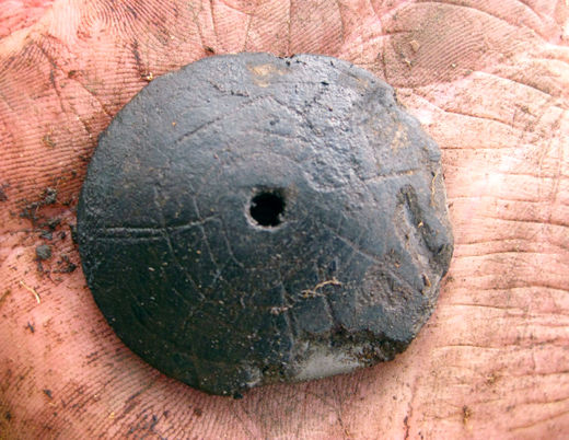
A bronze 'buckle' believed to be 1,400 years old had been unearthed in Alaska for the first time - and archeologists are mystified about how it got there.

The artifact was found in sediment as they dug on a site where a 1,000-year-old Inupiat home was built.

The two inch by one inch object - which seems to have been molded - appears to have been part of a harness.

How it got to Alaska is a mystery - although it is thought it may have been brought by Eskimos from East Asia around 1,400 years ago and passed down through the generations.

Info

Divers Find the Wreck of 17th Century Warship

Battle of Öland
© Wikimedia CommonsBattle of Öland. Claus Møinichen, 1686.
Swedish divers have discovered the wreck of one of the largest 17th century warships.

Found off the coast of the Baltic island of Öland at a depth of between 160 and 320 feet, the wooden wreck is believed to be that of the royal warship Svärdet.

According to Deep Sea Productions, the underwater research team who identified the wreck, the vessel is "a prime example of richly decorated 'gaudy' ships, built largely to impress the enemy."

The 82-foot Svärdet (the Sword) sank in 1676 in the largest naval battle in the Baltic, when Sweden was defeated by a Danish-Dutch fleet.

After fighting for five hours, the Svärdet was set afire by a Dutch ship.

"The commander, admiral Claes Uggla, chose to go under with his ship, rather than surrender to the enemy," Deep Sea Productions said in a statement.

The Svärdet went down with its sister ship the Kronan (the Crown), whose wreck was discovered in 1981. It has yielded more than 30,000 archaeological artifacts, many of which are displayed at the Kalmar County Museum in Sweden.

Info

Tribal Fates: Why the Navajo Have Succeeded

The 3 Sisters Rock
© David P. Smith | ShutterstockThe Three Sisters rock formation found in the Navajo nation land of Monument Valley. Two geographers argue that the relatively isolated and rugged nature of Navajo country ultimately contributed to the tribe's success.

While other tribes have disappeared from North America over the centuries, the Navajo Nation has done the opposite. Two geographers from the University of California, Los Angeles, offer an explanation for why the Navajos have been able to grow to more than 300,000 members today: a combination of geography and culture.

Jared Diamond and Ronan Arthur propose that the geographical isolation and cultural flexibility of the Navajos, who call themselves the Diné, allowed them to expand, even after the arrival of Europeans in North America in 1492 and efforts four centuries later to assimilate them into white U.S. culture.

"Many tribes decreased their numbers, disappeared or lost their homeland, language or cultural identity," Arthur and Diamond write in the Nov. 18 issue of the journal Science. "The Navajos are a striking exception."

In fact, they are arguably the largest American Indian tribe in the United States. (The Cherokee Nation, with different membership requirements, also can make that claim.) And the Navajo reservation, established in 1868, has expanded from roughly 3.3 million acres to more than 17 million in Arizona, Utah and New Mexico.

Sherlock

UK: Cirencester Roman dig is 'history changing'

Image
© Cotswold ArchaeologyArchaeologists have uncovered more than 40 burials at the site
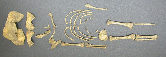
Excavations in Cirencester have unearthed one of the earliest burial sites ever found in Roman Britain. The dig at the former Bridges Garage on Tetbury Road has uncovered over 40 burials and four cremations. Experts say it is the largest archaeological find in the town since the 1970s.

Neil Holbrook, chief executive at Cotswold Archaeology, said he could not "underestimate the potential significance" of the discovery. Archaeologists said they were particularly excited by the discovery of a child's grave containing a pottery flagon, which could date to the early Roman period, between 70 AD and 120 AD.

They said if the burial could be dated to this time, it could "challenge the current belief amongst archaeologists" that inhumation burials were not common practice until the later Roman period. "Whilst we are being cautious, we can't underestimate the potential significance this discovery could have for archaeologists in Britain," said Mr Holbrook. "Our specialists are working hard to provide further information to try to confirm the dating of this site."

Pharoah

Discoveries at Mendes and Theban Tombs Opening More Windows on Ancient Egypt

Image
© Susan Redford, The Theban Tomb SurveyEntrance and courtyard of one of the newly-discovered tombs of the Assasif concession (the region that includes Parennefer's tomb).
A wealth of discoveries and information already, with a promise of more to come.

One might think that the archaeological treasures of ancient Egypt have been pretty much picked over by now. Of all the civilizations that have graced the pages of archaeological romance, ancient Egypt stands arguably on top. For thousands of years, tomb robbers have looted it, and since the 18th century, archaeologists have systematically pored over the remains. Thus it could be said that this field has already seen its heyday.

But for Professor Donald Redford and Dr. Susan Redford of Pennsylvania State University, like other scholars in their field, it offers a seemingly inexhaustible supply of new finds and surprises that continue to excite the imagination of would-be Egyptologists and archaeologists.

For the past two decades, they have directed expeditions to two separate ancient locations in Egypt, one near the west bank of the Nile in the Valley of the Nobles, part of the Theban necropolis opposite Luxor, and the other much farther to the north in the Nile Delta region. Both locations have yielded discoveries that have made archaeology news headlines and have created new questions and avenues of investigation.

Footprints

Famous Nasca Lines of Peru at Risk, Say Conservationists

Image
© Unknown
The monumental Nasca lines may not be around for long if steps are not taken, according to conservationists in the know.

Located in the arid coastal plain south of Lima, Peru, these incredible lines are only visible in their entirety from a tower, airplane or from space. Created on a gigantic scale, they consist of hundreds of simple lines, geometric shapes, and zoomorphic figures representing entities such as human figures, hummingbirds, spiders, sharks, orcas, llamas, jaguar, lizards, fish, and a monkey. Declared a UNESCO World Heritage Site in 1994, the geoglyphs or "lines" of Nasca and the pampas of Jumana are well-known to the world, and are today an important tourist destination.

These Nasca Lines, as they are popularly called, date from 500 B.C. to 500 A.D. and cover an area consisting of foothills and desert for more than 450 square kilometers. Attributed to three different stages of development corresponding to the Chavín, Paracas, and Nasca cultures respectively, they were made by removing the overlying dark sand and iron oxide gravel to expose a lighter ground underneath. Although numerous theories abound concerning their origin and meaning, many scholars suggest that they had ritual astronomical functions.