Storms
S

Bizarro Earth

'Ginormous'! Hurricane Irma is larger than the entire state of Florida

Hurrican Irma
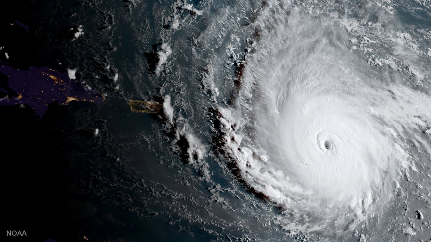
© Nasa / ReutersHurricane Irma, a record Category 5 storm, churns across the Atlantic Ocean on a collision course with Puerto Rico and the Virgin Islands, is show in this NASA GOES satellite image taken at 1715 EDT (2215 GMT)) on September 5, 2017
Not only is Hurricane Irma the strongest storm to form in the Atlantic outside the Gulf of Mexico and Caribbean Sea, it's also larger than entire U.S. states.

Irma is larger than Florida, the very state forecasts show it reaching by the weekend, according to CBS News weather producer David Parkinson.

Bizarro Earth

Hurricane Irma presents an extreme storm surge threat to the US and Bahamas

Radar image of Irma from the Puerto Rico radar at 9 pm EDT September 6, 2017.

After clobbering the Lesser Antilles islands of Barbuda, Saint Barthelemy, Anguilla, and Saint Martin/Sint Maarten early Wednesday morning, Hurricane Irma carried its march of destruction into the British Virgin Islands on Wednesday afternoon, still packing top winds of 185 mph. As of 5 pm EDT Wednesday, Irma had spent a remarkable 1.5 days as a Category 5 hurricane, which is the 7th longest stretch on record in the Atlantic, according to Dr. Phil Klotzbach.

Longer-range outlook for Irma: Cuba, The Bahamas, and Southeast U.S.

The 12Z Wednesday runs of our top four track models-the European, GFS, HWRF, and UKMET models-were in strikingly close agreement that Irma will continue on a west-northwest track till Saturday, then arc sharply to the north-northwest. All four model runs placed the center of Irma within roughly 50 miles of Miami on Sunday morning; the latest 18Z GFS was also there. The average track error in a 4-day forecast is 175 miles, but this remarkable agreement among the models lends additional confidence to the NHC forecast track, which brings Irma over or very near southeast Florida on Sunday. All four models move Irma northward along or near Florida's east coast, with landfall in Georgia or South Carolina on Monday.

Cloud Precipitation

According to Texas A&M expert the rainfall from Harvey shattered every record

Hurricane harvey rainfall
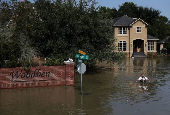
© Justin Sullivan/Getty ImagesChris Ginter wades through deep floodwaters on September 6, 2017 in Houston, Texas. Ginter, a Houston resident, has been taking local residents to their flooded homes in his monster truck which can drive through waters up to 4 feet deep.
Hurricane Harvey was billed as a once-in-every-500-year event, and it more than lived up to its billing. It produced rainfall amounts that will re-write the weather books in Texas and the United States, says a Texas A&M University expert.

John Nielsen-Gammon, who is a Regents Professor of Atmospheric Sciences at Texas A&M and also serves as Texas State Climatologist, says Harvey set new standards for historic rainfall and flooding.
"Harvey is head and shoulders above all previous multi-day storms ever recorded in the continental United States," says Nielsen-Gammon.

"I examined 18 different combinations of storm lengths and area sizes, from two days long to five days long, and standard areas from 1,000 square miles to 50,000 square miles. According to the preliminary data, Harvey was the worst in all but one."
Nielsen-Gammon said that the most amazing record is for the five-day total over an area of 10,000 square miles.
"For Harvey to average 34.72 inches over five days across that large an area is ridiculous," Nielsen-Gammon says. "The previous all-time United States record, set in Texas back in 1899, was estimated at 21.39 inches. Harvey exceeded that record by 62 percent."
Bizarro Earth

As hurricanes slam the Southern US, the West is literally on fire

Wildfires Western US
© fireweatheravalanche.org
Amid the aftermath of Hurricane Harvey and the impending destruction of Hurricane Irma, many Americans may not be aware that the western region of the country is suffering the opposite wrath of mother nature. From southern California to Washington, wildfires are engulfing thousands of acres of land and prompting thousands of evacuations. Many of the states battling the wildfires have been doing so all summer.

On Saturday, Washington Governor Jay Inslee declared a state of emergency across the state due to the risk of wildfires, and the National Weather Service warned that 26 of the state's 39 counties were at very high or extreme risk. According to the Washington Department of Ecology, "[a]lmost all of WA [was] awash in wildfire smoke" on Sunday. The department noted air quality in many areas had suffered as a result. According to NASA satellite imagery, smoke is also being pushed eastward across the U.S

Cloud Precipitation

Turks and Caicos Islands struck by Hurricane Irma

The powerful category 4 storm made landfall in the British Overseas on Thursday evening and isn't expected to slow down through Friday morning. Pictured is the island of Providenciales
Extent of damage unclear after communications cut as category 5 storm continues on path towards Florida

Hurricane Irma has hit the Turks and Caicos Islands as the category 5 storm, which has killed at least 11 people, continues to move across the Caribbean towards Florida.

Waves as high as 6 metres (20ft) were expected on Friday in the Turks and Caicos, where communications went down as the storm hit the islands, leaving the extent of the devastation unclear.

The first hurricane warnings were issued for parts of southern Florida as the US state braced for Irma, while some of those islands hit hardest by the storm prepared for Hurricane Jose, a category 3 storm following in Irma's wake with 120mph (195km/h) winds.

French, British and Dutch military authorities sent aid to devastated Caribbean islands where at least 11 people were dead and thousands left homeless. Warships and planes were sent with food, water and troops after the hurricane smashed homes, schools and roads, laying waste to some of the world's most beautiful tourist destinations.

The French prime minister, ร‰douard Philippe, said on Thursday that four people were confirmed dead and about 50 injured on the French side of Saint Martin, an island split between Dutch and French control. Homes there were splintered and road signs scattered by the strong winds, while cafes and shops in the seaside town of Marigot were submerged in flood water. Rescue teams had yet to cover the entire area of damage, meaning the death toll could rise.


Tornado1

Category 5 Irma hits Leeward Islands at peak strength, eye misses Puerto Rico, Virgin Islands

Irma hurrican leeward islands
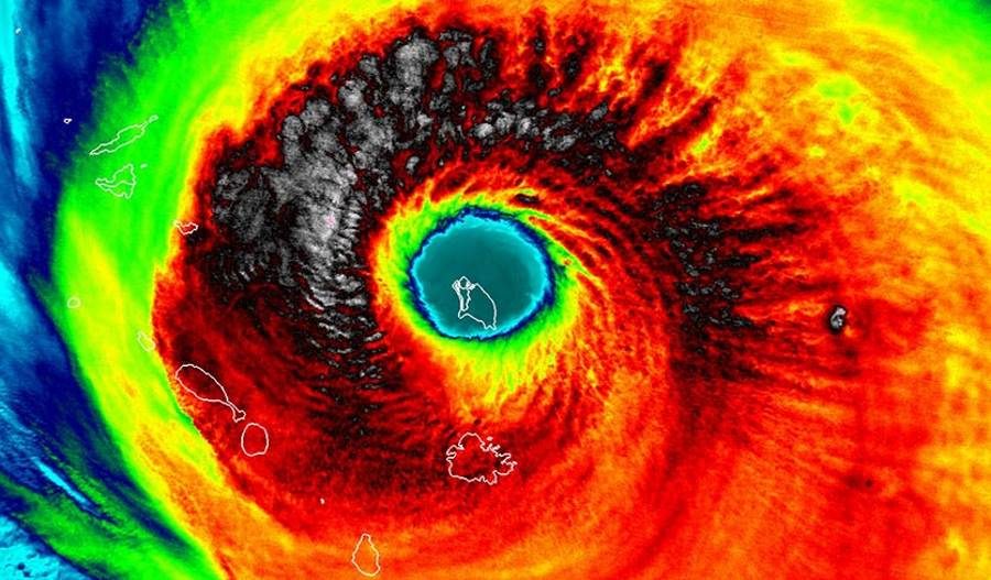
© UW-Madison/CIMSSAbove: VIIRS infrared image of Hurricane Irma taken at 1:35 am EDT Wednesday, September 6, 2017. At the time, the island of Barbuda was in the eye, and Irma was a Category 5 storm with 185 mph winds.
Hurricane Irma smashed into the small Lesser Antilles islands of Barbuda (population 1,638), Saint Barthelemy (population 9,000), Anguilla (population 15,000), and Saint Martin/Sint Maarten (population 8,000/33,000) early Wednesday as a mighty Category 5 hurricane with 185 mph winds. As the front southwestern eyewall of Irma hit, Barbuda reported sustained winds of 118 mph, gusting to 155 mph, before the instrument failed. The minimum pressure in the eye was 916 mb on Barbuda and St. Barthelemy. Preliminary reports from these islands indicate heavy wind and storm surge damage occurred. On Saint Martin, storm surge flooding to rooftop level was observed. Irma brought a storm surge of 7.95 feet (2.42 meters) to Barbuda, according to a Wednesday afternoon blog post by storm surge scientist Dr. Hal Needham. Barbuda has not been heard from yet.

A hurricane with top winds of 185 mph has never been recorded in these islands, and Irma's landfall intensity of 185 mph winds in the Leeward islands is tied with the 1935 Florida Keys Labor Day Hurricane as the highest landfall intensity on record for an Atlantic hurricane (third place globally.) The most recent close analog for Irma may be Hurricane Hugo (1989), which tore through the Leewards and struck Puerto Rico as a Category 4 storm, causing $3 billion in damage (1989 dollars) and 72 deaths.

Cloud Precipitation

Hurricane Irma pummels the Dominican Republic

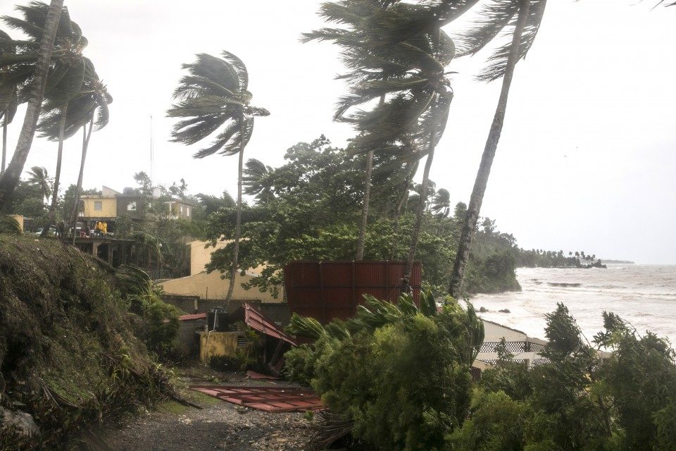
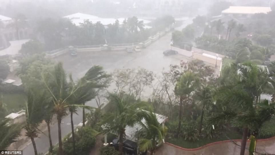
Palm trees bend in Samana, Dominican Republic, on Thursday, as Irma roared off the northern coast of the island the country shares with Haiti
© Tatiana Fernandez/APPalm trees bend in Samana, Dominican Republic, on Thursday, as Irma roared off the northern coast of the island the country shares with Haiti
Irma's strong winds and torrential rains pummeled the Dominican Republic on Thursday, damaging homes and inundating streets in the beach towns on the north coast, according to local media reports.

Among the towns pounded by the storm were Cabarete and Sosua, part of the Puerto Plata region popular with foreign tourists.

More than 5,500 people in the country were evacuated in the run-up to the storm, officials said.


Bizarro Earth

The 275 trillion pounds of water from Hurricane Harvey deformed the earth's crust in Houston

Hurricane Harvey
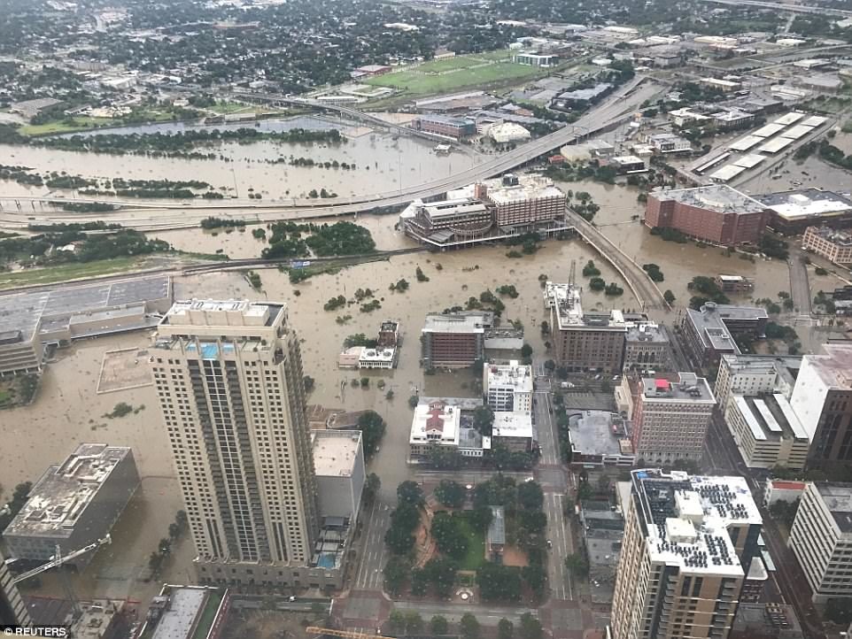
An aerial photograph reveals the huge swathes of flooded land in Houston, Texas on Sunday. Hurricane Harvey blustered through the town on Friday and Saturday, bringing with it unprecedented downpour and triggering life-threatening floods.
The weight of water can deform the Earth's crust, if there's enough of it. And we can measure that change with the ultraprecise global-positioning satellites humans have launched into orbit.

On Monday, Chris Milliner of the Jet Propulsion Laboratory tweeted a simple map visualizing data from the Nevada Geodetic Laboratory. It showed that the GPS data from special stations around Houston detected that the whole area had been pushed down roughly two centimeters by the weight of the water that fell during Hurricane Harvey.

Bizarro Earth

Category 5 Hurricane Irma stronger than all of 2017's other eight Atlantic storms combined

Hurricane Irma
The Category 5 storm is breaking records and headed towards Puerto Rico and the Bahamas. Florida may be next.
Hurricane Irma's winds are stronger than if you were to add up all of the winds of the prior eight storms Atlantic storms together at maximum intensity.

That's just one shattering measure of the storm's strength from meteorologist Phil Klotzbach, research scientist at Colorado State University's Department of Atmospheric Science. Irma's 185 mph winds make it the strongest storm on record in the Atlantic Ocean outside of the Caribbean and Gulf of Mexico, according to Klotzbach's research, which he shared with The Daily Beast.

"Most of the other storms this season were pretty weak and short-lived. While Harvey was intense, it was intense for a short time period before making landfall," Klotzbach said.

Tornado1

Tropical triple threat: Hurricanes Katia & Jose follow on the heels of Irma

hurricanes katia jose
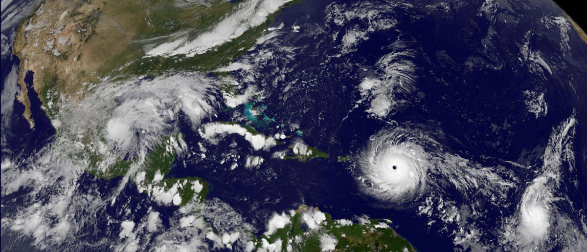
© NASAHurricanes Katia and Jose
Two other giant storms - Katia and Jose - have grown to hurricane levels, and now trail the calamitous Category 5 Hurricane Irma, which has battered the Caribbean and is headed toward the southern coast of Florida.

Katia, a Category 1 hurricane as of Wednesday evening, is in the Gulf of Mexico and is expected to make landfall in Mexico late Friday or early Saturday.

The storm is forecast to produce up to 10 inches of rain, with the possibility of 15 inches in northern Veracruz, according to the National Hurricane Center.

"This rainfall may cause life-threatening flash floods and mudslides, especially in areas of mountainous terrain," NHC said.

For comparison, Hurricane Harvey unloaded over 50 inches of rain east of Houston, Texas last week.