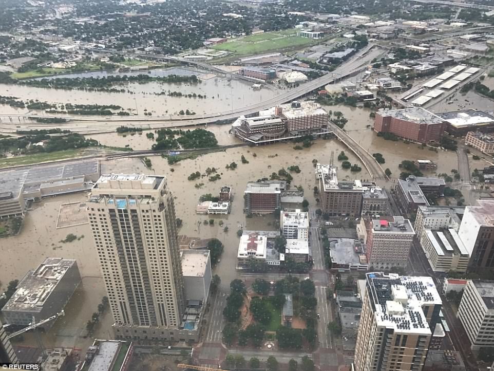
On Monday, Chris Milliner of the Jet Propulsion Laboratory tweeted a simple map visualizing data from the Nevada Geodetic Laboratory. It showed that the GPS data from special stations around Houston detected that the whole area had been pushed down roughly two centimeters by the weight of the water that fell during Hurricane Harvey.
Why this would happen is simpler than you might think. A gallon of water weighs about 8.34 pounds. And by one estimate, Harvey dropped 33 trillion gallons of water across the area it hit. So that's roughly 275 trillion pounds.
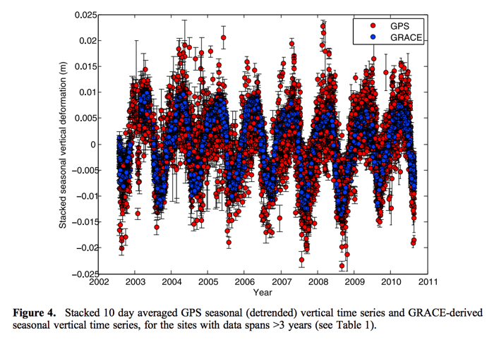
And it turns out that scientists have measured the effects of loading a bunch of water onto land many times. For example, a 2012 study of the Himalayas detected a seasonal flux in the height of the mountains as water fell, and then ran off those mountains into Asia's rivers.
A 2017 study in Science found that the Sierra Nevada exhibits "vertical surface displacement [with] peak-to-peak amplitudes" of 0.5 to one centimeter. More water is more mass. Less water is less mass. And the crust underneath that water responds to the changes.
One could see Harvey's deposition of water as a fast-action version of what happens in the Earth's mountain ranges each year.
There are some caveats, Milliner later explained. Some of the change could come from the soil underneath the GPS stations becoming compacted by the water's weight. But because some stations located on bedrock also experienced the depression, he believed that the key mechanism was crust deformation. It's also possible, he elaborated, that some areas outside Houston were pushed up by the way the water squished the Houston crust.
Perhaps a hurricane seems a match for the crust of the Earth, in mental scale. But humans can also have this sort of effect (even without calculating how much of Harvey's water was due to climate change). Huge dams can impound water on a scale of Hurricane Harvey's rains. The Hoover Dam and Three Gorges Dam both created reservoirs with a capacity of roughly 10 trillion gallons of water.
The effect of the filling of the Three Gorges Dam has experienced substantial attention from Chinese researchers, in part because there was a marked increase in small earthquakes in the region as the reservoir was filled. That's not a concern in Houston, which is not a seismically active region.
It also remains to be seen how quickly the Earth rebounds in Houston, given that the water is rushing back to the sea, rather than sitting on mountaintops as glaciers or in reservoirs as hydrologic storage. And one assumes there's an interesting paper in that for a geodetic researcher.
And there are (at least) two more ways humans are changing the crust of the Earth. Because the climate is warming, there's less ice-and therefore less mass-attached to the world's mountaintops. "The Earth, behaving like an elastic body, uplifts in a response to the load loss," the Himalayan researchers write.
Comment: Well no, actually the climate is experiencing a cooling trend. The Arctic sea ice melt season is behaving strangely, showing signs of an early end to the melt season. Winter has arrived about 10 days early in the Arctic, and Greenland's surface has gained 500 billion tons of ice - about 33% above normal.
Meanwhile, in Houston, the ground had already been sinking-scientists call it subsidence-because humans have pumped the groundwater out of the aquifers under the city.
With each passing year, the combined and uncoordinated efforts of humanity force the mountains a little higher and the flats a bit lower.


Reader Comments
to our Newsletter