Storms
S


Tornado2

Impressive waterspout touches down on Chios Island, Greece

waterspout
A sea tornado, or waterspout, was spotted in the early hours of Friday morning off the coast of Chios Island in Greece.

The spectacular scene captured the attention of many people on the island, who tried to record it in a number of photographs and videos.

The impressive meteorological phenomenon took place just a few meters off the coastline near the town of Vrontado, which is well-known for its "Rocket War" during Easter.


Tornado2

Another tornado hits South Africa's KwaZulu-Natal, second in two days

Tornado in KZN, South Africa
© Storm Report SA
Another tornado hit KwaZulu-Natal on Thursday as officials warned residents to take precautions as a mega storm rolled into the province.

Storm Report SA received several pictures and video from residents in Bergville in the KZN Midlands of another tornado that formed in the area on Thursday. It was unclear if anyone was injured.

The tornado formed two days after another one ripped through a farming community of in New Hanover in the KZN Midlands on Tuesday, killing two people and leaving a trail of destruction in its wake.


The SA Weather service said that tornadoes are not uncommon in South Africa, and normally occur in the spring and summer period, an SA Weather Service forecaster said.

Tokelo Chiloane said tornadoes occurred during severe thunderstorms which included strong winds.

The lifespan of a tornado was between three to five minutes, said Chiloane, adding that South African tornadoes differed from tornadoes that occurred in countries like the US, where they could last for hours.


Tornado2

Impressive waterspout filmed off Cyprus

waterspout
Parts of the island are experiencing thunderstorms, strong winds and heavy rain today due to a low-pressure weather system.

On Friday morning, a video of a waterspout that formed off the coast off Episkopi was caught on camera and posted on the Facebook pages of Kitas Weather and Weather Enthusiasts of Cyprus ( Kairofili).


Source: Philnews

Attention

Adapt 2030 Ice Age Report: This cycle is going to be different

US arctic blast
© YouTube/Adapt 2030 (screen capture)
With heavier more powerful cycles at our door step we as a society need to have conversations on global food security. We as a species have even forgotten major celestial events as recently as 200 years with the meteor shower of 1833 in SE USA and the Carrington event that aurora were seen in South America. Now this year unprecedented blizzards, Arctic freezes cover the N. Hemisphere and the coldest temperature ever recorded in October in the N. Hemisphere in Utah. Changes have begun.


Comment: See also:


Snowflake Cold

Winter Already? Snow, deep freeze from Rockies to East Coast

SNOW ON BUFFALO
Snow on Buffalo
An arctic air mass that brought snow and ice to an area stretching from the Rocky Mountains to northern New England on Monday was poised to give way to record-breaking cold temperatures.

In mid-Michigan, three people were killed in a two-vehicle crash that the Eaton County sheriff's department attributed to heavy snowfall. And in Kansas, the highway patrol reported that a truck lost control on an icy highway and slammed head-on into another truck, killing an 8-year-old girl in the other vehicle.

In Chicago, where as much as 6 inches of snow fell, an Envoy Air flight from Greensboro, North Carolina, slid off an icy runway at O'Hare International Airport as it tried to land at about 7:45 a.m.

None of the 38 passengers and three crew members were injured, according to the city's aviation department.


Cloud Precipitation

Flash floods and snowstorm slam north Algeria

Flash floods in Bouzeguene, Algeria 12 November 2019.
© Civil Protection AlgeriaFlash floods in Bouzeguene, Algeria 12 November 2019.
At least 1 person has died and 3 were rescued after flash floods in Algeria on 12 November.

Severe weather affected wide areas of the country from 11 November, brought by a storm system informally named 'Medicane Trudy'.

Strong winds with gusts of 90 km/h, storm surge and high waves were reported along the Algerian coast. An orange alert was issued by for several provinces including M'Sila, Batna, Khenchela, Biskra, Bejaia, Jijel, Skikda, Annaba and El Tarf.

A snowstorm was reported in Sidi Bel Abbès province on 11 November. Military personnel were deployed to assist the local community, Algeria Press Service reported.


Cloud Precipitation

India and Bangladesh - Cyclone 'Bulbul' leaves 24 dead, over 2 million displaced - 11 inches of rain in 24 hours

Tropical Cyclone Bulbul approaching West Bengal
© NASATropical Cyclone Bulbul approaching West Bengal, India, and Bangladesh, November 2019.
At least 24 people have died and more than 2 million displaced after Tropical Cyclone 'Bulbul' hit coastal areas of Bangladesh and the states of West Bengal and Odisha in north east India.

Bulbul made landfall in West Bengal on 09 November, 2019, with wind gusts of 135 km/h. According to media reports, the fatalities and much of the damage were the result of the strong winds.

Over 26,000 houses have been damaged in West Bengal and Odisha, India, where 12 people have died as a result of the storm. Over 120,000 people were moved to safety.


Cloud Precipitation

Southern Italy battered by storms, floods and tornadoes

Flooded olive groves in Salento
© ColdirettiFlooded olive groves in Salento
Heavy rain, hail, thunderstorms, and winds of more than 100 kilometres per hour hit many parts of southern Italy on Tuesday.

The Italian Civil Protection Department issued a red alert for the regions of Basilicata, Calabria and Sicily, and a lower orange alert was issued for Puglia ahead of fierce storms which began in the early hours of Tuesday morning.

Schools across many parts of the southern regions announced closures for Tuesday, and the Civil Protection Department warned drivers of the risk of falling trees and swollen rivers.

Since Monday night, firefighters in the four southern regions have been called out a total of 460 times to deal with storm damage, the fire service wrote on Twitter.


Comment: Further north: Two reported dead as Venice flooded by highest tide in 50 years - 85% of city under water


Tornado2

Very large tornado hits KwaZulu Natal, South Africa

South Africa tornado
© Twitter screenshot
A massive tornado ripped through parts of KwaZulu-Natal (KZN), South Africa, on Tuesday with several video posts showing it hit New Hanover outside Pietermaritzburg in the KZN Midlands. SAWX - Weather Forecasts for South Africa has also posted several satellite images.

The KZN MEC for Cooperative Governance, Sipho Hlomuka, confirmed the tornado to Jacaranda FM. His spokesperson said: "There are fears of possible missing people and deaths."

Disaster management teams have been dispatched to the affected areas - including Thokozani and Mpolweni.

It is feared that many people have sustained injuries, and homes have been destroyed. Trees were blown over and roads have been closed, the KZN spokesperson told Jacaranda FM.


Snowflake

November snowstorm shocker dumps up to 30 inches in Michigan

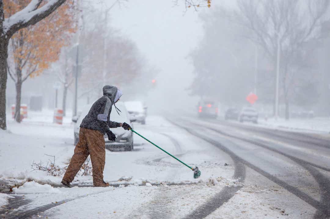
Steven Holston of Detroit helps out an aging family member by managing their snow on E. Grand Blvd. as snow hit the region Monday, Nov. 11, 2019.
© Mandi Wright, Detroit Free PressSteven Holston of Detroit helps out an aging family member by managing their snow on E. Grand Blvd. as snow hit the region Monday, Nov. 11, 2019.
The unseasonable snowstorm that pounded southeast Michigan with more than a half-foot of snow on Monday will conclude in metro Detroit by Tuesday morning — but only to see temperatures plunge to single-digit wind chills.

The snowfall snarled traffic across the region as Metro Airport was hit by 7.6 inches by early Monday evening, Ann Arbor had 9.3 inches, Flint 7.7. The highest snowfall in metro Detroit was 9.6 inches in Wixom.

Elsewhere across the state, snowfall totals varied but were especially intense along Lake Michigan because of the lake effect, with some communities getting about 18 inches of snowfall, said National Weather Service meteorologist Jeff Lutz.

"Lake effect snow can fall very intensely for a short period in a small area," he said.

Grand Rapids and Alpena had 5.5 inches, but Gaylord and Petoskey got only a trace of white.


Comment: Today, MLive reports:
Complete snow totals look from Veterans Day snowstorm, including 30 inches burying a city

Michigan experienced its first widespread snowstorm yesterday. The only sections really missing the snow were far northeast Lower Michigan and part of the U.P. The snow totals following reflect the widespread south across southern Lower and the very heavy lake effect in the snowbelts.

snow totals
Statewide look at snow totals

The map above shows the storm system snow that moved across the southern half of Lower Michigan. Southeast Lower was hit the hardest from the widespread storm system, with five to nine inches being very common.

You can also see the huge snow totals around the Leelanau Peninsula.

snow map