Floods
S


Cloud Precipitation

Widespread flooding hits Indonesia's capital Jakarta

Jakarta flooding
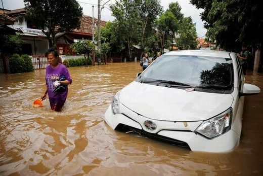
© Reuters A woman wades through floodwaters in a flood-hit area in Jatinegara district, Jakarta, Indonesia.
Torrential rains in the Indonesian capital have overwhelmed drains and flooded roads and thousands of homes.

The disaster mitigation agency says more than 50 areas are flooded in Jakarta with waters up to 1.5 metres (4.9 feet) high in East Jakarta.

It said the city's drains couldn't accommodate the runoff and rivers also overflowed.

Floods in 2013 forced killed more than two dozen people in Jakarta and forced tens of thousands to flee their homes.

The city, which has about 30 million people in its greater metropolitan area, says it has reduced the number of flood prone areas since then by dredging rivers and other measures.

Cloud Precipitation

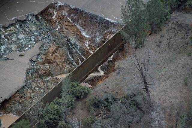
National Guard re-evacuation of Oroville Dam, general denies but eight inches of rain falling

Oroville Dam
Oroville Dam
Some National Guard on station near Oroville Dam were asked by citizen journalists what they were doing in the area and the response was that "they were there to help with the re-evacuation", this was quickly corrected by a major general within an hour. Winter storm warnings for all northern California with forecast of 8 inches as Southern California slammed with Cat 2 hurricane force winds.


Sources

Bizarro Earth

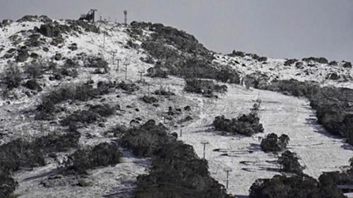
Fires, storms and now snow? More extreme weather hits New South Wales, Australia

Thedbo resort
Mt Kosciusko has received a light dusting of snow overnight. (Thredbo Resort)
The alpine regions of New South Wales and Victoria have been hit by a dusting of snow in summer, following heatwaves and wild storms. Between five and 10 centimetres of snow fell on Victoria's Mount Buller overnight, as temperatures dipped to - 0.8degress just after midnight.

In New South Wales - which last week grappled with catastrophic bushfire conditions and then severe storms - a light dusting of white sprinkled snow-cams on the summit of Mt Kosciusko today.

Bizarro Earth

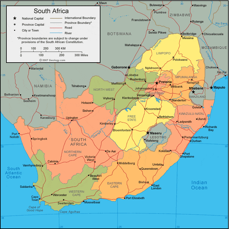
Gale force winds, heavy rains and flood warnings for central South Africa

south africa
The rainy weekend weather is set to continue as we head into the new week, with widespread showers expected across central SA and flash flood warnings in place.

Flood risk continue

SA Weather Services warns Monday 20 February will see heavy rain leading to localised flooding in the eastern parts of the Eastern Cape, southern KwaZulu-Natal, southern and western parts of the Free State and eastern Northern Cape.

An 80% chance of rain exists for most of Gauteng, the Free State and the Northern Cape, while a 60% to 30% chance of rain exists for the rest of the central region, extending to the east coast of KwaZulu-Natal.

These rainy conditions are expected to continue into the rest of the week - with heavy flood risks expected for Joburg and the surrounding area.

Gale Force Winds

A watch has been issued for Monday, when gale force winds of up to 65km/h can be expected over Richard's Bay and Kosi Bay at first. While towards the south of the country gale force winds of up to 70km/h can be expected between Lamberts Bay and Cape Point.

Cloud Precipitation

Flash floods in hit Malaga, Spain; 5 inches of rain in 6 hours

Flood
© Sergio Brenes
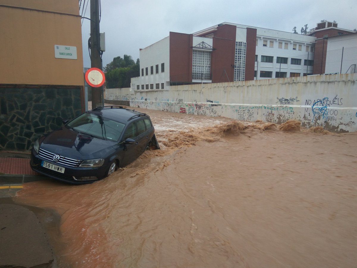
Storms in the Province of Malaga, southern Spain , resulted in widespread flash flooding on 19 February 2017 causing damage to damaged homes, roads and vehicles.

The city of Malaga was the worst affected area. Spain's meteorological office, AEMET, says that the the port of Malaga recorded 152.6 mm of rain in 24 hours on 19 February, with as much as 130.06 mm of that total falling in a 6 hour period.

Emergency services say they responded to 230 incidents during the heavy rainfall. However, there have been no reported fatalities or injuries.

Roads collapsed and buildings flooded. Torrents of water swept through the streets of the city, dragging vehicles along with it. There were also reports of landslides along the A-45 highway in Casabermeja, triggered by the heavy rain.

AEMET issued a red level (highest) warning for parts of the province of Malaga on 18 February, 2017.


Cloud Precipitation

More flood fears as California braces for another storm

California flooding
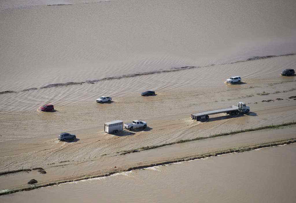
© Randy Pench/The Sacramento Bee via APFlood water crosses over Interstate 5 at Williams, California.
Some Northern California residents are preparing for another powerful Pacific storm by patrolling levees for signs of danger, reviewing evacuation plans and filling hundreds of sand bags.

One resident near Tracy, which is 80 miles east of San Francisco, said that though the levees appear in good shape, they decided take charge after the San Joaquin River started rising.

"We have a levee response team, a sand bagging team, teams to check on what walkers checking on the levees find," said San Joaquin River Club resident Paula Martin, who is helping coordinate emergency plans for the private neighborhood of 800 homes.

Martin said the neighborhood has sirens in the clubhouse and at a church that can warn residents of impending flooding.

"Our community is pulling together like real champs," she said, adding that volunteers have been patrolling the levees every two hours.

The area saw rain and wind Sunday afternoon but forecasters said a storm packing a bigger punch will reach the San Francisco Bay Area overnight before moving to the Central Valley.
Comment: Not just Oroville: Record rain is straining California's whole flood control network


Cloud Precipitation

California storm death toll increases to 5 as rain pummels Bay Area

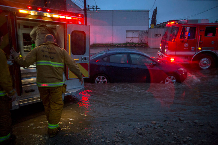
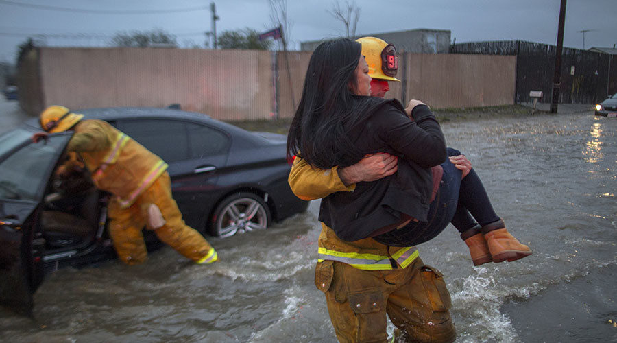
Firefighters prepare to transport a patient by ambulance at the scene of a car stuck in flooding as a powerful storm moves across Southern California on February 17, 2017 in Sun Valley, California.
© GettyFirefighters prepare to transport a patient by ambulance at the scene of a car stuck in flooding as a powerful storm moves across Southern California on February 17, 2017 in Sun Valley, California.
The death toll in the recent powerful California rainstorms rose to five as the weather system moved to pummel the northern portion of the state.

In Thousands Oaks, rescuers discovered the body of a man in his 20s who was swept away by floodwaters, the Ventura County Sheriff's Office said Saturday. On Friday, one person was found dead in Victorville in a flooded vehicle, a 55-year-old man was electrocuted in Sherman Oaks when a power line fell and two people died after a traffic accident in San Diego because of water on Interstate 15.

Meteorologists have called the storm "bombogenesis," an intense extra-tropical cyclonic low-pressure area, or "a weather bomb." They say the system is one of the strongest in years.

The storm flooded roadways in Los Angles and San Diego as power remained out and cars were underwater. At least 8 inches of rain fell on roads in San Diego.

On Friday, two cars plunged into a massive sinkhole in the Studio City neighborhood of Los Angeles.

Cloud Precipitation

Storm kills at least 2 in southern California

California flash flood
© David McNew / Getty Images / AFP Sun Valley, California. February 17, 2017.
At least two people have been killed - one drowned and another electrocuted - in a heavy storm that hit southern California, uprooting trees and sweeping vehicles away. Voluntary evacuations were called, while some highways were closed and numerous flights delayed or cancelled.

Two cars were swept away by floodwaters in Victorville, where police discovered one person dead in a submerged car, but were able to rescue another person in a separate car.

Los Angeles Fire Department responded to a man in Sherman Oaks who came in contact with downed power lines. The man was found in critical condition and was rushed to the hospital, where he was pronounced dead.

Two vehicles were reported to have fallen into a sinkhole in Studio City shortly after 8:30pm local time.

Fire and rescue crews are on scene.

Cloud Precipitation

Heavy rain, flooding as ex- Cyclone Dineo sweeps over South Africa

Floods
As the tropical ex-cyclone Dineo dissipates over SA, heavy rainfall has hit the north-eastern parts of the country.

Flooding has occurred following heavy rainfall late on Thursday afternoon, 16 February in the Free State capital of Bloemfontein, as some cars appeared to be floating.

To the north-eastern side of Bloem, the expected areas over Limpopo also received heavy rain. In the Kruger National Park, specifically, gravel roads have been closed and select remote camps evacuated in the wake of the rains.

KwaZulu-Natal, on the other hand, where disaster management teams have been on standby since Wednesday, was not hit as hard by the effect of Dineo.

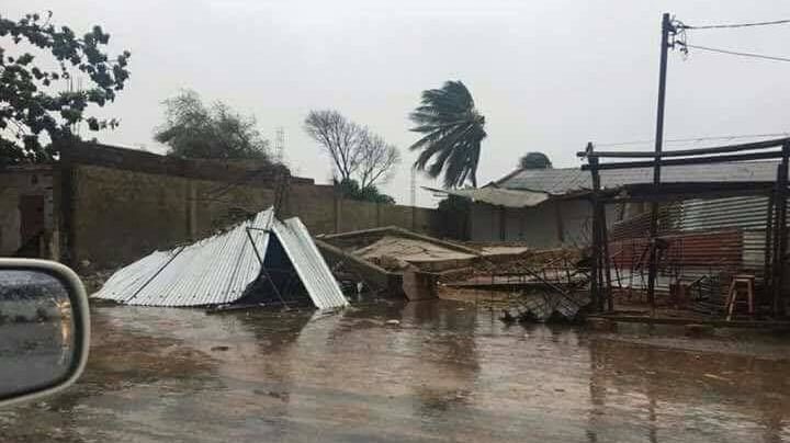
In Mozambique, Dineo has displaced thousands of people, while seven fatalities have already been reported, the country's government disaster centre said on Thursday. Heavy rains and fierce winds have destroyed about 20 000 homes, they say.

Comment: See also: Tropical Cyclone Dineo leaves 4 dead in Mozambique


Red Flag

Not just Oroville: Record rain is straining California's whole flood control network

Northern California reservoir levels
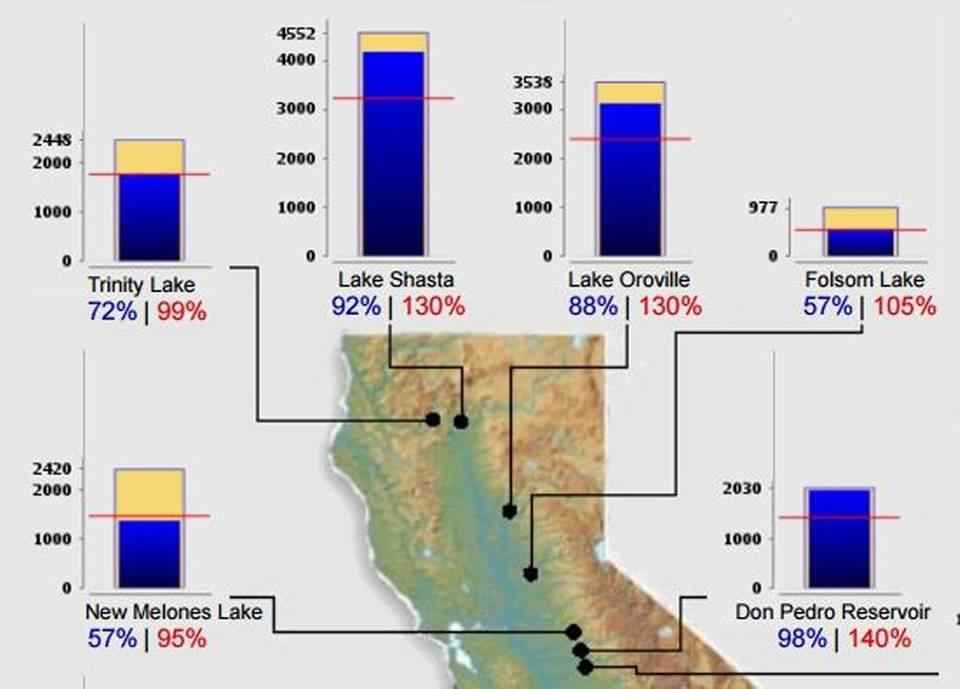
© California Department of Water ResourcesThis image shows conditions at Lake Oroville and other Northern California reservoirs as of midnight February 15, 2017.
The frantic effort over the last few days to lower water levels at Oroville Dam after the structure's two spillways became damaged is part of a larger drama playing out as California rapidly shifts from extreme drought to intense deluges.

Large swaths of the region are on track to experience their wettest winter on record, with many areas having already surpassed their average precipitation for an entire year.

And all that water is putting new strains on the network of dams, rivers, levees and other waterways that are essential to preventing massive flooding during wet years like this one.

The biggest danger zone lies in the Central Valley at the base of the Sierra Nevada, whose tall peaks can wring the skies of huge amounts of rain and snow. The area is essentially one giant floodplain that would be easily transformed into an inland sea without man-made flood control. At 400 miles long and 40 miles wide, it has only a tiny bottleneck from which to drain — a one-mile opening at the Carquinez Strait at San Pablo Bay — before water heads into the San Francisco Bay.